


Hazardous Weather Conditions

Current conditions at
Pagosa Springs, Wolf Creek Pass (KCPW)
Lat: 37.45° N Lon: 106.8° W Elev: 11759 ft.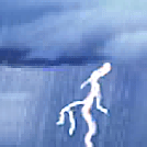
Thunderstorm in Vicinity
39°F
4°C
| Humidity | 48% |
| Wind Speed | SW 7 mph |
| Barometer | 30.29 in |
| Dewpoint | 21°F (-6°C) |
| Visibility | 10.00 mi |
| Wind Chill | 34°F (1°C) |
| Last update | 15 May 1:35 pm MDT |
Detailed forecast for
Eastern San Juan Mountains Above 10000 Ft
Today
Partly sunny with thunderstorms likely and chance of snow showers. No snow accumulation. Highs 44 to 57. West winds 10 to 15 mph. Chance of precipitation 60 percent.
Tonight
Mostly cloudy. Chance of thunderstorms and slight chance of snow showers until midnight, then chance of rain showers, slight chance of thunderstorms and snow showers after midnight. Lows 28 to 37. North winds around 10 mph. Chance of precipitation 30 percent.
Thursday
Mostly cloudy. Slight chance of thunderstorms and snow showers in the morning, then chance of thunderstorms and snow showers in the afternoon. Highs 43 to 57. Northeast winds up to 10 mph. Chance of precipitation 40 percent.
Thursday Night
Mostly cloudy. A 10 percent chance of thunderstorms and snow showers until midnight. Lows 27 to 36. Northwest winds around 10 mph.
Friday
Mostly sunny. A 10 percent chance of thunderstorms and snow showers in the afternoon. Highs 48 to 62. West winds 10 to 15 mph.
Friday Night Through Saturday Night
Partly cloudy. Lows 32 to 41. Highs 49 to 64.
Sunday
Sunny. Highs 49 to 63.
Sunday Night
Partly cloudy. Lows 32 to 40.
Monday
Mostly sunny with a 10 percent chance of thunderstorms and snow showers. Highs 45 to 60.
Monday Night
Partly cloudy with a 10 percent chance of snow showers. Lows 28 to 36.
Tuesday
Sunny with a 10 percent chance of thunderstorms and snow showers. Highs 45 to 58.
Additional Resources
Radar & Satellite Image


Hourly Weather Forecast


