

Severe Thunderstorms and Heavy Rainfall for the Southwest; Heat Spreads Across the Center of the Nation

Moisture will continue to move into areas of the West. This will increase showers and thunderstorms coverage and intensity, with the risk of flash flooding and damaging wind gusts. Meanwhile, heat across the Southwest will expand into the center of the nation this weekend into early next week. Trends favor this heat will spread across the Ohio Valley, mid-Atlantic next week. Read More >

Current conditions at

ROCK CANDY MOUNTAIN (TCAND)

Lat: 47.0338°NLon: 123.0971°WElev: 562.0ft.

unknown precip

52°F

11°C

Humidity 91%
Wind Speed WNW 0 MPH
Barometer NA
Dewpoint 49°F (9°C)
Visibility 1.24 mi
Last update 30 Aug 05:15 AM PDT
Extended Forecast for

4 Miles W Olympia WA

  • Today

    Today: Cloudy, then gradually becoming mostly sunny, with a high near 71. Calm wind becoming northwest around 5 mph in the afternoon.

    High: 71 °F

    Decreasing
    Clouds

  • Tonight

    Tonight: Partly cloudy, with a low around 51. Light northwest wind.

    Low: 51 °F

    Partly Cloudy

  • Monday

    Monday: Mostly sunny, with a high near 78. Calm wind becoming north northeast around 6 mph in the afternoon.

    High: 78 °F

    Mostly Sunny

  • Monday Night

    Monday Night: Partly cloudy, with a low around 54. North northeast wind around 5 mph becoming calm  in the evening.

    Low: 54 °F

    Partly Cloudy

  • Tuesday

    Tuesday: Mostly cloudy, with a high near 72. Calm wind becoming west southwest 5 to 9 mph in the afternoon.

    High: 72 °F

    Mostly Cloudy

  • Tuesday Night

    Tuesday Night: A 40 percent chance of rain.  Mostly cloudy, with a low around 53.

    Low: 53 °F

    Chance Rain

  • Wednesday

    Wednesday: Rain.  High near 65. Chance of precipitation is 90%.

    High: 65 °F

    Rain

  • Wednesday Night

    Wednesday Night: Rain, mainly before 11pm.  Mostly cloudy, with a low around 51.

    Low: 51 °F

    Rain

  • Thursday

    Thursday: A chance of rain, then showers likely and possibly a thunderstorm after 11am.  Mostly cloudy, with a high near 66.

    High: 66 °F

    Showers
    Likely

Detailed Forecast

Today
Cloudy, then gradually becoming mostly sunny, with a high near 71. Calm wind becoming northwest around 5 mph in the afternoon.
Tonight
Partly cloudy, with a low around 51. Light northwest wind.
Monday
Mostly sunny, with a high near 78. Calm wind becoming north northeast around 6 mph in the afternoon.
Monday Night
Partly cloudy, with a low around 54. North northeast wind around 5 mph becoming calm in the evening.
Tuesday
Mostly cloudy, with a high near 72. Calm wind becoming west southwest 5 to 9 mph in the afternoon.
Tuesday Night
A 40 percent chance of rain. Mostly cloudy, with a low around 53.
Wednesday
Rain. High near 65. Chance of precipitation is 90%.
Wednesday Night
Rain, mainly before 11pm. Mostly cloudy, with a low around 51.
Thursday
A chance of rain, then showers likely and possibly a thunderstorm after 11am. Mostly cloudy, with a high near 66.
Thursday Night
A chance of rain. Mostly cloudy, with a low around 50.
Friday
A chance of rain. Partly sunny, with a high near 70.
Friday Night
A slight chance of rain. Partly cloudy, with a low around 50.
Saturday
A slight chance of rain. Mostly sunny, with a high near 73.
Basemap Options
Click map to change the forecast location
Loading map...

ABOUT THIS FORECAST

 
Point Forecast:
4 Miles W Olympia WA
 47.04°N 122.97°W (Elev. 200 ft)
11:26 pm PDT Aug 29, 2026
5am PDT Aug 30, 2026-6pm PDT Sep 5, 2026
 
Get as KML Get as XML

Additional Resources

Radar & Satellite Image
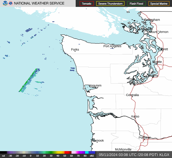
Link to Local Radar Data Link to Satellite Data

Hourly Weather Forecast

National Digital Forecast Database


