Catastrophic Flooding Impacts in South-Central Texas

Widespread life-threatening flash and urban flooding will continue to pose a significant threat to life and property in south-central Texas. Catastrophic fiver flooding, with rapid rises on small streams, arroyos, and typically dry washes, is expected. Monsoonal showers persist across the Great Basin and Southwest with greatest flash flooding in southern Arizona. Read More >

Hazardous Weather Conditions

Current conditions at

Lansing Municipal Airport (KIGQ)

Lat: 41.54°NLon: 87.53°WElev: 607ft.

Overcast with Haze

76°F

24°C

Humidity 82%
Wind Speed Calm
Barometer 30.08 in
Dewpoint 71°F (22°C)
Visibility 1.50 mi
Heat Index77°F (25°C)
Last update 17 Jul 2:55 am CDT
Extended Forecast for

Munster IN

  • Overnight

    Overnight: Widespread smoke. Mostly cloudy, with a steady temperature around 74. Calm wind.

    Low: 74 °F

    Smoke

  • Friday

    Friday: Scattered showers and thunderstorms, mainly after noon.  Widespread smoke, mainly before 1pm. Partly sunny, with a high near 89. Heat index values as high as 96. Calm wind becoming southwest around 5 mph in the morning. Winds could gust as high as 10 mph.  Chance of precipitation is 50%.

    High: 89 °F

    Isolated
    T-storms then
    Scattered
    T-storms

  • Friday Night

    Friday Night: Scattered showers and thunderstorms, mainly before 8pm.  Partly cloudy, with a low around 73. Southwest wind around 5 mph, with gusts as high as 15 mph.  Chance of precipitation is 30%.

    Low: 73 °F

    Scattered
    T-storms then
    Partly Cloudy

  • Saturday

    Saturday: A chance of showers and thunderstorms, then showers likely and possibly a thunderstorm after 5pm.  Mostly sunny, with a high near 90. Heat index values as high as 100. West southwest wind 10 to 15 mph becoming north in the afternoon. Winds could gust as high as 20 mph.  Chance of precipitation is 60%.

    High: 90 °F

    Slight Chance
    T-storms then
    Showers
    Likely

  • Saturday Night

    Saturday Night: A 30 percent chance of showers before 7pm.  Mostly clear, with a low around 67. North northeast wind 5 to 10 mph, with gusts as high as 15 mph.

    Low: 67 °F

    Chance
    Showers then
    Mostly Clear

  • Sunday

    Sunday: Sunny, with a high near 83.

    High: 83 °F

    Sunny

  • Sunday Night

    Sunday Night: Mostly clear, with a low around 65.

    Low: 65 °F

    Mostly Clear

  • Monday

    Monday: Mostly sunny, with a high near 87.

    High: 87 °F

    Mostly Sunny

  • Monday Night

    Monday Night: A chance of showers and thunderstorms.  Partly cloudy, with a low around 71.

    Low: 71 °F

    Chance
    T-storms

Detailed Forecast

Overnight
Widespread smoke. Mostly cloudy, with a steady temperature around 74. Calm wind.
Friday
Scattered showers and thunderstorms, mainly after noon. Widespread smoke, mainly before 1pm. Partly sunny, with a high near 89. Heat index values as high as 96. Calm wind becoming southwest around 5 mph in the morning. Winds could gust as high as 10 mph. Chance of precipitation is 50%.
Friday Night
Scattered showers and thunderstorms, mainly before 8pm. Partly cloudy, with a low around 73. Southwest wind around 5 mph, with gusts as high as 15 mph. Chance of precipitation is 30%.
Saturday
A chance of showers and thunderstorms, then showers likely and possibly a thunderstorm after 5pm. Mostly sunny, with a high near 90. Heat index values as high as 100. West southwest wind 10 to 15 mph becoming north in the afternoon. Winds could gust as high as 20 mph. Chance of precipitation is 60%.
Saturday Night
A 30 percent chance of showers before 7pm. Mostly clear, with a low around 67. North northeast wind 5 to 10 mph, with gusts as high as 15 mph.
Sunday
Sunny, with a high near 83.
Sunday Night
Mostly clear, with a low around 65.
Monday
Mostly sunny, with a high near 87.
Monday Night
A chance of showers and thunderstorms. Partly cloudy, with a low around 71.
Tuesday
Mostly sunny, with a high near 86.
Tuesday Night
Partly cloudy, with a low around 64.
Wednesday
Sunny, with a high near 78.
Wednesday Night
Mostly clear, with a low around 61.
Thursday
Sunny, with a high near 79.
Basemap Options
Click map to change the forecast location
Loading map...

ABOUT THIS FORECAST

 
Point Forecast:
Munster IN
 41.54°N 87.5°W
1:21 am CDT Jul 17, 2026
3am CDT Jul 17, 2026-6pm CDT Jul 23, 2026
 
Get as KML Get as XML

Additional Resources

Radar & Satellite Image
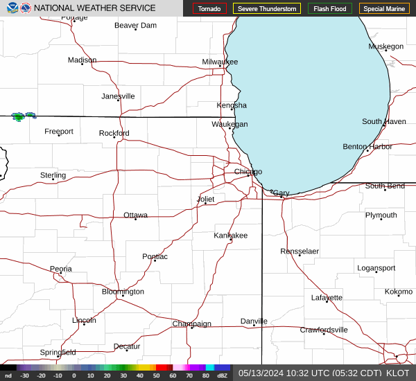
Link to Local Radar Data Link to Satellite Data

Hourly Weather Forecast

National Digital Forecast Database