

Threats of Heavy Rainfall, Severe Thunderstorms and Dangerous Heat

Several complexes of thunderstorms, some severe with heavy rainfall, will impact areas from the northern Plains, Great Lakes, Ohio Valley to the mid-Atlantic. This threat will shift toward the Carolinas on Friday. Heavy rainfall, remnants of Edouard, continues for portions of eastern Texas through today. In-between these systems, a dome of high pressure and heat for central and eastern states. Read More >

Current conditions at

SOMES BAR (SMBC1)

Lat: 41.39007°NLon: 123.49267°WElev: 915.0ft.

NA

65°F

18°C

Humidity 77%
Wind Speed SSE 2 MPH
Barometer NA
Dewpoint 58°F (14°C)
Visibility NA
Last update 03 Sep 04:16 PM PDT
Extended Forecast for

10 Miles SSE Happy Camp CA

  • This Afternoon

    This Afternoon: A 30 percent chance of showers, mainly after 5pm.  Mostly sunny, with a high near 56. Southwest wind around 9 mph.

    High: 56 °F

    Chance
    Showers

  • Tonight

    Tonight: A 30 percent chance of showers, mainly between midnight and 5am.  Partly cloudy, with a low around 45. Southwest wind 5 to 8 mph becoming south southeast after midnight.

    Low: 45 °F

    Chance
    Showers

  • Friday

    Friday: A chance of showers, with thunderstorms also possible after 2pm.  Partly sunny, with a high near 64. Calm wind becoming west southwest 5 to 9 mph in the afternoon.  Chance of precipitation is 50%.

    High: 64 °F

    Chance
    Showers

  • Friday Night

    Friday Night: A 10 percent chance of showers before 7pm.  Mostly clear, with a low around 47. West southwest wind 5 to 8 mph becoming light and variable  after midnight.

    Low: 47 °F

    Slight Chance
    Showers then
    Mostly Clear

  • Saturday

    Saturday: Sunny, with a high near 71. Calm wind becoming west around 6 mph in the afternoon.

    High: 71 °F

    Sunny

  • Saturday Night

    Saturday Night: A 30 percent chance of showers, mainly after 11pm.  Mostly cloudy, with a low around 50.

    Low: 50 °F

    Chance
    Showers

  • Sunday

    Sunday: A chance of showers, with thunderstorms also possible after 11am.  Partly sunny, with a high near 67. Chance of precipitation is 50%.

    High: 67 °F

    Chance
    Showers

  • Sunday Night

    Sunday Night: A chance of rain before 11pm.  Partly cloudy, with a low around 47.

    Low: 47 °F

    Chance Rain
    then Mostly
    Clear

  • Labor Day

    Labor Day: Sunny, with a high near 75.

    High: 75 °F

    Sunny

Detailed Forecast

This Afternoon
A 30 percent chance of showers, mainly after 5pm. Mostly sunny, with a high near 56. Southwest wind around 9 mph.
Tonight
A 30 percent chance of showers, mainly between midnight and 5am. Partly cloudy, with a low around 45. Southwest wind 5 to 8 mph becoming south southeast after midnight.
Friday
A chance of showers, with thunderstorms also possible after 2pm. Partly sunny, with a high near 64. Calm wind becoming west southwest 5 to 9 mph in the afternoon. Chance of precipitation is 50%.
Friday Night
A 10 percent chance of showers before 7pm. Mostly clear, with a low around 47. West southwest wind 5 to 8 mph becoming light and variable after midnight.
Saturday
Sunny, with a high near 71. Calm wind becoming west around 6 mph in the afternoon.
Saturday Night
A 30 percent chance of showers, mainly after 11pm. Mostly cloudy, with a low around 50.
Sunday
A chance of showers, with thunderstorms also possible after 11am. Partly sunny, with a high near 67. Chance of precipitation is 50%.
Sunday Night
A chance of rain before 11pm. Partly cloudy, with a low around 47.
Labor Day
Sunny, with a high near 75.
Monday Night
Mostly clear, with a low around 51.
Tuesday
Mostly sunny, with a high near 79.
Tuesday Night
Partly cloudy, with a low around 54.
Wednesday
Sunny, with a high near 82.
Wednesday Night
Mostly clear, with a low around 57.
Thursday
A slight chance of rain. Sunny, with a high near 82.
Basemap Options
Click map to change the forecast location
Loading map...

ABOUT THIS FORECAST

 
Point Forecast:
10 Miles SSE Happy Camp CA
 41.66°N 123.32°W (Elev. 2201 ft)
1:30 pm PDT Sep 3, 2026
4pm PDT Sep 3, 2026-6pm PDT Sep 10, 2026
 
Get as KML Get as XML

Additional Resources

Radar & Satellite Image
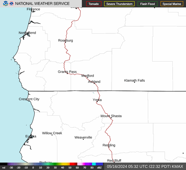
Link to Local Radar Data Link to Satellite Data

Hourly Weather Forecast

National Digital Forecast Database


