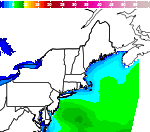
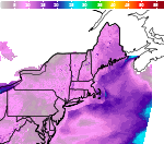
Flooding Risks from Tropical Moisture Across the Intermountain West and East Coast

Tropical moisture from Isaias and Rachel will impact portions of the Intermountain West and East Coast states. Flooding, gusty winds and even a threat for severe thunderstorms and tornadoes are possible. Meanwhile, record warmth will spread northward across the Mississippi Valley the next few days. Looking for snow, the first winter storm of the season is underway across the northern Rockies. Read More >

For More Weather Information:

Norton, MA Local Forecast Office

5NM E Hyannis MA

Marine Point Forecast

[NOTICE]
    • Today

      Today:SSE wind 6 to 8 kt. A slight chance of showers after 5pm.   Seas 1 ft or less.

      High: 62 °F

      SSE 8kt
      < 1ft

    • Tonight

      Tonight:SE wind 6 to 9 kt becoming E after midnight. Winds could gust as high as 20 kt. Showers, with thunderstorms also possible after 5am. Some of the storms could produce heavy rainfall.  Patchy fog.  Seas 1 ft or less.

      Low: 53 °F

      E 9kt
      < 1ft

    • Columbus Day

      Columbus Day:N wind around 10 kt. A chance of showers and thunderstorms before 8am, then a slight chance of showers between 8am and 10am.  Patchy fog before 11am.  Seas 1 ft or less.

      High: 63 °F

      N 10kt
      < 1ft

    • Monday Night

      Monday Night:Variable winds 5 kt or less. Increasing clouds. Seas 1 ft or less.

      Low: 51 °F

      Light Wind
      < 1ft

    • Tuesday

      Tuesday:E wind 6 to 8 kt becoming SSE in the afternoon. Mostly cloudy. Seas 1 ft or less.

      High: 65 °F

      ESE 8kt
      < 1ft

    • Tuesday Night

      Tuesday Night:S wind 8 to 10 kt becoming SSW after midnight. Winds could gust as high as 22 kt. A chance of showers, with thunderstorms also possible after 2am.   Seas 1 ft or less.

      Low: 55 °F

      SSW 10kt
      < 1ft

    • Wednesday

      Wednesday:SW wind around 10 kt becoming WNW in the afternoon. Winds could gust as high as 20 kt. A chance of showers before 9am.   Seas 1 ft or less.

      High: 68 °F

      SW 10kt
      < 1ft

    • Wednesday Night

      Wednesday Night:NNW wind around 8 kt. Partly cloudy. Seas 1 ft or less.

      Low: 46 °F

      NNW 8kt
      < 1ft

    • Thursday

      Thursday:NNW wind 10 to 12 kt, with gusts as high as 20 kt. Sunny. Seas 1 ft or less.

      High: 60 °F

      NNW 12kt
      < 1ft


High and low forecast temperature values represent air temperature.

Associated Zone Forecast which includes this point

Last Update: 8:57 am EDT Oct 11, 2026
Forecast Valid: 9am EDT Oct 11, 2026-6pm EDT Oct 17, 2026

View Nearby Observations

Detailed Forecast


Today
SSE wind 6 to 8 kt. A slight chance of showers after 5pm. Seas 1 ft or less.
Tonight
SE wind 6 to 9 kt becoming E after midnight. Winds could gust as high as 20 kt. Showers, with thunderstorms also possible after 5am. Some of the storms could produce heavy rainfall. Patchy fog. Seas 1 ft or less.
Columbus Day
N wind around 10 kt. A chance of showers and thunderstorms before 8am, then a slight chance of showers between 8am and 10am. Patchy fog before 11am. Seas 1 ft or less.
Monday Night
Variable winds 5 kt or less. Increasing clouds. Seas 1 ft or less.
Tuesday
E wind 6 to 8 kt becoming SSE in the afternoon. Mostly cloudy. Seas 1 ft or less.
Tuesday Night
S wind 8 to 10 kt becoming SSW after midnight. Winds could gust as high as 22 kt. A chance of showers, with thunderstorms also possible after 2am. Seas 1 ft or less.
Wednesday
SW wind around 10 kt becoming WNW in the afternoon. Winds could gust as high as 20 kt. A chance of showers before 9am. Seas 1 ft or less.
Wednesday Night
NNW wind around 8 kt. Partly cloudy. Seas 1 ft or less.
Thursday
NNW wind 10 to 12 kt, with gusts as high as 20 kt. Sunny. Seas 1 ft or less.

Seas are reported as significant wave height, which is the average of the highest third of the waves. Individual wave heights may be more than twice the significant wave height.

*Notices:

  1. This forecast is for a single location. For safety concerns, mariners should be aware of the weather over a larger area. Forecast information for a larger area can be found within the zone forecast and the NDFD graphics.
  2. The forecast conditions at a particular point may not exceed the criteria of a Small Craft Advisory, Gale, Storm etc. These watches/warnings/advisories are issued for the entire zone in which the point resides and mariners should act accordingly.
Basemap Options
Click map to change the forecast location
Loading map...

ABOUT THIS FORECAST

Point Forecast: 41.67°N 70.2°W
Last Update: 8:57 am EDT Oct 11, 2026
Forecast Valid: 9am EDT Oct 11, 2026-6pm EDT Oct 17, 2026
  Forecast Discussion
  Get as KML Get as XML

RADAR & SATELLITE IMAGES

 Link to Satellite Data