Tracking Severe Thunderstorms and Excessive Rainfall in the Southern U.S.; Winter Storm to Impact the Northern U.S.

A storm system will shift from eastern Texas into the lower Mississippi Valley Monday with additional threats of severe thunderstorms and heavy to excessive rainfall which may bring flooding. A Flood Watch remains in effect. In the northern U.S., a storm will bring heavy snow and gusty winds over parts of the northern Rockies, northern Plains, and Upper Midwest Monday into Wednesday. Read More >

Current conditions at

Roseburg Regional Airport (KRBG)

Lat: 43.23368°NLon: 123.3577°WElev: 499.0ft.
rain,mist

48°F

9°C

Humidity 96%
Wind Speed NNE 4 MPH
Barometer 30.21 in (1023.03 mb)
Dewpoint 47°F (8°C)
Visibility 1.75 mi
Wind Chill47°F (8°C)
Last update 23 Nov 10:22 PM PST
Extended Forecast for

16 Miles ENE Azalea OR

  • Tonight

    Tonight: Rain, mainly before 2am.  Patchy dense fog. Low around 39. Calm wind becoming west around 5 mph after midnight.  Chance of precipitation is 90%. New precipitation amounts between a tenth and quarter of an inch possible.

    Low: 39 °F

    Rain and
    Patchy Dense
    Fog

  • Monday

    Monday: Patchy dense fog before 11am.  Otherwise, partly sunny, with a high near 46. Calm wind becoming northwest around 5 mph in the afternoon.

    High: 46 °F

    Patchy Dense
    Fog then
    Partly Sunny

  • Monday Night

    Monday Night: Patchy fog before 10pm.  Otherwise, partly cloudy, with a low around 34. Light and variable wind.

    Low: 34 °F

    Patchy Fog
    then Partly
    Cloudy

  • Tuesday

    Tuesday: Partly sunny, with a high near 51. Calm wind.

    High: 51 °F

    Partly Sunny

  • Tuesday Night

    Tuesday Night: A 20 percent chance of rain.  Mostly cloudy, with a low around 41. Southeast wind 5 to 7 mph.

    Low: 41 °F

    Slight Chance
    Rain

  • Wednesday

    Wednesday: A 30 percent chance of rain.  Mostly cloudy, with a high near 54.

    High: 54 °F

    Chance Rain

  • Wednesday Night

    Wednesday Night: A 30 percent chance of rain.  Mostly cloudy, with a low around 43.

    Low: 43 °F

    Chance Rain

  • Thanksgiving Day

    Thanksgiving Day: A chance of rain.  Mostly cloudy, with a high near 53.

    High: 53 °F

    Chance Rain

  • Thursday Night

    Thursday Night: A chance of rain.  Mostly cloudy, with a low around 41.

    Low: 41 °F

    Chance Rain

Detailed Forecast

Tonight
Rain, mainly before 2am. Patchy dense fog. Low around 39. Calm wind becoming west around 5 mph after midnight. Chance of precipitation is 90%. New precipitation amounts between a tenth and quarter of an inch possible.
Monday
Patchy dense fog before 11am. Otherwise, partly sunny, with a high near 46. Calm wind becoming northwest around 5 mph in the afternoon.
Monday Night
Patchy fog before 10pm. Otherwise, partly cloudy, with a low around 34. Light and variable wind.
Tuesday
Partly sunny, with a high near 51. Calm wind.
Tuesday Night
A 20 percent chance of rain. Mostly cloudy, with a low around 41. Southeast wind 5 to 7 mph.
Wednesday
A 30 percent chance of rain. Mostly cloudy, with a high near 54.
Wednesday Night
A 30 percent chance of rain. Mostly cloudy, with a low around 43.
Thanksgiving Day
A chance of rain. Mostly cloudy, with a high near 53.
Thursday Night
A chance of rain. Mostly cloudy, with a low around 41.
Friday
A chance of rain. Snow level 5000 feet. Mostly cloudy, with a high near 47.
Friday Night
A chance of rain. Snow level 4300 feet. Mostly cloudy, with a low around 37.
Saturday
A chance of rain. Snow level 3700 feet. Mostly cloudy, with a high near 44.
Saturday Night
A chance of rain. Snow level 3800 feet. Mostly cloudy, with a low around 34.
Sunday
A slight chance of rain. Snow level 3300 feet rising to 4100 feet in the afternoon. Mostly sunny, with a high near 43.
Basemap Options
Click map to change the forecast location
Loading map...

ABOUT THIS FORECAST

 
Point Forecast:
16 Miles ENE Azalea OR
 42.89°N 122.98°W (Elev. 2218 ft)
9:51 pm PST Nov 23, 2025
10pm PST Nov 23, 2025-6pm PST Nov 30, 2025
 
Get as KML Get as XML

Additional Resources

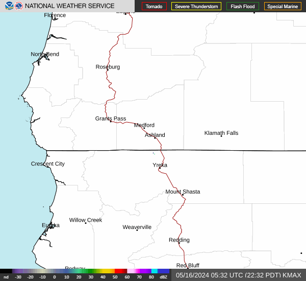
Radar & Satellite Image

Link to Local Radar Data Link to Satellite Data

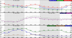
Hourly Weather Forecast

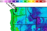
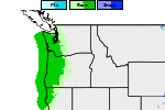
National Digital Forecast Database