

Thunderstorms and Heavy Rainfall in the Southeast, Montana, and Iowa; Lowell Begins to Impact Hawaii

Strong thunderstorms with damaging winds and heavy rain are expected across portions of the Southeast. Thunderstorms may produce large hail across portions of Montana. Heavy rainfall could produce flash flooding across Iowa and vulnerable areas in Utah. Lowell will bring heavy rain, dangerous swells and rip currents to portions of Hawaii. Sweltering heat persists across the South-Central US. Read More >

Current conditions at

PACCTY-2 Pacific City (AT297)

Lat: 45.19683°NLon: 123.96733°WElev: 31.23ft.

NA

58°F

14°C

Humidity 100%
Wind Speed N 0 MPH
Barometer 30.0 in (1015.92 mb)
Dewpoint 58°F (14°C)
Visibility NA
Last update 06 Sep 09:53 AM PDT
Extended Forecast for

2 Miles N Cape Kiwanda OR

  • Today

    Today: A slight chance of showers between 2pm and 3pm.  Partly sunny, with a steady temperature around 58. Calm wind becoming west around 5 mph.  Chance of precipitation is 20%.

    High: 58 °F

    Mostly Cloudy
    then Slight
    Chance
    Showers

  • Tonight

    Tonight: Patchy fog between 11pm and 4am.  Otherwise, mostly cloudy, with a low around 56. Calm wind.

    Low: 56 °F

    Patchy Fog

  • Labor Day

    Labor Day: Cloudy through mid morning, then gradual clearing, with a high near 62. Calm wind becoming northwest 5 to 7 mph in the afternoon.

    High: 62 °F

    Gradual
    Clearing

  • Monday Night

    Monday Night: Partly cloudy, with a low around 54. North northeast wind around 7 mph.

    Low: 54 °F

    Partly Cloudy

  • Tuesday

    Tuesday: Sunny, with a high near 64. Breezy, with a north northeast wind 6 to 11 mph increasing to 12 to 17 mph in the afternoon. Winds could gust as high as 20 mph.

    High: 64 °F

    Sunny then
    Sunny and
    Breezy

  • Tuesday Night

    Tuesday Night: Mostly clear, with a low around 57. Breezy.

    Low: 57 °F

    Mostly Clear
    and Breezy
    then Mostly
    Clear

  • Wednesday

    Wednesday: Sunny, with a high near 67.

    High: 67 °F

    Sunny

  • Wednesday Night

    Wednesday Night: Partly cloudy, with a low around 57.

    Low: 57 °F

    Partly Cloudy

  • Thursday

    Thursday: Partly sunny, with a high near 63.

    High: 63 °F

    Partly Sunny

Detailed Forecast

Today
A slight chance of showers between 2pm and 3pm. Partly sunny, with a steady temperature around 58. Calm wind becoming west around 5 mph. Chance of precipitation is 20%.
Tonight
Patchy fog between 11pm and 4am. Otherwise, mostly cloudy, with a low around 56. Calm wind.
Labor Day
Cloudy through mid morning, then gradual clearing, with a high near 62. Calm wind becoming northwest 5 to 7 mph in the afternoon.
Monday Night
Partly cloudy, with a low around 54. North northeast wind around 7 mph.
Tuesday
Sunny, with a high near 64. Breezy, with a north northeast wind 6 to 11 mph increasing to 12 to 17 mph in the afternoon. Winds could gust as high as 20 mph.
Tuesday Night
Mostly clear, with a low around 57. Breezy.
Wednesday
Sunny, with a high near 67.
Wednesday Night
Partly cloudy, with a low around 57.
Thursday
Partly sunny, with a high near 63.
Thursday Night
Mostly cloudy, with a low around 56.
Friday
Partly sunny, with a high near 61.
Friday Night
A slight chance of rain. Mostly cloudy, with a low around 55.
Saturday
Partly sunny, with a high near 62.
Basemap Options
Click map to change the forecast location
Loading map...

ABOUT THIS FORECAST

 
Point Forecast:
2 Miles N Cape Kiwanda OR
 45.24°N 123.98°W (Elev. 0 ft)
9:41 am PDT Sep 6, 2026
10am PDT Sep 6, 2026-6pm PDT Sep 12, 2026
 
Get as KML Get as XML

Additional Resources

Radar & Satellite Image
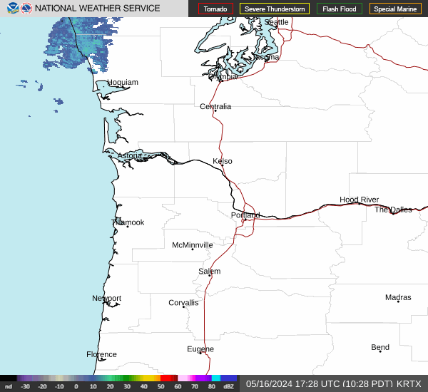
Link to Local Radar Data Link to Satellite Data

Hourly Weather Forecast

National Digital Forecast Database


