

Isaias Expected To Be A Strong Hurricane Approaching The Northern Gulf Coast

Isaias is expected to strengthen and be a strong hurricane when it approaches the northern Gulf Coast on Friday. There is an increasing risk of damaging hurricane-force winds and life-threatening storm surge impacts Friday into Saturday. Isaias will bring heavy rainfall to the northern Gulf Coast and much of the Southeast U.S. Friday into the weekend. Read More >

Current conditions at

CAPE HORN (TBELL)

Lat: 45.569°NLon: 122.203°WElev: 486.0ft.

unknown precip

68°F

20°C

Humidity 58%
Wind Speed NNE 0 MPH
Barometer NA
Dewpoint 53°F (12°C)
Visibility 1.24 mi
Last update 07 Oct 06:45 PM PDT
Extended Forecast for

2 Miles SW Multnomah Falls OR

  • Tonight

    Tonight: Clear, with a low around 56. Light and variable wind becoming east northeast around 6 mph in the evening.

    Low: 56 °F

    Clear

  • Thursday

    Thursday: Sunny, with a high near 73. East wind around 6 mph becoming light and variable.

    High: 73 °F

    Sunny

  • Thursday Night

    Thursday Night: Partly cloudy, with a low around 54. South wind around 6 mph.

    Low: 54 °F

    Partly Cloudy

  • Friday

    Friday: A 50 percent chance of rain.  Mostly cloudy, with a high near 59. West wind 7 to 13 mph, with gusts as high as 22 mph.  New precipitation amounts of less than a tenth of an inch possible.

    High: 59 °F

    Chance Rain

  • Friday Night

    Friday Night: Rain likely, mainly before 11pm.  Mostly cloudy, with a low around 48. West southwest wind around 10 mph, with gusts as high as 21 mph.  Chance of precipitation is 60%.

    Low: 48 °F

    Rain Likely

  • Saturday

    Saturday: A 40 percent chance of showers.  Partly sunny, with a high near 54.

    High: 54 °F

    Chance
    Showers

  • Saturday Night

    Saturday Night: Partly cloudy, with a low around 44.

    Low: 44 °F

    Partly Cloudy

  • Sunday

    Sunday: Sunny, with a high near 58. Breezy.

    High: 58 °F

    Sunny and
    Breezy

  • Sunday Night

    Sunday Night: Mostly clear, with a low around 44. Breezy.

    Low: 44 °F

    Mostly Clear
    then Mostly
    Clear and
    Breezy

Detailed Forecast

Tonight
Clear, with a low around 56. Light and variable wind becoming east northeast around 6 mph in the evening.
Thursday
Sunny, with a high near 73. East wind around 6 mph becoming light and variable.
Thursday Night
Partly cloudy, with a low around 54. South wind around 6 mph.
Friday
A 50 percent chance of rain. Mostly cloudy, with a high near 59. West wind 7 to 13 mph, with gusts as high as 22 mph. New precipitation amounts of less than a tenth of an inch possible.
Friday Night
Rain likely, mainly before 11pm. Mostly cloudy, with a low around 48. West southwest wind around 10 mph, with gusts as high as 21 mph. Chance of precipitation is 60%.
Saturday
A 40 percent chance of showers. Partly sunny, with a high near 54.
Saturday Night
Partly cloudy, with a low around 44.
Sunday
Sunny, with a high near 58. Breezy.
Sunday Night
Mostly clear, with a low around 44. Breezy.
Columbus Day
Sunny, with a high near 59. Breezy.
Monday Night
Mostly clear, with a low around 46. Breezy.
Tuesday
A slight chance of rain. Mostly sunny, with a high near 62. Breezy.
Tuesday Night
A chance of rain. Mostly cloudy, with a low around 49.
Wednesday
A slight chance of rain. Partly sunny, with a high near 59.
Basemap Options
Click map to change the forecast location
Loading map...

ABOUT THIS FORECAST

 
Point Forecast:
2 Miles SW Multnomah Falls OR
 45.56°N 122.12°W (Elev. 2083 ft)
6:41 pm PDT Oct 7, 2026
7pm PDT Oct 7, 2026-6pm PDT Oct 14, 2026
 
Get as KML Get as XML

Additional Resources

Radar & Satellite Image
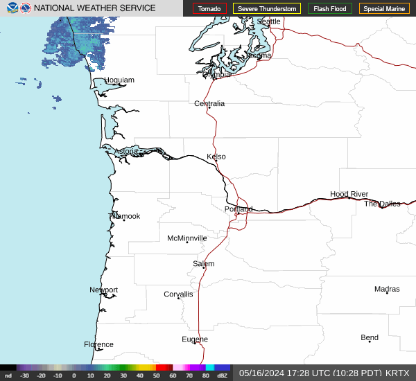
Link to Local Radar Data Link to Satellite Data

Hourly Weather Forecast

National Digital Forecast Database


