

Hazardous Coastal Conditions for the Mid-Atlantic; Storm System Approaching Southern Alaska

A Nor'easter will create hazardous marine and coastal conditions along the Mid-Atlantic coast through mid-week, with significant coastal flooding and beach erosion possible. Meanwhile, another strong storm system is forecast to bring high winds and heavy precipitation to portions of southern Alaska. Elsewhere, relatively benign weather is expected through the first half of the work week. Read More >

Current conditions at

CANYON CREEK (CYFW1)

Lat: 45.92944°NLon: 122.20278°WElev: 2592.0ft.

NA

64°F

18°C

Humidity 35%
Wind Speed SSE 4 MPH
Barometer NA
Dewpoint 36°F (2°C)
Visibility NA
Last update 18 Oct 01:52 PM PDT
Extended Forecast for

3 Miles WNW Mount St Helens WA

  • This Afternoon

    This Afternoon: Mostly sunny, with a high near 51. Calm wind.

    High: 51 °F

    Mostly Sunny

  • Tonight

    Tonight: Cloudy, with a low around 40. South southeast wind 3 to 5 mph.

    Low: 40 °F

    Cloudy

  • Monday

    Monday: Mostly cloudy, with a steady temperature around 44. Light and variable wind.

    High: 44 °F

    Mostly Cloudy

  • Monday Night

    Monday Night: Cloudy, with a low around 38. Calm wind becoming northeast 5 to 7 mph in the evening.

    Low: 38 °F

    Cloudy

  • Tuesday

    Tuesday: Mostly cloudy, then gradually becoming sunny, with a high near 57. East northeast wind 5 to 8 mph becoming calm  in the morning.

    High: 57 °F

    Decreasing
    Clouds

  • Tuesday Night

    Tuesday Night: Mostly clear, with a low around 44.

    Low: 44 °F

    Mostly Clear

  • Wednesday

    Wednesday: Mostly sunny, with a high near 61.

    High: 61 °F

    Mostly Sunny

  • Wednesday Night

    Wednesday Night: Partly cloudy, with a low around 42.

    Low: 42 °F

    Partly Cloudy

  • Thursday

    Thursday: Partly sunny, with a high near 45.

    High: 45 °F

    Partly Sunny

Detailed Forecast

This Afternoon
Mostly sunny, with a high near 51. Calm wind.
Tonight
Cloudy, with a low around 40. South southeast wind 3 to 5 mph.
Monday
Mostly cloudy, with a steady temperature around 44. Light and variable wind.
Monday Night
Cloudy, with a low around 38. Calm wind becoming northeast 5 to 7 mph in the evening.
Tuesday
Mostly cloudy, then gradually becoming sunny, with a high near 57. East northeast wind 5 to 8 mph becoming calm in the morning.
Tuesday Night
Mostly clear, with a low around 44.
Wednesday
Mostly sunny, with a high near 61.
Wednesday Night
Partly cloudy, with a low around 42.
Thursday
Partly sunny, with a high near 45.
Thursday Night
A chance of rain before 11pm, then a chance of rain and snow. Snow level 5800 feet lowering to 4300 feet after midnight . Mostly cloudy, with a low around 34.
Friday
A slight chance of rain and snow. Partly sunny, with a high near 39.
Friday Night
Mostly cloudy, with a low around 33.
Saturday
A chance of rain and snow. Snow level rising to 4900 feet in the afternoon. Partly sunny, with a high near 41.
Basemap Options
Click map to change the forecast location
Loading map...

ABOUT THIS FORECAST

 
Point Forecast:
3 Miles WNW Mount St Helens WA
 46.19°N 122.24°W (Elev. 4167 ft)
2:41 pm PDT Oct 18, 2026
2pm PDT Oct 18, 2026-6pm PDT Oct 24, 2026
 
Get as KML Get as XML

Additional Resources

Radar & Satellite Image
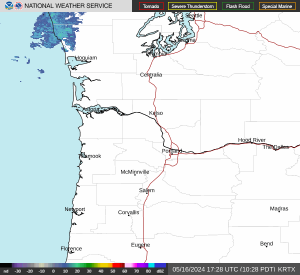
Link to Local Radar Data Link to Satellite Data

Hourly Weather Forecast

National Digital Forecast Database


