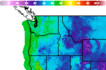
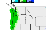
Weather Impacts for the Pacific Northwest This Week; Watching the Northeast U.S.

A series of Pacific fronts will bring periods of moderate rain, higher elevation snow, and gusty winds to the Pacific Northwest through this week. A more widespread precipitation event looks likely this weekend. In the Northeast U.S. a storm may bring gusty winds, low elevation rain, and high elevation snow Friday into this coming weekend. Read More >

Current conditions at

Renton Municipal Airport (KRNT)

Lat: 47.49509°NLon: 122.21437°WElev: 23.0ft.
Overcast

52°F

11°C

Humidity 71%
Wind Speed SSE 4 MPH
Barometer 29.96 in (1014.56 mb)
Dewpoint 43°F (6°C)
Visibility 10.00 mi
Last update 09 Nov 12:15 PM PST
Extended Forecast for

2 Miles ESE Renton WA

  • This Afternoon

    This Afternoon: Rain, mainly after 1pm.  Temperature falling to around 52 by 4pm. East southeast wind 3 to 6 mph.  Chance of precipitation is 90%. New precipitation amounts between a tenth and quarter of an inch possible.

    High: 57 °F⇓

    Rain

  • Tonight

    Tonight: Rain likely before 9pm, then a slight chance of rain after 4am.  Increasing clouds, with a low around 47. South wind 5 to 11 mph, with gusts as high as 20 mph.  Chance of precipitation is 60%. New precipitation amounts between a tenth and quarter of an inch possible.

    Low: 47 °F

    Rain Likely
    then Slight
    Chance Rain

  • Tuesday

    Tuesday: Rain.  High near 55. East southeast wind around 7 mph.  Chance of precipitation is 90%. New precipitation amounts between a quarter and half of an inch possible.

    High: 55 °F

    Rain

  • Tuesday Night

    Tuesday Night: A 10 percent chance of rain before 7pm.  Mostly cloudy, with a low around 51. Southeast wind around 8 mph.

    Low: 51 °F

    Slight Chance
    Rain

  • Veterans Day

    Veterans Day: Mostly cloudy, with a high near 65. South wind 5 to 8 mph.

    High: 65 °F

    Mostly Cloudy

  • Wednesday Night

    Wednesday Night: Mostly cloudy, with a low around 50.

    Low: 50 °F

    Mostly Cloudy

  • Thursday

    Thursday: A 20 percent chance of rain after 10am.  Cloudy, with a high near 61.

    High: 61 °F

    Slight Chance
    Rain

  • Thursday Night

    Thursday Night: Rain likely, mainly after 4am.  Mostly cloudy, with a low around 49.

    Low: 49 °F

    Rain Likely

  • Friday

    Friday: Rain.  Cloudy, with a high near 56.

    High: 56 °F

    Rain

Detailed Forecast

This Afternoon
Rain, mainly after 1pm. Temperature falling to around 52 by 4pm. East southeast wind 3 to 6 mph. Chance of precipitation is 90%. New precipitation amounts between a tenth and quarter of an inch possible.
Tonight
Rain likely before 9pm, then a slight chance of rain after 4am. Increasing clouds, with a low around 47. South wind 5 to 11 mph, with gusts as high as 20 mph. Chance of precipitation is 60%. New precipitation amounts between a tenth and quarter of an inch possible.
Tuesday
Rain. High near 55. East southeast wind around 7 mph. Chance of precipitation is 90%. New precipitation amounts between a quarter and half of an inch possible.
Tuesday Night
A 10 percent chance of rain before 7pm. Mostly cloudy, with a low around 51. Southeast wind around 8 mph.
Veterans Day
Mostly cloudy, with a high near 65. South wind 5 to 8 mph.
Wednesday Night
Mostly cloudy, with a low around 50.
Thursday
A 20 percent chance of rain after 10am. Cloudy, with a high near 61.
Thursday Night
Rain likely, mainly after 4am. Mostly cloudy, with a low around 49.
Friday
Rain. Cloudy, with a high near 56.
Friday Night
Rain. Cloudy, with a low around 46.
Saturday
Rain. Cloudy, with a high near 54.
Saturday Night
Rain. Cloudy, with a low around 45.
Sunday
Rain likely. Mostly cloudy, with a high near 52.
Basemap Options
Click map to change the forecast location
Loading map...

ABOUT THIS FORECAST

 
Point Forecast:
2 Miles ESE Renton WA
 47.46°N 122.18°W (Elev. 400 ft)
10:26 am PST Nov 9, 2026
12pm PST Nov 9, 2026-6pm PST Nov 15, 2026
 
Get as KML Get as XML

Additional Resources

Radar & Satellite Image
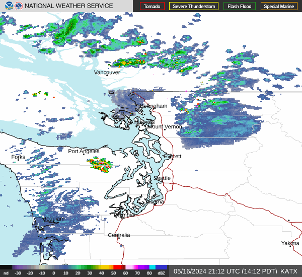
Link to Local Radar Data Link to Satellite Data

Hourly Weather Forecast

National Digital Forecast Database