

Extreme Heat in the Southwest; Severe Weather in the Northern Plains; Heavy Rain in the East

Extreme heat continues across the Southwest as temperatures may top 120 degrees. The heat may expand across the West and south-central U.S. into the middle of the month. Severe thunderstorms capable of severe wind gusts and large hail will be the primary hazards today across the northern Plains into the upper Midwest. Rainfall could be locally heavy across the Eastern U.S. today. Read More >

Current conditions at

WATERHOLE (WHSW1)

Lat: 47.94485°NLon: 123.42594°WElev: 5010.0ft.

NA

45°F

7°C

Humidity NA
Wind Speed NA NA MPH
Barometer NA
Dewpoint N/A
Visibility NA
Last update NA
Extended Forecast for

5 Miles ESE Hurricane Ridge WA

  • Tonight

    Tonight: Clear, with a steady temperature around 47. East wind 3 to 5 mph.

    Low: 47 °F

    Clear

  • Tuesday

    Tuesday: Widespread smoke, mainly after 10am. Sunny, with a high near 68. North northeast wind 3 to 5 mph.

    High: 68 °F

    Smoke

  • Tuesday Night

    Tuesday Night: Areas of smoke. Mostly clear, with a low around 50. Light and variable wind.

    Low: 50 °F

    Areas Smoke

  • Wednesday

    Wednesday: Sunny, with a high near 73. South wind around 5 mph becoming calm.

    High: 73 °F

    Sunny

  • Wednesday Night

    Wednesday Night: Clear, with a low around 53. Calm wind becoming south southwest around 5 mph after midnight.

    Low: 53 °F

    Clear

  • Thursday

    Thursday: Sunny, with a high near 72.

    High: 72 °F

    Sunny

  • Thursday Night

    Thursday Night: Mostly clear, with a low around 53.

    Low: 53 °F

    Mostly Clear

  • Friday

    Friday: Sunny, with a high near 67.

    High: 67 °F

    Sunny

  • Friday Night

    Friday Night: Mostly clear, with a low around 47.

    Low: 47 °F

    Mostly Clear

Detailed Forecast

Tonight
Clear, with a steady temperature around 47. East wind 3 to 5 mph.
Tuesday
Widespread smoke, mainly after 10am. Sunny, with a high near 68. North northeast wind 3 to 5 mph.
Tuesday Night
Areas of smoke. Mostly clear, with a low around 50. Light and variable wind.
Wednesday
Sunny, with a high near 73. South wind around 5 mph becoming calm.
Wednesday Night
Clear, with a low around 53. Calm wind becoming south southwest around 5 mph after midnight.
Thursday
Sunny, with a high near 72.
Thursday Night
Mostly clear, with a low around 53.
Friday
Sunny, with a high near 67.
Friday Night
Mostly clear, with a low around 47.
Saturday
Sunny, with a high near 61.
Saturday Night
Mostly clear, with a low around 46.
Sunday
Sunny, with a high near 59.
Sunday Night
Mostly clear, with a low around 45.
Monday
Sunny, with a high near 60.
Basemap Options
Click map to change the forecast location
Loading map...

ABOUT THIS FORECAST

 
Point Forecast:
5 Miles ESE Hurricane Ridge WA
 47.95°N 123.41°W (Elev. 4951 ft)
11:26 am PDT Aug 3, 2026
11pm PDT Aug 3, 2026-6pm PDT Aug 10, 2026
 
Get as KML Get as XML

Additional Resources

Radar & Satellite Image
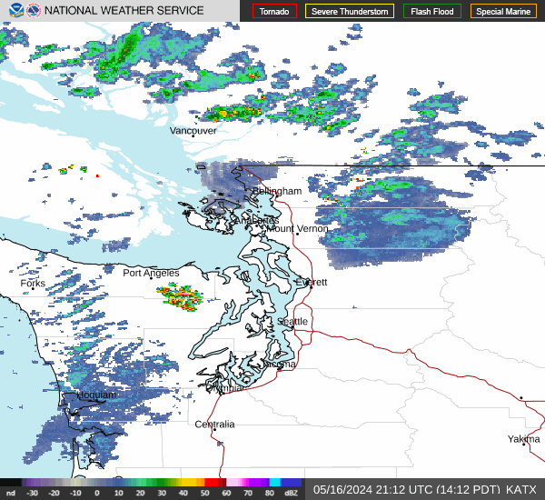
Link to Local Radar Data Link to Satellite Data

Hourly Weather Forecast

National Digital Forecast Database


