

Areas of Severe Thunderstorms and Excessive Rainfall Thursday

Severe thunderstorms posing a risk for strong gusts and/or large hail are possible across portions of the northern and central Plains, the Lower Missouri to Lower Ohio Valleys, and across the Mid-Atlantic Thursday afternoon and evening. Excessive rainfall may bring flash and urban flooding over the Mid-Mississippi and Ohio Valleys, and Mid-Atlantic on Thursday. Read More >

Current conditions at

JIM CREEK (SWYW1)

Lat: 48.1785°NLon: 122.02919°WElev: 786.0ft.

NA

54°F

12°C

Humidity 83%
Wind Speed N 1 MPH
Barometer NA
Dewpoint 49°F (9°C)
Visibility NA
Last update 08 Jul 11:42 PM PDT
Extended Forecast for

12 Miles ESE Granite Falls WA

  • Overnight

    Overnight: Mostly cloudy, with a low around 48. Calm wind.

    Low: 48 °F

    Mostly Cloudy

  • Thursday

    Thursday: Mostly sunny, with a high near 63. Calm wind becoming west 5 to 8 mph in the morning.

    High: 63 °F

    Mostly Sunny

  • Thursday Night

    Thursday Night: Increasing clouds, with a low around 51. West northwest wind 5 to 7 mph becoming calm  in the evening.

    Low: 51 °F

    Increasing
    Clouds

  • Friday

    Friday: Mostly cloudy, with a high near 59. Calm wind becoming southwest 5 to 7 mph in the morning.

    High: 59 °F

    Mostly Cloudy

  • Friday Night

    Friday Night: Mostly cloudy, with a low around 50. West southwest wind 5 to 7 mph becoming calm  in the evening.

    Low: 50 °F

    Mostly Cloudy

  • Saturday

    Saturday: Partly sunny, with a high near 58.

    High: 58 °F

    Partly Sunny

  • Saturday Night

    Saturday Night: Partly cloudy, with a low around 47.

    Low: 47 °F

    Partly Cloudy

  • Sunday

    Sunday: Mostly sunny, with a high near 60.

    High: 60 °F

    Mostly Sunny

  • Sunday Night

    Sunday Night: Mostly clear, with a low around 47.

    Low: 47 °F

    Mostly Clear

Detailed Forecast

Overnight
Mostly cloudy, with a low around 48. Calm wind.
Thursday
Mostly sunny, with a high near 63. Calm wind becoming west 5 to 8 mph in the morning.
Thursday Night
Increasing clouds, with a low around 51. West northwest wind 5 to 7 mph becoming calm in the evening.
Friday
Mostly cloudy, with a high near 59. Calm wind becoming southwest 5 to 7 mph in the morning.
Friday Night
Mostly cloudy, with a low around 50. West southwest wind 5 to 7 mph becoming calm in the evening.
Saturday
Partly sunny, with a high near 58.
Saturday Night
Partly cloudy, with a low around 47.
Sunday
Mostly sunny, with a high near 60.
Sunday Night
Mostly clear, with a low around 47.
Monday
Sunny, with a high near 66.
Monday Night
Mostly clear, with a low around 52.
Tuesday
Sunny, with a high near 67.
Tuesday Night
Mostly clear, with a low around 53.
Wednesday
Sunny, with a high near 65.
Basemap Options
Click map to change the forecast location
Loading map...

ABOUT THIS FORECAST

 
Point Forecast:
12 Miles ESE Granite Falls WA
 48.03°N 121.72°W (Elev. 2808 ft)
11:26 pm PDT Jul 8, 2026
12am PDT Jul 9, 2026-6pm PDT Jul 15, 2026
 
Get as KML Get as XML

Additional Resources

Radar & Satellite Image
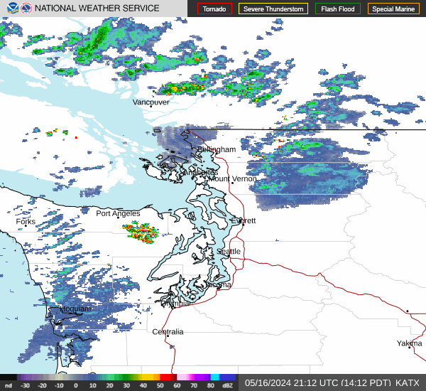
Link to Local Radar Data Link to Satellite Data

Hourly Weather Forecast

National Digital Forecast Database


