

Severe Thunderstorms for Mid-Atlantic and Northeast; Typhoon Approaching Guam

A cold front will sweep eastward today accompanied by strong to severe thunderstorms for the mid-Atlantic and Northeast today. In the wake of this cold front, autumn like temperatures and gusty winds from the Plains, Mississippi Valley, Great Lakes to most of the eastern seaboard. Fire weather conditions for lower Mississippi Valley into portions of California. For Guam, a typhoon is approaching. Read More >

Current conditions at

JIM CREEK (SWYW1)

Lat: 48.1785°NLon: 122.02919°WElev: 786.0ft.

NA

70°F

21°C

Humidity 30%
Wind Speed E 0 MPH
Barometer NA
Dewpoint 37°F (3°C)
Visibility NA
Last update 16 Oct 11:42 AM PDT
Extended Forecast for

8 Miles E Granite Falls WA

  • This Afternoon

    This Afternoon: Sunny, with a high near 76. Light and variable wind.

    High: 76 °F

    Sunny

  • Tonight

    Tonight: Rain, mainly after 3am.  Low around 49. Calm wind becoming south southeast 5 to 7 mph in the evening.  Chance of precipitation is 80%. New precipitation amounts between a quarter and half of an inch possible.

    Low: 49 °F

    Partly Cloudy
    then Rain

  • Saturday

    Saturday: Rain, mainly before 9am.  High near 59. West wind 5 to 7 mph.  Chance of precipitation is 80%. New precipitation amounts between a quarter and half of an inch possible.

    High: 59 °F

    Rain then
    Mostly Sunny

  • Saturday Night

    Saturday Night: Mostly clear, with a low around 39. Light and variable wind.

    Low: 39 °F

    Mostly Clear

  • Sunday

    Sunday: Mostly sunny, with a high near 59. East wind around 5 mph becoming calm  in the morning.

    High: 59 °F

    Mostly Sunny

  • Sunday Night

    Sunday Night: Mostly cloudy, with a low around 42.

    Low: 42 °F

    Mostly Cloudy

  • Monday

    Monday: Mostly cloudy, with a high near 57.

    High: 57 °F

    Mostly Cloudy

  • Monday Night

    Monday Night: Mostly cloudy, with a low around 40.

    Low: 40 °F

    Mostly Cloudy

  • Tuesday

    Tuesday: Mostly sunny, with a high near 59.

    High: 59 °F

    Mostly Sunny

Detailed Forecast

This Afternoon
Sunny, with a high near 76. Light and variable wind.
Tonight
Rain, mainly after 3am. Low around 49. Calm wind becoming south southeast 5 to 7 mph in the evening. Chance of precipitation is 80%. New precipitation amounts between a quarter and half of an inch possible.
Saturday
Rain, mainly before 9am. High near 59. West wind 5 to 7 mph. Chance of precipitation is 80%. New precipitation amounts between a quarter and half of an inch possible.
Saturday Night
Mostly clear, with a low around 39. Light and variable wind.
Sunday
Mostly sunny, with a high near 59. East wind around 5 mph becoming calm in the morning.
Sunday Night
Mostly cloudy, with a low around 42.
Monday
Mostly cloudy, with a high near 57.
Monday Night
Mostly cloudy, with a low around 40.
Tuesday
Mostly sunny, with a high near 59.
Tuesday Night
Mostly clear, with a low around 40.
Wednesday
Sunny, with a high near 63.
Wednesday Night
Partly cloudy, with a low around 44.
Thursday
A chance of rain. Mostly cloudy, with a high near 56.
Basemap Options
Click map to change the forecast location
Loading map...

ABOUT THIS FORECAST

 
Point Forecast:
8 Miles E Granite Falls WA
 48.1°N 121.8°W (Elev. 974 ft)
11:26 am PDT Oct 16, 2026
12pm PDT Oct 16, 2026-6pm PDT Oct 22, 2026
 
Get as KML Get as XML

Additional Resources

Radar & Satellite Image
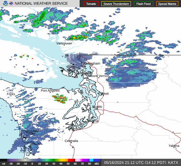
Link to Local Radar Data Link to Satellite Data

Hourly Weather Forecast

National Digital Forecast Database


