

Heat Continues Across the Southern Plains and Gulf Coast; Heavy Rainfall from the Tennessee Valley to Southeast on Friday

Hazardous heat will continue across the Southern Plains, Gulf Coast and Desert Southwest through the weekend. Additional heat will build into the Great Basin and Northern Plains this weekend. A stalled front is expected to bring periods of heavy to excessive rainfall and flooding from the Tennessee Valley to the Southeast U.S on Friday. Read More >

Current conditions at

FINNEY CREEK (FIFW1)

Lat: 48.39236°NLon: 121.81828°WElev: 2160.0ft.

NA

58°F

14°C

Humidity 92%
Wind Speed SE 0 MPH
Barometer NA
Dewpoint 56°F (13°C)
Visibility NA
Last update 23 Jul 10:28 PM PDT
Extended Forecast for

9 Miles S Lyman WA

  • Tonight

    Tonight: Partly cloudy, with a low around 58. Calm wind.

    Low: 58 °F

    Partly Cloudy

  • Friday

    Friday: Mostly sunny, with a high near 70. Calm wind becoming southwest around 6 mph in the afternoon.

    High: 70 °F

    Mostly Sunny

  • Friday Night

    Friday Night: Partly cloudy, with a low around 56. West southwest wind around 6 mph becoming calm.

    Low: 56 °F

    Partly Cloudy

  • Saturday

    Saturday: Partly sunny, with a high near 61. South southwest wind 7 to 10 mph, with gusts as high as 21 mph.

    High: 61 °F

    Partly Sunny

  • Saturday Night

    Saturday Night: A 20 percent chance of rain after 11pm.  Mostly cloudy, with a low around 54. South southeast wind 9 to 11 mph, with gusts as high as 21 mph.

    Low: 54 °F

    Slight Chance
    Rain

  • Sunday

    Sunday: Rain likely, mainly after 11am.  Mostly cloudy, with a high near 59. Chance of precipitation is 60%. New precipitation amounts of less than a tenth of an inch possible.

    High: 59 °F

    Rain Likely

  • Sunday Night

    Sunday Night: A 30 percent chance of rain before 11pm.  Mostly cloudy, with a low around 53.

    Low: 53 °F

    Chance Rain
    then Mostly
    Cloudy

  • Monday

    Monday: Partly sunny, with a high near 63.

    High: 63 °F

    Partly Sunny

  • Monday Night

    Monday Night: Partly cloudy, with a low around 53.

    Low: 53 °F

    Partly Cloudy

Detailed Forecast

Tonight
Partly cloudy, with a low around 58. Calm wind.
Friday
Mostly sunny, with a high near 70. Calm wind becoming southwest around 6 mph in the afternoon.
Friday Night
Partly cloudy, with a low around 56. West southwest wind around 6 mph becoming calm.
Saturday
Partly sunny, with a high near 61. South southwest wind 7 to 10 mph, with gusts as high as 21 mph.
Saturday Night
A 20 percent chance of rain after 11pm. Mostly cloudy, with a low around 54. South southeast wind 9 to 11 mph, with gusts as high as 21 mph.
Sunday
Rain likely, mainly after 11am. Mostly cloudy, with a high near 59. Chance of precipitation is 60%. New precipitation amounts of less than a tenth of an inch possible.
Sunday Night
A 30 percent chance of rain before 11pm. Mostly cloudy, with a low around 53.
Monday
Partly sunny, with a high near 63.
Monday Night
Partly cloudy, with a low around 53.
Tuesday
Partly sunny, with a high near 62.
Tuesday Night
Mostly clear, with a low around 51.
Wednesday
Sunny, with a high near 65.
Wednesday Night
Mostly clear, with a low around 51.
Thursday
Sunny, with a high near 65.
Basemap Options
Click map to change the forecast location
Loading map...

ABOUT THIS FORECAST

 
Point Forecast:
9 Miles S Lyman WA
 48.39°N 122.05°W (Elev. 2946 ft)
1:16 pm PDT Jul 23, 2026
10pm PDT Jul 23, 2026-6pm PDT Jul 30, 2026
 
Get as KML Get as XML

Additional Resources

Radar & Satellite Image
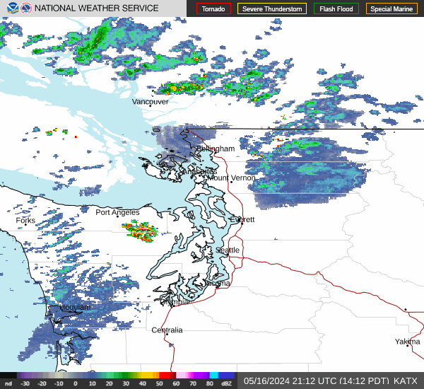
Link to Local Radar Data Link to Satellite Data

Hourly Weather Forecast

National Digital Forecast Database


