Heavy Rain and Thunderstorms in the Lower Ohio Valley and Southeast; Flooding Continues Along the East Coast of Florida

An approaching cold front may produce isolated heavy rainfall and severe weather today over portions of the Lower Ohio Valley and Southeast. While the heavy rainfall is ending across east Florida, significant river flooding is forecast along the St. John’s and the Peace rivers through the end of the week as flood waters will be slow to recede. Read More >

Current conditions at

Burlington/Mount Vernon, Skagit Regional Airport (KBVS)

Lat: 48.47083°NLon: 122.42083°WElev: 144.0ft.

Clear

50°F

10°C

Humidity 81%
Wind Speed N 0 MPH
Barometer 30.06 in (1017.95 mb)
Dewpoint 45°F (7°C)
Visibility 10.00 mi
Last update 04 Nov 10:35 AM PST
Extended Forecast for

Burlington WA

  • Today

    Today: A 30 percent chance of rain, mainly after 5pm.  Mostly cloudy, with a high near 59. Calm wind becoming south southeast around 6 mph in the afternoon.

    High: 59 °F

    Partly Sunny
    then Chance
    Rain

  • Tonight

    Tonight: Rain, mainly before 3am.  Low around 46. Southeast wind 10 to 15 mph becoming light south southeast  after midnight. Winds could gust as high as 26 mph.  Chance of precipitation is 90%. New precipitation amounts of less than a tenth of an inch possible.

    Low: 46 °F

    Rain then
    Chance Rain

  • Thursday

    Thursday: Partly sunny, with a high near 55. South southeast wind 3 to 8 mph.

    High: 55 °F

    Partly Sunny

  • Thursday Night

    Thursday Night: A 50 percent chance of rain after 3am.  Cloudy, with a low around 46. East southeast wind 8 to 13 mph, with gusts as high as 23 mph.

    Low: 46 °F

    Mostly Cloudy
    then Chance
    Rain

  • Friday

    Friday: Rain.  High near 54. Southeast wind 15 to 18 mph, with gusts as high as 32 mph.  Chance of precipitation is 100%. New precipitation amounts between a quarter and half of an inch possible.

    High: 54 °F

    Rain

  • Friday Night

    Friday Night: Rain likely, mainly before 10pm.  Cloudy, with a low around 48. Chance of precipitation is 60%. New precipitation amounts of less than a tenth of an inch possible.

    Low: 48 °F

    Rain Likely

  • Saturday

    Saturday: A chance of rain before 10am, then a chance of rain after 4pm.  Cloudy, with a high near 62. Chance of precipitation is 30%.

    High: 62 °F

    Chance Rain

  • Saturday Night

    Saturday Night: Rain, mainly after 10pm.  Cloudy, with a low around 48.

    Low: 48 °F

    Rain

  • Sunday

    Sunday: Showers and possibly a thunderstorm before 10am, then a chance of showers and thunderstorms between 10am and 4pm, then a slight chance of rain and thunderstorms after 4pm.  Mostly cloudy, with a high near 54.

    High: 54 °F

    Showers

Detailed Forecast

Today
A 30 percent chance of rain, mainly after 5pm. Mostly cloudy, with a high near 59. Calm wind becoming south southeast around 6 mph in the afternoon.
Tonight
Rain, mainly before 3am. Low around 46. Southeast wind 10 to 15 mph becoming light south southeast after midnight. Winds could gust as high as 26 mph. Chance of precipitation is 90%. New precipitation amounts of less than a tenth of an inch possible.
Thursday
Partly sunny, with a high near 55. South southeast wind 3 to 8 mph.
Thursday Night
A 50 percent chance of rain after 3am. Cloudy, with a low around 46. East southeast wind 8 to 13 mph, with gusts as high as 23 mph.
Friday
Rain. High near 54. Southeast wind 15 to 18 mph, with gusts as high as 32 mph. Chance of precipitation is 100%. New precipitation amounts between a quarter and half of an inch possible.
Friday Night
Rain likely, mainly before 10pm. Cloudy, with a low around 48. Chance of precipitation is 60%. New precipitation amounts of less than a tenth of an inch possible.
Saturday
A chance of rain before 10am, then a chance of rain after 4pm. Cloudy, with a high near 62. Chance of precipitation is 30%.
Saturday Night
Rain, mainly after 10pm. Cloudy, with a low around 48.
Sunday
Showers and possibly a thunderstorm before 10am, then a chance of showers and thunderstorms between 10am and 4pm, then a slight chance of rain and thunderstorms after 4pm. Mostly cloudy, with a high near 54.
Sunday Night
A slight chance of rain before 10pm. Mostly cloudy, with a low around 36.
Monday
Mostly cloudy, with a high near 55.
Monday Night
A chance of rain. Mostly cloudy, with a low around 45.
Tuesday
Rain likely. Mostly cloudy, with a high near 55.
Basemap Options
Click map to change the forecast location
Loading map...

ABOUT THIS FORECAST

 
Point Forecast:
Burlington WA
 48.48°N 122.33°W (Elev. 154 ft)
10:26 am PST Nov 4, 2026
10am PST Nov 4, 2026-6pm PST Nov 10, 2026
 
Get as KML Get as XML

Additional Resources

Radar & Satellite Image
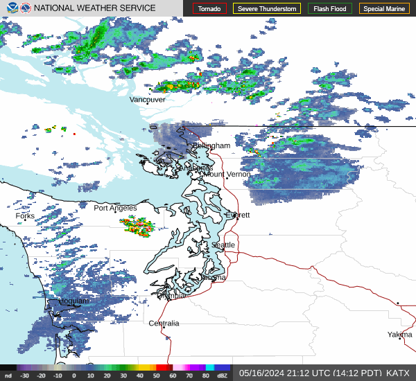
Link to Local Radar Data Link to Satellite Data

Hourly Weather Forecast

National Digital Forecast Database