


Hazardous Weather Conditions
Current conditions at
Selfridge Air National Guard Base (KMTC)
Lat: 42.6°NLon: 82.84°WElev: 577ft.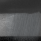
Showers in Vicinity
61°F
16°C
| Humidity | 60% |
| Wind Speed | NE 5 mph |
| Barometer | 29.54 in (1000.8 mb) |
| Dewpoint | 47°F (8°C) |
| Visibility | 10.00 mi |
| Last update | 7 May 8:56 pm EDT |
Extended Forecast for
Sterling Heights MI
Tonight
Low: 56 °F
Showers then
Mostly CloudyWednesday
High: 79 °F
Mostly Sunny
then Sunny
and BreezyWednesday Night
Low: 51 °F
Partly Cloudy
then Chance
ShowersThursday

High: 60 °F
Showers
LikelyThursday Night

Low: 47 °F
Chance
ShowersFriday

High: 64 °F
Partly Sunny
Friday Night

Low: 45 °F
Partly Cloudy
Saturday

High: 63 °F
Chance
ShowersSaturday Night

Low: 46 °F
Mostly Cloudy
Detailed Forecast
Tonight
Showers and possibly a thunderstorm before 11pm, then a chance of showers and thunderstorms between 11pm and midnight. Low around 56. East southeast wind 5 to 10 mph becoming light and variable. Chance of precipitation is 80%. New precipitation amounts between a quarter and half of an inch possible.
Wednesday
Sunny, with a high near 79. Breezy, with a southwest wind 8 to 13 mph increasing to 16 to 21 mph in the afternoon. Winds could gust as high as 29 mph.
Wednesday Night
A chance of showers after 2am. Increasing clouds, with a low around 51. West northwest wind 9 to 14 mph becoming northeast after midnight. Winds could gust as high as 20 mph. Chance of precipitation is 50%.
Thursday
Showers likely, mainly after 8am. Cloudy, with a high near 60. North northeast wind 11 to 14 mph, with gusts as high as 21 mph. Chance of precipitation is 70%. New precipitation amounts between a tenth and quarter of an inch possible.
Thursday Night
A chance of showers before 2am. Mostly cloudy, with a low around 47. North northwest wind 10 to 13 mph, with gusts as high as 20 mph. Chance of precipitation is 40%.
Friday
Partly sunny, with a high near 64.
Friday Night
Partly cloudy, with a low around 45.
Saturday
A chance of showers after 8am. Partly sunny, with a high near 63.
Saturday Night
Mostly cloudy, with a low around 46.
Sunday
A chance of showers after 2pm. Partly sunny, with a high near 69.
Sunday Night
A chance of showers. Partly cloudy, with a low around 50.
Monday
A chance of showers. Mostly sunny, with a high near 74.
Monday Night
A chance of showers. Partly cloudy, with a low around 53.
Tuesday
Mostly sunny, with a high near 76.
ABOUT THIS FORECAST
Point Forecast:
Sterling Heights MI
42.57°N 83.04°W (Elev. 630 ft)
42.57°N 83.04°W (Elev. 630 ft)
6:24 pm EDT May 7, 2024
9pm EDT May 7, 2024-6pm EDT May 14, 2024
Additional Resources
Radar & Satellite Image


Hourly Weather Forecast


