Tropical Storm Edouard Along the Gulf Coast; Heat Expands Eastward
Tropical Storm Edouard off the central Gulf Coast will bring tropical storm conditions and heavy rainfall to portions of Upper Texas and southwestern Louisiana coasts Tuesday into Wednesday. Storm Surge Watches and Tropical Storm Warnings are in effect. Hot and humid conditions will continue to expand from the Central Plains into the Ohio Valley and Mid-Atlantic this week. Read More >

Current conditions at
Shreveport, Shreveport Downtown Airport (KDTN)
Lat: 32.54° N Lon: 93.74° W Elev: 177 ft.
Fair
81°F
27°C
| Humidity | 74% |
| Wind Speed | SE 3 mph |
| Barometer | 30.02 in (1016.2 mb) |
| Dewpoint | 72°F (22°C) |
| Visibility | 10.00 mi |
| Heat Index | 85°F (29°C) |
| Last update | 1 Sep 2:53 am CDT |
Detailed forecast for
Caddo Parish
Rest Of Tonight
Mostly clear. Lows in the mid 70s. Southeast winds around 5 mph.
Tuesday
Mostly sunny. Hot with highs in the upper 90s. East winds 5 to 10 mph.
Tuesday Night
Mostly clear. Lows in the mid 70s. Southeast winds 5 to 10 mph.
Wednesday
Partly cloudy. A slight chance of showers and thunderstorms in the afternoon. Hot with highs in the mid 90s. Southeast winds 5 to 10 mph. Chance of rain 20 percent. Heat index values up to 105 in the afternoon.
Wednesday Night
Mostly clear. Lows in the mid 70s. South winds 5 to 10 mph.
Thursday
Mostly sunny. A slight chance of showers and thunderstorms in the afternoon. Hot with highs in the mid 90s. Chance of rain 20 percent. Heat index values up to 105 in the afternoon.
Thursday Night
Mostly clear. Lows in the mid 70s.
Friday
Partly cloudy with a slight chance of showers. A slight chance of thunderstorms in the afternoon. Hot with highs in the mid 90s. Chance of rain 20 percent.
Friday Night
Mostly clear. Lows in the mid 70s.
Saturday
Mostly sunny. A slight chance of showers in the morning, then a chance of showers and thunderstorms in the afternoon. Hot with highs in the mid 90s. Chance of rain 30 percent.
Saturday Night
Mostly clear. Lows in the mid 70s.
Sunday
Mostly sunny. A slight chance of showers and thunderstorms in the afternoon. Hot with highs in the upper 90s. Chance of rain 20 percent. Heat index values up to 105 in the afternoon.
Sunday Night
Mostly clear. Lows in the mid 70s.
Labor Day
Mostly sunny. Hot with highs in the upper 90s. Heat index values up to 105 in the afternoon.
Basemap Options
Click map to change the forecast location
Loading map...
 Forecast Area
Additional Resources
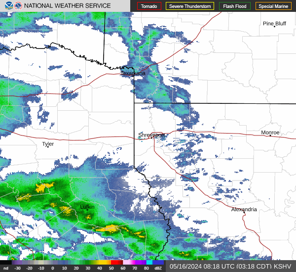
Radar & Satellite Image

Hourly Weather Forecast