Current conditions at
Hilo, Hilo International Airport (PHTO)
Lat: 19.72°NLon: 155.06°WElev: 36ft.
Overcast
72°F
22°C
| Humidity | 91% |
| Wind Speed | W 10 mph |
| Barometer | 30.03 in (1016.8 mb) |
| Dewpoint | 69°F (21°C) |
| Visibility | 10.00 mi |
| Last update | 9 Nov 1:53 am HST |
Extended Forecast for
10 Miles SSE Hawaii Volcanoes National Park HI
Overnight

Low: 69 °F
Mostly Cloudy
and WindyMonday

High: 84 °F
Mostly Sunny
and WindyMonday Night
Low: 68 °F
Mostly Cloudy
and BreezyTuesday
High: 85 °F
Mostly Sunny
and BreezyTuesday Night
Low: 69 °F
Mostly Cloudy
and WindyVeterans Day
High: 84 °F
Mostly Sunny
and WindyWednesday Night

Low: 68 °F
Partly Cloudy
and BreezyThursday
High: 84 °F
Mostly Sunny
and WindyThursday Night
Low: 68 °F
Partly Cloudy
and Breezy
Detailed Forecast
Overnight
Mostly cloudy, with a low around 69. Windy, with a north northeast wind 23 to 25 mph, with gusts as high as 36 mph.
Monday
Mostly sunny, with a high near 84. Windy, with a northeast wind 17 to 23 mph, with gusts as high as 32 mph.
Monday Night
Mostly cloudy, with a low around 68. Breezy, with a north northeast wind 17 to 20 mph, with gusts as high as 28 mph.
Tuesday
Mostly sunny, with a high near 85. Breezy, with a northeast wind 17 to 21 mph, with gusts as high as 29 mph.
Tuesday Night
Mostly cloudy, with a low around 69. Windy, with a northeast wind 21 to 28 mph, with gusts as high as 40 mph.
Veterans Day
Mostly sunny, with a high near 84. Windy, with a northeast wind 21 to 23 mph, with gusts as high as 32 mph.
Wednesday Night
Partly cloudy, with a low around 68. Breezy, with a northeast wind around 22 mph, with gusts as high as 31 mph.
Thursday
Mostly sunny, with a high near 84. Windy, with a northeast wind 21 to 24 mph, with gusts as high as 34 mph.
Thursday Night
Partly cloudy, with a low around 68. Breezy, with a northeast wind 17 to 21 mph, with gusts as high as 29 mph.
Friday
Mostly sunny, with a high near 83. Breezy, with a northeast wind 17 to 21 mph, with gusts as high as 29 mph.
Friday Night
Partly cloudy, with a low around 68. Breezy, with a northeast wind 15 to 17 mph, with gusts as high as 24 mph.
Saturday
Mostly sunny, with a high near 83. Breezy, with a northeast wind 15 to 20 mph, with gusts as high as 28 mph.
Saturday Night
Partly cloudy, with a low around 68. Breezy, with a northeast wind 17 to 20 mph, with gusts as high as 28 mph.
Sunday
Sunny, with a high near 83. Breezy, with a northeast wind 17 to 20 mph, with gusts as high as 28 mph.
Additional Forecasts and Information
Basemap Options
Click map to change the forecast location
Loading map...
 Forecast Area
ABOUT THIS FORECAST
Point Forecast:
10 Miles SSE Hawaii Volcanoes National Park HI
19.3°N 155.23°W (Elev. 955 ft)
19.3°N 155.23°W (Elev. 955 ft)
8:51 pm HST Nov 8, 2026
2am HST Nov 9, 2026-6pm HST Nov 15, 2026


Additional Resources
Radar & Satellite Image
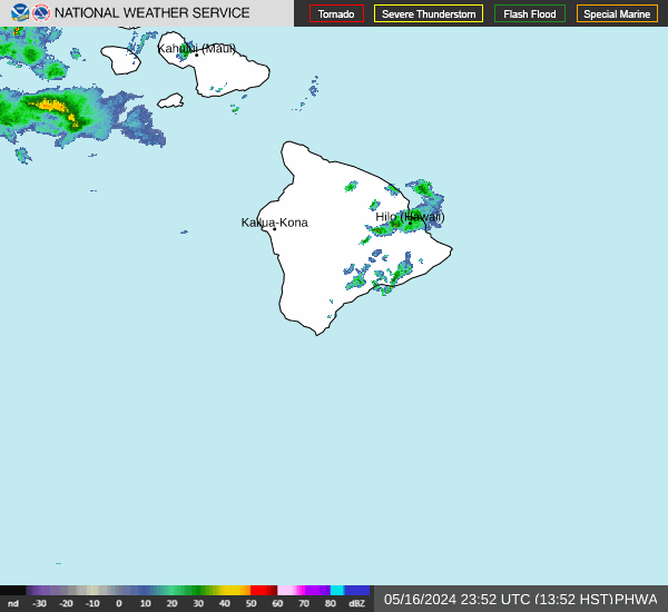

Hourly Weather Forecast