Current conditions at
Bradshaw Army Air Field / Hawaii (PHSF)
Lat: 19.76°NLon: 155.55°WElev: 6138ft.
Fair
57°F
14°C
| Humidity | 88% |
| Wind Speed | E 9 mph |
| Barometer | 30.30 in (1014.7 mb) |
| Dewpoint | 53°F (12°C) |
| Visibility | NA |
| Last update | 7 Nov 1:55 am HST |
Extended Forecast for
20 Miles S Bradshaw Army Air Field HI
Overnight

Low: 39 °F
Isolated
Showers and
BreezySaturday
High: 48 °F
Mostly Sunny
and Breezy
then Mostly
SunnySaturday Night

Low: 41 °F
Partly Cloudy
Sunday

High: 48 °F
Mostly Sunny
and BreezySunday Night
Low: 42 °F
Partly Cloudy
then Partly
Cloudy and
BreezyMonday

High: 48 °F
Sunny and
WindyMonday Night
Low: 44 °F
Mostly Clear
and Breezy
then Mostly
ClearTuesday
High: 48 °F
Mostly Sunny
and BreezyTuesday Night

Low: 45 °F
Mostly Clear
and Windy
Detailed Forecast
Overnight
Isolated showers. Partly cloudy, with a low around 39. Breezy, with a north northeast wind 10 to 15 mph. Chance of precipitation is 20%.
Saturday
Mostly sunny, with a high near 48. Breezy, with an east northeast wind 9 to 15 mph.
Saturday Night
Partly cloudy, with a low around 41. East wind 5 to 9 mph.
Sunday
Mostly sunny, with a high near 48. Breezy, with an east northeast wind 9 to 18 mph, with gusts as high as 22 mph.
Sunday Night
Partly cloudy, with a low around 42. Breezy, with an east southeast wind 10 to 15 mph increasing to 17 to 22 mph after midnight. Winds could gust as high as 26 mph.
Monday
Sunny, with a high near 48. Windy, with an east southeast wind 15 to 23 mph, with gusts as high as 28 mph.
Monday Night
Mostly clear, with a low around 44. Breezy, with a south southeast wind 8 to 15 mph.
Tuesday
Mostly sunny, with a high near 48. Breezy, with an east wind 14 to 21 mph, with gusts as high as 25 mph.
Tuesday Night
Mostly clear, with a low around 45. Windy, with an east wind 18 to 26 mph, with gusts as high as 32 mph.
Veterans Day
Sunny, with a high near 50. Windy, with an east wind 24 to 30 mph, with gusts as high as 37 mph.
Wednesday Night
Mostly clear, with a low around 46. Windy, with an east southeast wind 21 to 24 mph, with gusts as high as 29 mph.
Thursday
Sunny, with a high near 51. Windy, with an east northeast wind 16 to 24 mph, with gusts as high as 29 mph.
Thursday Night
Mostly clear, with a low around 46. Breezy, with an east southeast wind 9 to 16 mph, with gusts as high as 20 mph.
Friday
Sunny, with a high near 50. Breezy, with an east northeast wind 9 to 18 mph, with gusts as high as 22 mph.
Additional Forecasts and Information
Basemap Options
Click map to change the forecast location
Loading map...
 Forecast Area
ABOUT THIS FORECAST
Point Forecast:
20 Miles S Bradshaw Army Air Field HI
19.5°N 155.57°W (Elev. 12838 ft)
19.5°N 155.57°W (Elev. 12838 ft)
10:48 pm HST Nov 6, 2026
2am HST Nov 7, 2026-6pm HST Nov 13, 2026


Additional Resources
Radar & Satellite Image
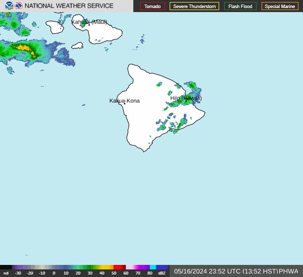

Hourly Weather Forecast