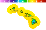
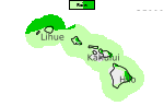
Hazardous Weather Conditions
Current conditions at
Bradshaw Army Air Field / Hawaii (PHSF)
Lat: 19.76°NLon: 155.55°WElev: 6138ft.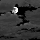
Mostly Cloudy
62°F
17°C
| Humidity | 90% |
| Wind Speed | E 10 G 20 mph |
| Barometer | 30.28 in (1012.0 mb) |
| Dewpoint | 59°F (15°C) |
| Visibility | 10.00 mi |
| Last update | 23 Sep 10:55 pm HST |
Extended Forecast for
Waimea HI
Hurricane Watch until further notice
Flood Watch until September 26, 06:00pm
NOW: Multiple hazards in effect

Click HERE for Details
Overnight

Low: 67 °F
Heavy Rain
and BreezyThursday

High: 73 °F
Heavy Rain
and BreezyThursday Night
Low: 68 °F
Heavy Rain
and WindyFriday

High: 75 °F
Tropical
Storm
Conditions
Possible With
Hurricane
Conditions
Also PossibleFriday Night

Low: 68 °F
Tropical
Storm
Conditions
PossibleSaturday
High: 75 °F
Tropical
Storm
Conditions
PossibleSaturday Night

Low: 66 °F
Heavy Rain
and Damaging
WindsSunday

High: 75 °F
Heavy Rain
and Very
Windy
Detailed Forecast
Overnight
Showers likely and possibly a thunderstorm. Some of the storms could produce heavy rainfall. Cloudy, with a low around 67. Breezy, with an east northeast wind 17 to 20 mph, with gusts as high as 28 mph. Chance of precipitation is 70%. New rainfall amounts between a half and three quarters of an inch possible.
Thursday
Showers likely and possibly a thunderstorm. Some of the storms could produce heavy rainfall. Cloudy, with a high near 73. Breezy, with an east northeast wind 20 to 22 mph, with gusts as high as 31 mph. Chance of precipitation is 70%. New rainfall amounts between 1 and 2 inches possible.
Thursday Night
Showers likely and possibly a thunderstorm. Some of the storms could produce heavy rainfall. Cloudy, with a low around 68. Windy, with an east northeast wind 21 to 26 mph, with gusts as high as 38 mph. Chance of precipitation is 70%. New rainfall amounts between 1 and 2 inches possible.
Friday
Tropical storm conditions possible, with hurricane conditions also possible. Showers likely and possibly a thunderstorm. Some of the storms could produce heavy rainfall. Mostly cloudy, with a high near 75. Chance of precipitation is 60%. New rainfall amounts between three quarters and one inch possible.
Friday Night
Tropical storm conditions possible. Showers likely and possibly a thunderstorm before midnight, then scattered showers and thunderstorms after midnight. Some of the storms could produce heavy rainfall. Mostly cloudy, with a low around 68. Chance of precipitation is 60%. New rainfall amounts between 1 and 2 inches possible.
Saturday
Tropical storm conditions possible. Scattered showers and thunderstorms. Some of the storms could produce heavy rainfall. Mostly cloudy, with a high near 75. Chance of precipitation is 50%. New rainfall amounts between a half and three quarters of an inch possible.
Saturday Night
Scattered showers and thunderstorms. Some of the storms could produce heavy rainfall. Mostly cloudy, with a low around 66. Strong and damaging winds, with an east wind 38 to 44 mph, with gusts as high as 65 mph. Chance of precipitation is 50%.
Sunday
Scattered showers and thunderstorms. Some of the storms could produce heavy rainfall. Partly sunny, with a high near 75. Very windy, with an east northeast wind 25 to 32 mph, with gusts as high as 47 mph. Chance of precipitation is 50%.
Sunday Night
Scattered showers. Mostly cloudy, with a low around 65. East northeast wind 9 to 13 mph. Chance of precipitation is 30%.
Monday
Scattered showers, mainly after noon. Mostly sunny, with a high near 76. East northeast wind 3 to 6 mph. Chance of precipitation is 30%.
Monday Night
Scattered showers. Mostly cloudy, with a low around 66. East wind 3 to 5 mph. Chance of precipitation is 30%.
Tuesday
Scattered showers. Partly sunny, with a high near 76. Calm wind. Chance of precipitation is 30%.
Tuesday Night
Scattered showers. Mostly cloudy, with a low around 65. Calm wind becoming east around 5 mph after midnight. Chance of precipitation is 40%.
Wednesday
Scattered showers. Partly sunny, with a high near 75. Calm wind. Chance of precipitation is 30%.
Additional Forecasts and Information
Basemap Options
Click map to change the forecast location
Loading map...
 Forecast Area
ABOUT THIS FORECAST
Point Forecast:
Waimea HI
20.02°N 155.66°W (Elev. 2762 ft)
20.02°N 155.66°W (Elev. 2762 ft)
11:43 pm HST Sep 23, 2026
12am HST Sep 24, 2026-6pm HST Sep 30, 2026


Additional Resources
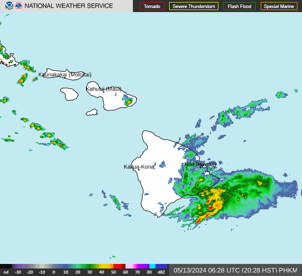
Radar & Satellite Image

Hourly Weather Forecast