Current conditions at
Sebring Regional Airport (KSEF)
Lat: 27.46°NLon: 81.34°WElev: 62ft.
Partly Cloudy
93°F
34°C
| Humidity | 55% |
| Wind Speed | Calm |
| Barometer | 29.98 in |
| Dewpoint | 74°F (23°C) |
| Visibility | 10.00 mi |
| Heat Index | 104°F (40°C) |
| Last update | 26 Aug 3:55 pm EDT |
Extended Forecast for
Zolfo Springs FL
This Afternoon

High: 95 °F
Heavy Rain
Tonight
Low: 72 °F
Heavy Rain
then Partly
CloudyThursday
High: 93 °F
Sunny then
T-storms
LikelyThursday Night
Low: 73 °F
T-storms then
Partly CloudyFriday
High: 93 °F
Sunny then
T-storms
LikelyFriday Night
Low: 74 °F
T-storms
Likely then
Isolated
ShowersSaturday
High: 93 °F
Sunny then
T-stormsSaturday Night
Low: 74 °F
T-storms then
Isolated
T-stormsSunday
High: 92 °F
Mostly Sunny
then T-storms
Detailed Forecast
This Afternoon
Showers and thunderstorms likely, mainly after 5pm. Some of the storms could produce heavy rainfall. Mostly sunny and hot, with a high near 95. Heat index values as high as 100. Southwest wind around 5 mph becoming west northwest. Chance of precipitation is 60%. New rainfall amounts between a quarter and half of an inch possible.
Tonight
Showers and thunderstorms likely, mainly before 10pm. Some of the storms could produce heavy rainfall. Mostly cloudy, then gradually becoming mostly clear, with a low around 72. Light southeast wind. Chance of precipitation is 60%. New precipitation amounts between a quarter and half of an inch possible.
Thursday
Showers and thunderstorms likely, mainly after 5pm. Sunny, with a high near 93. Heat index values as high as 102. Calm wind becoming south southeast around 5 mph in the afternoon. Chance of precipitation is 60%. New rainfall amounts between a tenth and quarter of an inch, except higher amounts possible in thunderstorms.
Thursday Night
Showers and thunderstorms, mainly before 8pm. Low around 73. Calm wind. Chance of precipitation is 80%.
Friday
Showers and thunderstorms likely after 2pm. Sunny, with a high near 93. Light south southeast wind. Chance of precipitation is 70%.
Friday Night
Showers and thunderstorms likely before 11pm, then isolated showers between 11pm and 2am. Partly cloudy, with a low around 74. Calm wind. Chance of precipitation is 60%.
Saturday
Showers and thunderstorms after 2pm. High near 93. East wind 3 to 6 mph. Chance of precipitation is 80%.
Saturday Night
Showers and thunderstorms, mainly before 8pm. Low around 74. East wind around 5 mph. Chance of precipitation is 80%.
Sunday
Showers and thunderstorms after 2pm. High near 92. East wind 5 to 7 mph. Chance of precipitation is 80%.
Sunday Night
Showers and thunderstorms, mainly before 8pm. Low around 75. Chance of precipitation is 80%.
Monday
Showers and thunderstorms. High near 93. Chance of precipitation is 80%.
Monday Night
Showers and thunderstorms. Low around 74. Chance of precipitation is 80%.
Tuesday
Showers and thunderstorms likely. Mostly sunny, with a high near 92. Chance of precipitation is 70%.
Tuesday Night
Showers and thunderstorms likely. Partly cloudy, with a low around 74. Chance of precipitation is 60%.
Wednesday
Showers and thunderstorms likely. Mostly sunny, with a high near 92.
Basemap Options
Click map to change the forecast location
Loading map...
 Forecast Area
ABOUT THIS FORECAST
Point Forecast:
Zolfo Springs FL
27.49°N 81.78°W (Elev. 82 ft)
27.49°N 81.78°W (Elev. 82 ft)
3:02 pm EDT Aug 26, 2026
4pm EDT Aug 26, 2026-6pm EDT Sep 2, 2026


Additional Resources
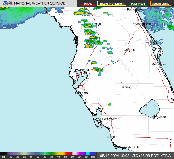
Radar & Satellite Image

Hourly Weather Forecast