News Headlines
- Prepare for an Active Severe Weather Season! Sign Up for an Upcoming SKYWARN Training Class
- Increased Potential for Well Above Normal Rainfall and Severe Weather This Upcoming Dry Season (Nov 2026 - Apr 2027)
- El Nino and Its Influence on East Central Florida Weather
- Seven Day Graphical Hazardous Weather Outlook

Hazardous Weather Conditions
Current conditions at
Sebastian Municipal Airport (KX26)
Lat: 27.81°NLon: 80.5°WElev: 22ft.
Partly Cloudy
77°F
25°C
| Humidity | 83% |
| Wind Speed | NE 18 G 24 mph |
| Barometer | 30.09 in |
| Dewpoint | 72°F (22°C) |
| Visibility | 10.00 mi |
| Heat Index | 78°F (26°C) |
| Last update | 19 Oct 12:55 am EDT |
Extended Forecast for
Sebastian FL
High Surf Advisory October 19, 01:02am until October 20, 04:00am
NOW until 4:00am Tue

High Surf Advisory
Overnight

Low: 72 °F
Chance
ShowersMonday

High: 82 °F
Chance
Showers and
WindyMonday Night

Low: 68 °F
Slight Chance
Showers and
WindyTuesday

High: 81 °F
Mostly Sunny
Tuesday Night

Low: 68 °F
Partly Cloudy
Wednesday
High: 82 °F
Mostly Sunny
Wednesday Night
Low: 67 °F
Partly Cloudy
Thursday

High: 80 °F
Sunny
Detailed Forecast
Overnight
A 30 percent chance of showers, mainly before 2am. Partly cloudy, with a low around 72. Northeast wind around 15 mph, with gusts as high as 30 mph.
Monday
A 30 percent chance of showers, mainly before 1pm. Mostly sunny, with a high near 82. Windy, with a north northeast wind 15 to 20 mph, with gusts as high as 30 mph.
Monday Night
A 20 percent chance of showers between midnight and 1am. Partly cloudy, with a low around 68. Windy, with a north northeast wind 15 to 20 mph, with gusts as high as 30 mph.
Tuesday
Mostly sunny, with a high near 81. North northeast wind around 15 mph, with gusts as high as 25 mph.
Tuesday Night
Partly cloudy, with a low around 68. North wind 10 to 15 mph, with gusts as high as 20 mph.
Wednesday
Mostly sunny, with a high near 82. North northeast wind 10 to 15 mph, with gusts as high as 25 mph.
Wednesday Night
Partly cloudy, with a low around 67. North northeast wind 10 to 15 mph, with gusts as high as 20 mph.
Thursday
Sunny, with a high near 80. North northeast wind 10 to 15 mph, with gusts as high as 25 mph.
Thursday Night
Mostly clear, with a low around 66. North northeast wind 10 to 15 mph, with gusts as high as 20 mph.
Friday
Sunny, with a high near 81. North northeast wind 10 to 15 mph, with gusts as high as 25 mph.
Friday Night
A 30 percent chance of showers. Partly cloudy, with a low around 68. Northeast wind around 15 mph, with gusts as high as 25 mph.
Saturday
Showers likely and possibly a thunderstorm. Mostly sunny, with a high near 80. Windy, with a northeast wind 15 to 25 mph, with gusts as high as 35 mph. Chance of precipitation is 60%.
Saturday Night
Showers likely and possibly a thunderstorm. Partly cloudy, with a low around 68. Windy, with a northeast wind around 20 mph, with gusts as high as 35 mph. Chance of precipitation is 60%.
Sunday
A 50 percent chance of showers and thunderstorms. Mostly sunny, with a high near 80. Windy, with a northeast wind around 25 mph, with gusts as high as 40 mph.
Additional Forecasts and Information
Basemap Options
Click map to change the forecast location
Loading map...
 Forecast Area
ABOUT THIS FORECAST
Point Forecast:
Sebastian FL
27.79°N 80.48°W (Elev. 16 ft)
27.79°N 80.48°W (Elev. 16 ft)
12:55 am EDT Oct 19, 2026
1am EDT Oct 19, 2026-6pm EDT Oct 25, 2026


Additional Resources
Radar & Satellite Image
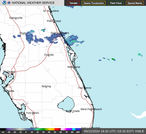

Hourly Weather Forecast