


Current conditions at
Titusville (KTIX)
Lat: 28.52°NLon: 80.8°WElev: 36ft.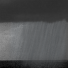
Showers in Vicinity
N/A
| Humidity | NA |
| Wind Speed | Calm |
| Barometer | 30.09 in |
| Dewpoint | N/A |
| Visibility | 7.00 mi |
| Last update | 25 Jun 8:47 pm EDT |
Extended Forecast for
3 Miles NE Sharpes FL
Tonight
Low: 77 °F
Chance
T-storms then
Partly CloudyFriday
High: 90 °F
Sunny then
Slight Chance
T-stormsFriday Night
Low: 79 °F
Chance
T-storms then
Partly CloudySaturday
High: 90 °F
Sunny then
Chance
T-stormsSaturday Night
Low: 78 °F
Chance
T-storms then
Mostly ClearSunday
High: 91 °F
Sunny then
Slight Chance
T-stormsSunday Night
Low: 78 °F
Slight Chance
T-storms then
Mostly ClearMonday
High: 91 °F
Slight Chance
T-storms then
Chance
T-stormsMonday Night

Low: 78 °F
Chance
T-storms
Detailed Forecast
Tonight
A 30 percent chance of showers and thunderstorms before 11pm. Partly cloudy, with a low around 77. South southwest wind around 5 mph becoming calm in the evening.
Friday
A 20 percent chance of showers and thunderstorms after 2pm. Mostly sunny, with a high near 90. Light south wind becoming southeast 5 to 10 mph in the morning.
Friday Night
A 30 percent chance of showers and thunderstorms, mainly between 10pm and 11pm. Partly cloudy, with a low around 79. Southeast wind 5 to 10 mph becoming light south after midnight.
Saturday
A 40 percent chance of showers and thunderstorms after 2pm. Mostly sunny, with a high near 90. Light and variable wind becoming east southeast 5 to 10 mph in the afternoon.
Saturday Night
A 30 percent chance of showers and thunderstorms before 8pm. Mostly clear, with a low around 78. Southeast wind around 5 mph becoming calm in the evening.
Sunday
A 20 percent chance of showers and thunderstorms after 2pm. Sunny, with a high near 91. Light and variable wind becoming east southeast 5 to 10 mph in the afternoon.
Sunday Night
A 10 percent chance of showers and thunderstorms before 8pm. Mostly clear, with a low around 78. South wind around 5 mph.
Monday
A 50 percent chance of showers and thunderstorms, mainly after 2pm. Mostly sunny, with a high near 91. Calm wind becoming east southeast around 5 mph in the afternoon.
Monday Night
A 30 percent chance of showers and thunderstorms before 2am. Partly cloudy, with a low around 78. South southeast wind around 5 mph becoming calm in the evening.
Tuesday
Showers and thunderstorms likely, mainly after 2pm. Mostly sunny, with a high near 90. Calm wind becoming east northeast around 5 mph in the afternoon. Chance of precipitation is 60%.
Tuesday Night
Showers and thunderstorms likely. Partly cloudy, with a low around 78. East northeast wind around 5 mph becoming calm. Chance of precipitation is 60%.
Wednesday
A 40 percent chance of showers and thunderstorms. Mostly sunny, with a high near 88. Light east northeast wind becoming east 5 to 10 mph in the afternoon.
Wednesday Night
A 30 percent chance of showers and thunderstorms. Mostly clear, with a low around 78. East wind around 5 mph becoming calm in the evening.
Thursday
A 30 percent chance of showers and thunderstorms. Mostly sunny, with a high near 89. Light east northeast wind becoming east 5 to 10 mph in the morning.
Additional Forecasts and Information
Basemap Options
Click map to change the forecast location
Loading map...
ABOUT THIS FORECAST
Point Forecast:
3 Miles NE Sharpes FL
28.45°N 80.71°W (Elev. 7 ft)
28.45°N 80.71°W (Elev. 7 ft)
7:39 pm EDT Jun 25, 2026
9pm EDT Jun 25, 2026-6pm EDT Jul 2, 2026
Additional Resources
Radar & Satellite Image


Hourly Weather Forecast


