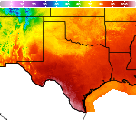
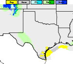
Heavy Snow in the Sierra Nevada; Heavy Rainfall in Texas Sunday
Heavy snow is expected in the Sierra Nevada mountain ranges into Saturday causing hazardous travel conditions. Winter Storm Warnings have been issued. Thunderstorms and moderate to heavy rainfall are expected across portions of eastern Texas into Louisiana on Sunday. Read More >

Current conditions at
Port Lavaca - Calhoun County Airport (KPKV)
Lat: 28.65°NLon: 96.68°WElev: 27ft.N/A
| Humidity | NA |
| Wind Speed | NA |
| Barometer | NA |
| Dewpoint | N/A |
| Visibility | NA |
| Last update | *** Not a current observation *** |
Extended Forecast for
2 Miles NNW Tivoli TX
Tonight

Low: 63 °F
Showers
LikelySunday
High: 73 °F
Chance
T-storms then
ShowersSunday Night
Low: 51 °F
Heavy Rain
then Mostly
CloudyMonday

High: 60 °F
Mostly Cloudy
Monday Night

Low: 50 °F
Mostly Cloudy
Tuesday

High: 65 °F
Mostly Sunny
Tuesday Night

Low: 55 °F
Partly Cloudy
Wednesday
High: 73 °F
Partly Sunny
Wednesday Night
Low: 63 °F
Mostly Cloudy
Detailed Forecast
Tonight
Showers likely, with thunderstorms also possible after 3am. Mostly cloudy, with a low around 63. Southeast wind 7 to 13 mph, with gusts as high as 24 mph. Chance of precipitation is 70%. New rainfall amounts between a tenth and quarter of an inch, except higher amounts possible in thunderstorms.
Sunday
Showers and thunderstorms likely, then showers and possibly a thunderstorm after 2pm. High near 73. Southeast wind 6 to 11 mph becoming north in the afternoon. Winds could gust as high as 20 mph. Chance of precipitation is 80%. New rainfall amounts between a half and three quarters of an inch possible.
Sunday Night
Showers likely, mainly before 10pm. The rain could be heavy at times. Mostly cloudy, with a low around 51. North northeast wind 7 to 16 mph, with gusts as high as 29 mph. Chance of precipitation is 70%. New precipitation amounts between a quarter and half of an inch possible.
Monday
Mostly cloudy, with a high near 60. North northeast wind 14 to 17 mph, with gusts as high as 28 mph.
Monday Night
Mostly cloudy, with a low around 50. North northeast wind 9 to 15 mph, with gusts as high as 28 mph.
Tuesday
Mostly sunny, with a high near 65. Northeast wind 7 to 10 mph, with gusts as high as 18 mph.
Tuesday Night
Partly cloudy, with a low around 55. Northeast wind 6 to 8 mph, with gusts as high as 18 mph.
Wednesday
Partly sunny, with a high near 73. East wind 8 to 13 mph, with gusts as high as 20 mph.
Wednesday Night
Mostly cloudy, with a low around 63. East wind 3 to 8 mph.
Thursday
A 30 percent chance of showers and thunderstorms, mainly after noon. Mostly cloudy, with a high near 75.
Thursday Night
Mostly cloudy, with a low around 64.
Friday
A 20 percent chance of showers and thunderstorms. Mostly sunny, with a high near 75.
Friday Night
Partly cloudy, with a low around 65.
Saturday
A 30 percent chance of showers. Partly sunny, with a high near 78.
Additional Forecasts and Information
Basemap Options
Click map to change the forecast location
Loading map...
 Forecast Area
ABOUT THIS FORECAST
Point Forecast:
2 Miles NNW Tivoli TX
28.46°N 96.89°W
28.46°N 96.89°W
12:46 pm CST Nov 14, 2026
8pm CST Nov 14, 2026-6pm CST Nov 21, 2026


Additional Resources
Radar & Satellite Image

Hourly Weather Forecast