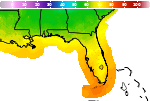
Localized Flooding through the Weekend followed by a Moderate Nor'easter and Tidal Flooding Next Week

Tropical moisture will fuel high chances for rain through the weekend and then along a stalling cold front next week. Several inches of rain are expected to fall over the next several days that will increase the risk for localized flooding each day. A Moderately Strong Nor'easter will develop Tuesday and bring gusty winds, dangerous surf/rip currents, and potential for moderate tidal flooding. Read More >

Current conditions at

Leesburg International Airport (KLEE)

Lat: 28.82°NLon: 81.81°WElev: 66ft.

Fair

78°F

26°C

Humidity 97%
Wind Speed E 6 mph
Barometer 30.02 in (1016.3 mb)
Dewpoint 77°F (25°C)
Visibility 10.00 mi
Heat Index81°F (27°C)
Last update 4 Oct 4:53 am EDT
Extended Forecast for

Ocklawaha FL

  • Today

    Today: A 40 percent chance of showers and thunderstorms after 2pm.  Mostly sunny, with a high near 91. Heat index values as high as 102. Calm wind becoming southeast around 5 mph.

    High: 91 °F

    Mostly Sunny
    then Chance
    T-storms

  • Tonight

    Tonight: Showers and thunderstorms likely, mainly before 11pm.  Mostly cloudy, with a low around 73. Calm wind.  Chance of precipitation is 60%. New rainfall amounts between a tenth and quarter of an inch, except higher amounts possible in thunderstorms.

    Low: 73 °F

    Showers
    Likely then
    Slight Chance
    T-storms

  • Monday

    Monday: A chance of showers and thunderstorms, then showers and possibly a thunderstorm after 5pm. Some of the storms could produce heavy rainfall.  High near 86. Light and variable wind.  Chance of precipitation is 80%. New rainfall amounts between a quarter and half of an inch possible.

    High: 86 °F

    Slight Chance
    Showers then
    Heavy Rain

  • Monday Night

    Monday Night: Showers and possibly a thunderstorm before 11pm, then showers likely. Some of the storms could produce heavy rainfall.  Low around 72. Calm wind.  Chance of precipitation is 80%.

    Low: 72 °F

    Heavy Rain

  • Tuesday

    Tuesday: Showers likely, then showers and possibly a thunderstorm after 11am.  High near 81. Calm wind becoming northeast around 5 mph in the afternoon. Winds could gust as high as 15 mph.  Chance of precipitation is 90%.

    High: 81 °F

    Showers
    Likely then
    T-storms

  • Tuesday Night

    Tuesday Night: Showers and possibly a thunderstorm.  Low around 71. Chance of precipitation is 80%.

    Low: 71 °F

    Showers

  • Wednesday

    Wednesday: Showers and possibly a thunderstorm.  High near 82. Chance of precipitation is 80%.

    High: 82 °F

    Showers

  • Wednesday Night

    Wednesday Night: Showers and possibly a thunderstorm before 8pm, then a chance of showers and thunderstorms between 8pm and 2am, then a chance of showers after 2am.  Low around 69. Chance of precipitation is 80%.

    Low: 69 °F

    Showers then
    Chance
    Showers

  • Thursday

    Thursday: A chance of showers, then showers likely and possibly a thunderstorm after 2pm.  Mostly cloudy, with a high near 83. Chance of precipitation is 60%.

    High: 83 °F

    Chance
    Showers then
    Showers
    Likely

Detailed Forecast

Today
A 40 percent chance of showers and thunderstorms after 2pm. Mostly sunny, with a high near 91. Heat index values as high as 102. Calm wind becoming southeast around 5 mph.
Tonight
Showers and thunderstorms likely, mainly before 11pm. Mostly cloudy, with a low around 73. Calm wind. Chance of precipitation is 60%. New rainfall amounts between a tenth and quarter of an inch, except higher amounts possible in thunderstorms.
Monday
A chance of showers and thunderstorms, then showers and possibly a thunderstorm after 5pm. Some of the storms could produce heavy rainfall. High near 86. Light and variable wind. Chance of precipitation is 80%. New rainfall amounts between a quarter and half of an inch possible.
Monday Night
Showers and possibly a thunderstorm before 11pm, then showers likely. Some of the storms could produce heavy rainfall. Low around 72. Calm wind. Chance of precipitation is 80%.
Tuesday
Showers likely, then showers and possibly a thunderstorm after 11am. High near 81. Calm wind becoming northeast around 5 mph in the afternoon. Winds could gust as high as 15 mph. Chance of precipitation is 90%.
Tuesday Night
Showers and possibly a thunderstorm. Low around 71. Chance of precipitation is 80%.
Wednesday
Showers and possibly a thunderstorm. High near 82. Chance of precipitation is 80%.
Wednesday Night
Showers and possibly a thunderstorm before 8pm, then a chance of showers and thunderstorms between 8pm and 2am, then a chance of showers after 2am. Low around 69. Chance of precipitation is 80%.
Thursday
A chance of showers, then showers likely and possibly a thunderstorm after 2pm. Mostly cloudy, with a high near 83. Chance of precipitation is 60%.
Thursday Night
Showers likely and possibly a thunderstorm before 8pm, then a chance of showers and thunderstorms between 8pm and 2am, then a chance of showers after 2am. Mostly cloudy, with a low around 70. Chance of precipitation is 60%.
Friday
Showers and possibly a thunderstorm. High near 85. Chance of precipitation is 80%.
Friday Night
Showers and thunderstorms. Low around 71. Chance of precipitation is 80%.
Saturday
Showers likely and possibly a thunderstorm. Mostly cloudy, with a high near 86. Chance of precipitation is 70%.
Basemap Options
Click map to change the forecast location
Loading map...

ABOUT THIS FORECAST

 
Point Forecast:
Ocklawaha FL
 29.04°N 81.93°W
2:35 am EDT Oct 4, 2026
5am EDT Oct 4, 2026-6pm EDT Oct 10, 2026
 
Get as KML Get as XML

Additional Resources

Radar & Satellite Image
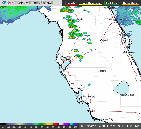
Link to Local Radar Data Link to Satellite Data

Hourly Weather Forecast

National Digital Forecast Database