Flood Watches through Tues Evening and Coastal Flood Advisories through Early Thurs

Tropical moisture and a stalling cold front will fuel waves of downpours during the next several days. Several inches of rain are expected to fall along the I-95 corridor, increasing the risk for flooding, especially for urban and normally flood prone locations. Nor'easter conditions will bring gusty winds, dangerous surf and rip currents, and the potential for moderate tidal flooding. Read More >

Current conditions at

Lake City Municipal Airport (KLCQ)

Lat: 30.18°NLon: 82.58°WElev: 201ft.

Light Rain

70°F

21°C

Humidity 100%
Wind Speed NE 3 mph
Barometer 29.98 in
Dewpoint 70°F (21°C)
Visibility 5.00 mi
Last update 6 Oct 8:55 am EDT
Extended Forecast for

6 Miles WSW Lulu FL

  • Today

    Today: Showers and possibly a thunderstorm.  High near 75. Northeast wind 7 to 9 mph, with gusts as high as 20 mph.  Chance of precipitation is 90%. New rainfall amounts between three quarters and one inch possible.

    High: 75 °F

    Showers

  • Tonight

    Tonight: A chance of showers and thunderstorms.  Mostly cloudy, with a low around 68. Northeast wind 8 to 10 mph, with gusts as high as 23 mph.  Chance of precipitation is 50%. New precipitation amounts between a quarter and half of an inch possible.

    Low: 68 °F

    Chance
    T-storms then
    Chance
    Showers

  • Wednesday

    Wednesday: A 30 percent chance of showers and thunderstorms, mainly between 3pm and 5pm.  Mostly cloudy, with a high near 81. Northeast wind 9 to 13 mph, with gusts as high as 21 mph.

    High: 81 °F

    Slight Chance
    T-storms then
    Chance
    Showers

  • Wednesday Night

    Wednesday Night: A 20 percent chance of showers after 2am.  Mostly cloudy, with a low around 67. Northeast wind 6 to 9 mph, with gusts as high as 15 mph.

    Low: 67 °F

    Mostly Cloudy
    then Slight
    Chance
    Showers

  • Thursday

    Thursday: A 50 percent chance of showers, mainly after 8am.  Mostly cloudy, with a high near 80. Northeast wind around 11 mph, with gusts as high as 20 mph.

    High: 80 °F

    Chance
    Showers

  • Thursday Night

    Thursday Night: A chance of showers, with thunderstorms also possible after 2am.  Cloudy, with a low around 66. Chance of precipitation is 50%.

    Low: 66 °F

    Chance
    Showers

  • Friday

    Friday: Showers likely and possibly a thunderstorm.  Mostly cloudy, with a high near 79. Chance of precipitation is 70%.

    High: 79 °F

    Showers
    Likely

  • Friday Night

    Friday Night: Showers likely and possibly a thunderstorm before 2am, then a chance of showers and thunderstorms after 2am.  Cloudy, with a low around 68. Chance of precipitation is 60%.

    Low: 68 °F

    Showers
    Likely

  • Saturday

    Saturday: A chance of showers and thunderstorms, then showers and possibly a thunderstorm after 8am.  High near 82. Breezy.  Chance of precipitation is 80%.

    High: 82 °F

    Showers and
    Breezy

Detailed Forecast

Today
Showers and possibly a thunderstorm. High near 75. Northeast wind 7 to 9 mph, with gusts as high as 20 mph. Chance of precipitation is 90%. New rainfall amounts between three quarters and one inch possible.
Tonight
A chance of showers and thunderstorms. Mostly cloudy, with a low around 68. Northeast wind 8 to 10 mph, with gusts as high as 23 mph. Chance of precipitation is 50%. New precipitation amounts between a quarter and half of an inch possible.
Wednesday
A 30 percent chance of showers and thunderstorms, mainly between 3pm and 5pm. Mostly cloudy, with a high near 81. Northeast wind 9 to 13 mph, with gusts as high as 21 mph.
Wednesday Night
A 20 percent chance of showers after 2am. Mostly cloudy, with a low around 67. Northeast wind 6 to 9 mph, with gusts as high as 15 mph.
Thursday
A 50 percent chance of showers, mainly after 8am. Mostly cloudy, with a high near 80. Northeast wind around 11 mph, with gusts as high as 20 mph.
Thursday Night
A chance of showers, with thunderstorms also possible after 2am. Cloudy, with a low around 66. Chance of precipitation is 50%.
Friday
Showers likely and possibly a thunderstorm. Mostly cloudy, with a high near 79. Chance of precipitation is 70%.
Friday Night
Showers likely and possibly a thunderstorm before 2am, then a chance of showers and thunderstorms after 2am. Cloudy, with a low around 68. Chance of precipitation is 60%.
Saturday
A chance of showers and thunderstorms, then showers and possibly a thunderstorm after 8am. High near 82. Breezy. Chance of precipitation is 80%.
Saturday Night
Showers and possibly a thunderstorm before 8pm, then a chance of showers and thunderstorms between 8pm and 2am, then a slight chance of showers after 2am. Low around 70. Chance of precipitation is 80%.
Sunday
Showers likely and possibly a thunderstorm. Mostly cloudy, with a high near 84. Chance of precipitation is 70%.
Sunday Night
Showers and thunderstorms likely. Mostly cloudy, with a low around 70. Chance of precipitation is 60%.
Columbus Day
Showers likely and possibly a thunderstorm. Partly sunny, with a high near 84. Chance of precipitation is 60%.
Basemap Options
Click map to change the forecast location
Loading map...

ABOUT THIS FORECAST

 
Point Forecast:
6 Miles WSW Lulu FL
 30.07°N 82.58°W
2:20 am EDT Oct 6, 2026
9am EDT Oct 6, 2026-6pm EDT Oct 12, 2026
 
Get as KML Get as XML

Additional Resources

Radar & Satellite Image
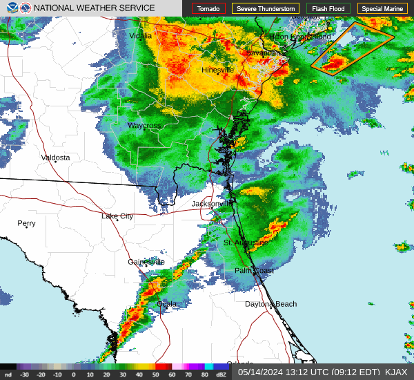
Link to Local Radar Data Link to Satellite Data

Hourly Weather Forecast

National Digital Forecast Database