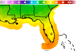
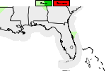
Flood Watch Continues through Friday for Portions of Northeast and North Central FL

Waves of moderate to heavy rainfall are expected through at least Friday night along much of the I-95 and U.S. Highway 17 corridors in northeast and north central FL. Rainfall totals of 4 to 8 inches, with locally higher amounts possible, are expected within the Flood Watch area. The threat for flooding will be exacerbated around times of high tide at coastal locations. Turn Around, Don't Drown! Read More >

Current conditions at

Fernandina Beach Municipal Airport (KFHB)

Lat: 30.61°NLon: 81.46°WElev: 16ft.

Rain Fog/Mist

68°F

20°C

Humidity 88%
Wind Speed NE 10 mph
Barometer 30.21 in
Dewpoint 64°F (18°C)
Visibility 5.00 mi
Last update 19 Nov 3:55 am EST
Extended Forecast for

5 Miles NNW Kings Bay Base GA

High Surf Advisory November 19, 04:01am until November 22, 07:00am
Click here for hazard details and duration
High Surf Advisory
  •  
    High Surf Advisory November 19, 04:01am until November 22, 07:00am

    NOW until 7:00am Sun

    High Surf Advisory

  • Overnight

    Low: 63 °F

    Heavy Rain

  • Thursday

    Thursday: Showers. The rain could be heavy at times.  High near 71. Breezy, with a northeast wind 13 to 16 mph, with gusts as high as 24 mph.  Chance of precipitation is 100%. New precipitation amounts between a half and three quarters of an inch possible.

    High: 71 °F

    Heavy Rain
    and Breezy

  • Thursday Night

    Thursday Night: A chance of showers before 1am, then a chance of showers after 4am.  Cloudy, with a low around 64. Northeast wind 10 to 14 mph, with gusts as high as 21 mph.  Chance of precipitation is 40%.

    Low: 64 °F

    Chance
    Showers

  • Friday

    Friday: Showers likely.  Cloudy, with a high near 72. Northeast wind 11 to 13 mph, with gusts as high as 20 mph.  Chance of precipitation is 70%.

    High: 72 °F

    Showers
    Likely

  • Friday Night

    Friday Night: A 30 percent chance of showers.  Cloudy, with a low around 63. Northeast wind 9 to 11 mph, with gusts as high as 17 mph.

    Low: 63 °F

    Chance
    Showers

  • Saturday

    Saturday: A chance of showers, with thunderstorms also possible after 1pm.  Mostly cloudy, with a high near 72. Chance of precipitation is 50%.

    High: 72 °F

    Chance
    Showers

  • Saturday Night

    Saturday Night: A 20 percent chance of showers before 1am.  Mostly cloudy, with a low around 59.

    Low: 59 °F

    Slight Chance
    Showers

  • Sunday

    Sunday: Mostly sunny, with a high near 74.

    High: 74 °F

    Mostly Sunny

Detailed Forecast

Overnight
Showers. The rain could be heavy at times. Low around 63. Northeast wind around 10 mph, with gusts as high as 16 mph. Chance of precipitation is 90%. New precipitation amounts between a tenth and quarter of an inch possible.
Thursday
Showers. The rain could be heavy at times. High near 71. Breezy, with a northeast wind 13 to 16 mph, with gusts as high as 24 mph. Chance of precipitation is 100%. New precipitation amounts between a half and three quarters of an inch possible.
Thursday Night
A chance of showers before 1am, then a chance of showers after 4am. Cloudy, with a low around 64. Northeast wind 10 to 14 mph, with gusts as high as 21 mph. Chance of precipitation is 40%.
Friday
Showers likely. Cloudy, with a high near 72. Northeast wind 11 to 13 mph, with gusts as high as 20 mph. Chance of precipitation is 70%.
Friday Night
A 30 percent chance of showers. Cloudy, with a low around 63. Northeast wind 9 to 11 mph, with gusts as high as 17 mph.
Saturday
A chance of showers, with thunderstorms also possible after 1pm. Mostly cloudy, with a high near 72. Chance of precipitation is 50%.
Saturday Night
A 20 percent chance of showers before 1am. Mostly cloudy, with a low around 59.
Sunday
Mostly sunny, with a high near 74.
Sunday Night
Mostly clear, with a low around 54.
Monday
Mostly sunny, with a high near 75.
Monday Night
Partly cloudy, with a low around 54.
Tuesday
Mostly sunny, with a high near 72.
Tuesday Night
A 20 percent chance of showers. Mostly cloudy, with a low around 56.
Wednesday
A 40 percent chance of showers. Mostly cloudy, with a high near 68.
Basemap Options
Click map to change the forecast location
Loading map...

ABOUT THIS FORECAST

 
Point Forecast:
5 Miles NNW Kings Bay Base GA
 30.86°N 81.61°W
1:17 am EST Nov 19, 2026
4am EST Nov 19, 2026-6pm EST Nov 25, 2026
 
Get as KML Get as XML

Additional Resources

Radar & Satellite Image
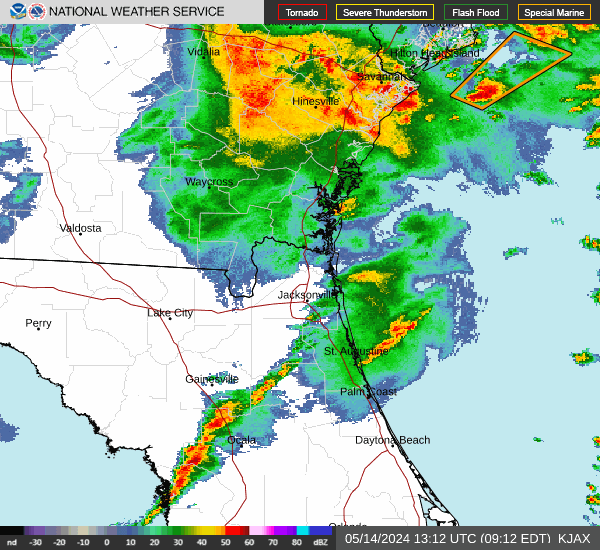
Link to Local Radar Data Link to Satellite Data

Hourly Weather Forecast

National Digital Forecast Database