News Headlines
- Tropical Storm Bertha 2026 Preliminary Post Tropical Cyclone Report Available - click "Observational data summary" 🌀📋
- Are you PREPARED for Hurricane Season? 🌀
- 🏖️ Heading to the Gulf Beaches? Learn about rip current safety! 🌊
- Extreme Drought Improved Some This Week, but Still Lingers in the Southeast Florida Big Bend. Click Here for the Latest

Hazardous Weather Conditions
Current conditions at
Moody Air Force Base (KVAD)
Lat: 30.98°NLon: 83.19°WElev: 230ft.
Fair
81°F
27°C
| Humidity | 94% |
| Wind Speed | SW 6 mph |
| Barometer | 29.78 in (1008.4 mb) |
| Dewpoint | 79°F (26°C) |
| Visibility | 10.00 mi |
| Heat Index | 89°F (32°C) |
| Last update | 29 Jul 6:55 am EDT |
Extended Forecast for
Nashville GA
Heat Advisory July 29, 11:00am until July 29, 08:00pm
Today
High: 99 °F
Mostly Sunny
then Chance
T-stormsTonight
Low: 75 °F
Chance
T-storms then
Slight Chance
ShowersThursday
High: 96 °F
Mostly Sunny
then Slight
Chance
T-stormsThursday Night
Low: 74 °F
Chance
T-storms then
Slight Chance
ShowersFriday
High: 96 °F
Sunny then
Slight Chance
T-stormsFriday Night
Low: 73 °F
Slight Chance
T-storms then
Partly CloudySaturday
High: 94 °F
Slight Chance
T-storms then
Chance
T-stormsSaturday Night

Low: 73 °F
Chance
T-stormsSunday
High: 90 °F
Showers
Likely then
T-storms
Detailed Forecast
Today
A 30 percent chance of showers and thunderstorms, mainly after 3pm. Mostly sunny and hot, with a high near 99. Heat index values as high as 111. West wind 5 to 10 mph.
Tonight
A chance of showers and thunderstorms before 11pm, then a slight chance of showers between 11pm and 1am. Mostly cloudy, then gradually becoming mostly clear, with a low around 75. West southwest wind around 5 mph becoming calm after midnight. Chance of precipitation is 40%.
Thursday
A 20 percent chance of showers and thunderstorms after 2pm. Mostly sunny and hot, with a high near 96. Heat index values as high as 104. Calm wind becoming west around 5 mph in the afternoon.
Thursday Night
A chance of showers and thunderstorms before 11pm, then a slight chance of showers between 11pm and 2am. Mostly cloudy during the early evening, then becoming mostly clear, with a low around 74. Calm wind. Chance of precipitation is 30%.
Friday
A 20 percent chance of showers and thunderstorms after 2pm. Mostly sunny and hot, with a high near 96. Calm wind becoming west around 5 mph in the afternoon.
Friday Night
A 10 percent chance of showers and thunderstorms before 8pm. Partly cloudy, with a low around 73.
Saturday
A 50 percent chance of showers and thunderstorms, mainly after 2pm. Mostly sunny, with a high near 94.
Saturday Night
A chance of showers and thunderstorms before 2am, then a slight chance of showers. Mostly cloudy, with a low around 73. Chance of precipitation is 50%.
Sunday
A slight chance of showers, then showers and possibly a thunderstorm after 8am. High near 90. Chance of precipitation is 80%.
Sunday Night
Showers and possibly a thunderstorm before 8pm, then a chance of showers and thunderstorms between 8pm and 2am, then a chance of showers after 2am. Low around 72. Chance of precipitation is 80%.
Monday
Showers and possibly a thunderstorm. High near 91. Chance of precipitation is 80%.
Monday Night
Showers and possibly a thunderstorm. Low around 72. Chance of precipitation is 80%.
Tuesday
A 50 percent chance of showers and thunderstorms. Mostly sunny, with a high near 93.
Additional Forecasts and Information
Basemap Options
Click map to change the forecast location
Loading map...
 Forecast Area
ABOUT THIS FORECAST
Point Forecast:
Nashville GA
31.22°N 83.25°W (Elev. 249 ft)
31.22°N 83.25°W (Elev. 249 ft)
7:15 am EDT Jul 29, 2026
7am EDT Jul 29, 2026-6pm EDT Aug 4, 2026


Additional Resources
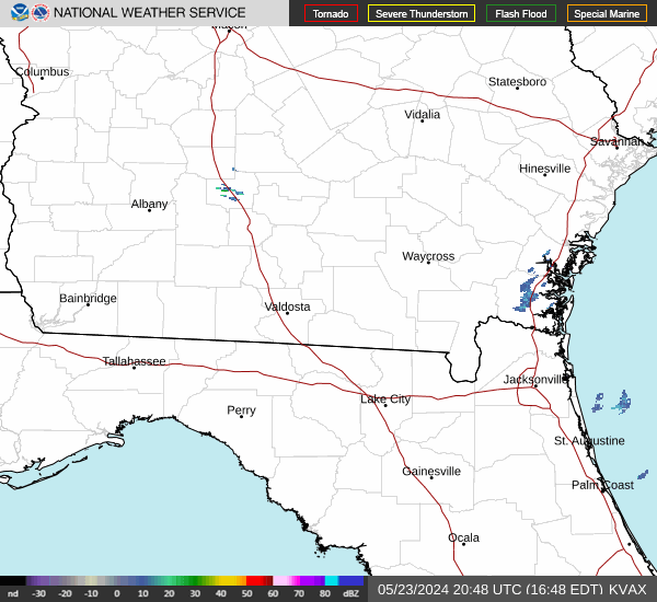
Radar & Satellite Image

Hourly Weather Forecast