Extreme Heat Continues; Severe Thunderstorms into Upper Midwest; Strong Bering Sea Storm

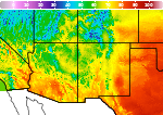
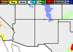
Wildfires and poor air quality continue for the Pacific Northwest, Rockies and extended into the Plains. Severe thunderstorms possible for the northern Plains and upper Midwest on Monday along a frontal boundary. Another boundary will focus showers and thunderstorms for the eastern seaboard with localized heavy rainfall possible. For Alaska, a strong Bering Sea storm will bring winds and rainfall. Read More >

Current conditions at

Alamogordo-White (KALM)

Lat: 32.84°NLon: 105.99°WElev: 4150ft.

Fair

75°F

24°C

Humidity 31%
Wind Speed SW 8 mph
Barometer 30.03 in
Dewpoint 43°F (6°C)
Visibility 10.00 mi
Last update 3 Aug 3:15 am MDT
Extended Forecast for

5 Miles WNW Sunspot NM

  • Overnight

    Overnight: Mostly clear, with a low around 65. South southeast wind around 10 mph.

    Low: 65 °F

    Mostly Clear

  • Monday

    Monday: A slight chance of showers and thunderstorms between 2pm and 5pm.  Sunny, with a high near 83. South southeast wind around 9 mph becoming southwest in the afternoon.  Chance of precipitation is 20%.

    High: 83 °F

    Sunny then
    Slight Chance
    T-storms

  • Monday Night

    Monday Night: Mostly clear, with a low around 69. Southwest wind 7 to 9 mph becoming south southeast in the evening.

    Low: 69 °F

    Mostly Clear

  • Tuesday

    Tuesday: A 30 percent chance of showers and thunderstorms, mainly between 3pm and 4pm.  Increasing clouds, with a high near 84. South southeast wind 5 to 8 mph becoming southwest in the morning.

    High: 84 °F

    Sunny then
    Chance
    T-storms

  • Tuesday Night

    Tuesday Night: A 20 percent chance of showers and thunderstorms before midnight.  Partly cloudy, with a low around 65. East wind 7 to 13 mph, with gusts as high as 18 mph.

    Low: 65 °F

    Slight Chance
    T-storms then
    Partly Cloudy

  • Wednesday

    Wednesday: A 20 percent chance of showers and thunderstorms after noon.  Mostly sunny, with a high near 82. Light and variable wind becoming southwest 5 to 7 mph in the morning.

    High: 82 °F

    Mostly Sunny
    then Slight
    Chance
    T-storms

  • Wednesday Night

    Wednesday Night: Partly cloudy, with a low around 65. South wind 5 to 10 mph becoming east in the evening.

    Low: 65 °F

    Partly Cloudy

  • Thursday

    Thursday: A 40 percent chance of showers and thunderstorms after noon.  Mostly sunny, with a high near 81. Light and variable wind becoming south southwest 5 to 7 mph in the morning.

    High: 81 °F

    Mostly Sunny
    then Chance
    T-storms

  • Thursday Night

    Thursday Night: A 20 percent chance of showers and thunderstorms before midnight.  Mostly cloudy, with a low around 64. East southeast wind 5 to 8 mph.

    Low: 64 °F

    Slight Chance
    T-storms then
    Mostly Cloudy

Detailed Forecast

Overnight
Mostly clear, with a low around 65. South southeast wind around 10 mph.
Monday
A slight chance of showers and thunderstorms between 2pm and 5pm. Sunny, with a high near 83. South southeast wind around 9 mph becoming southwest in the afternoon. Chance of precipitation is 20%.
Monday Night
Mostly clear, with a low around 69. Southwest wind 7 to 9 mph becoming south southeast in the evening.
Tuesday
A 30 percent chance of showers and thunderstorms, mainly between 3pm and 4pm. Increasing clouds, with a high near 84. South southeast wind 5 to 8 mph becoming southwest in the morning.
Tuesday Night
A 20 percent chance of showers and thunderstorms before midnight. Partly cloudy, with a low around 65. East wind 7 to 13 mph, with gusts as high as 18 mph.
Wednesday
A 20 percent chance of showers and thunderstorms after noon. Mostly sunny, with a high near 82. Light and variable wind becoming southwest 5 to 7 mph in the morning.
Wednesday Night
Partly cloudy, with a low around 65. South wind 5 to 10 mph becoming east in the evening.
Thursday
A 40 percent chance of showers and thunderstorms after noon. Mostly sunny, with a high near 81. Light and variable wind becoming south southwest 5 to 7 mph in the morning.
Thursday Night
A 20 percent chance of showers and thunderstorms before midnight. Mostly cloudy, with a low around 64. East southeast wind 5 to 8 mph.
Friday
A 50 percent chance of showers and thunderstorms after noon. Mostly sunny, with a high near 82.
Friday Night
A 20 percent chance of showers and thunderstorms. Partly cloudy, with a low around 63.
Saturday
A 40 percent chance of showers and thunderstorms. Sunny, with a high near 82.
Saturday Night
Partly cloudy, with a low around 64.
Sunday
A 30 percent chance of showers and thunderstorms. Sunny, with a high near 82.
Basemap Options
Click map to change the forecast location
Loading map...

ABOUT THIS FORECAST

 
Point Forecast:
5 Miles WNW Sunspot NM
 32.83°N 105.86°W (Elev. 7579 ft)
12:26 am MDT Aug 3, 2026
3am MDT Aug 3, 2026-6pm MDT Aug 9, 2026
 
Get as KML Get as XML

Additional Resources

Radar & Satellite Image
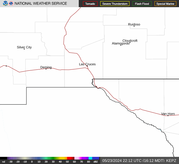
Link to Local Radar Data Link to Satellite Data

Hourly Weather Forecast

National Digital Forecast Database