Flooding Possible in the Southwest U.S.; Coastal Storm to Impact the East
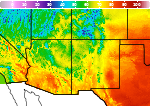
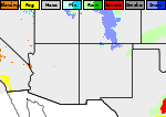
Heavy to excessive rainfall is expected today into Wednesday over New Mexico into far west Texas. Flash flooding and debris flows in wildfire burn areas will be possible. A strong coastal storm will develop off the Mid-Atlantic coast Wednesday, intensifying toward southern New England this weekend. Significant coastal flooding, strong rip currents, and beach erosion from high surf expected. Read More >

Hazardous Weather Conditions
Clovis Municipal Airport (KCVN)
Lat: 34.42°NLon: 103.08°WElev: 4191ft.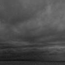
Overcast
67°F
19°C
| Humidity | 87% |
| Wind Speed | NE 6 mph |
| Barometer | 30.22 in (1019.2 mb) |
| Dewpoint | 63°F (17°C) |
| Visibility | 9.00 mi |
| Last update | 23 Sep 2:56 am MDT |
2 Miles NNE Clovis NM
NOW until 6:00am Thu

Flood Watch
Overnight

Low: 61 °F
Showers
LikelyWednesday

High: 76 °F
Showers
LikelyWednesday Night

Low: 62 °F
Showers
Thursday
High: 76 °F
Showers
LikelyThursday Night
Low: 61 °F
Chance
T-storms then
ShowersFriday
High: 76 °F
Showers then
Showers
LikelyFriday Night
Low: 60 °F
Chance
T-storms then
Chance
ShowersSaturday

High: 83 °F
Mostly Sunny
Detailed Forecast
 Forecast Area
ABOUT THIS FORECAST
34.44°N 103.2°W (Elev. 4291 ft)


Additional Resources
Radar & Satellite Image

Hourly Weather Forecast