

Wildfire Smoke and Severe Thunderstorms in the East; Monsoon Thunderstorms in the Southwest

Wildfire smoke continues to impact air quality from the Great Lakes region into New England and the Mid-Atlantic today with widespread Air Quality Alerts in effect. Severe thunderstorms are expected across portions of the Ohio Valley and Lower Great Lakes into the Mid-Atlantic and Northeast, this afternoon into the evening. Monsoonal thunderstorms may bring areas of flooding to the Southwest. Read More >

Current conditions at

I-40 @ Painted Desert NP HQ (AZT13)

Lat: 35.0637°NLon: 109.77562°WElev: 5745.0ft.

NA

72°F

22°C

Humidity 63%
Wind Speed SSE 5 MPH
Barometer NA
Dewpoint 59°F (15°C)
Visibility 1.24 mi
Last update 18 Jul 08:23 AM MST
Extended Forecast for

34 Miles NNE Snowflake AZ

  • Today

    Today: A 20 percent chance of showers and thunderstorms after 3pm.  Sunny, with a high near 87. South wind 6 to 10 mph, with gusts as high as 20 mph.

    High: 87 °F

    Sunny then
    Slight Chance
    T-storms

  • Tonight

    Tonight: A 50 percent chance of showers and thunderstorms, mainly before midnight.  Mostly cloudy, with a low around 65. Southwest wind 5 to 14 mph becoming southeast after midnight. Winds could gust as high as 26 mph.

    Low: 65 °F

    Chance
    T-storms then
    Slight Chance
    T-storms

  • Sunday

    Sunday: A 50 percent chance of showers and thunderstorms after 3pm.  Increasing clouds, with a high near 89. Light and variable wind becoming southeast 5 to 10 mph in the afternoon. Winds could gust as high as 24 mph.

    High: 89 °F

    Sunny then
    Chance
    T-storms

  • Sunday Night

    Sunday Night: A chance of showers and thunderstorms before 3am, then a slight chance of showers.  Cloudy, then gradually becoming partly cloudy, with a low around 66. South wind 5 to 10 mph becoming southwest in the evening. Winds could gust as high as 22 mph.  Chance of precipitation is 50%.

    Low: 66 °F

    Chance
    T-storms then
    Slight Chance
    T-storms

  • Monday

    Monday: A 50 percent chance of showers and thunderstorms after noon.  Mostly sunny, with a high near 90. South wind 7 to 9 mph becoming west in the morning. Winds could gust as high as 21 mph.

    High: 90 °F

    Mostly Sunny
    then Chance
    T-storms

  • Monday Night

    Monday Night: A 50 percent chance of showers and thunderstorms, mainly before midnight.  Mostly cloudy, with a low around 66. Southwest wind 5 to 10 mph becoming light south  after midnight. Winds could gust as high as 21 mph.

    Low: 66 °F

    Chance
    T-storms then
    Slight Chance
    T-storms

  • Tuesday

    Tuesday: A slight chance of showers, then showers and thunderstorms likely after noon.  Partly sunny, with a high near 89. Light and variable wind becoming south 5 to 8 mph in the afternoon. Winds could gust as high as 17 mph.  Chance of precipitation is 60%.

    High: 89 °F

    Slight Chance
    Showers then
    T-storms
    Likely

  • Tuesday Night

    Tuesday Night: Showers likely and possibly a thunderstorm before midnight, then a slight chance of showers and thunderstorms after midnight.  Mostly cloudy, with a low around 61. South wind 3 to 6 mph.  Chance of precipitation is 60%.

    Low: 61 °F

    Showers
    Likely then
    Slight Chance
    T-storms

  • Wednesday

    Wednesday: A 30 percent chance of showers and thunderstorms after noon.  Mostly sunny, with a high near 87. Southeast wind 5 to 7 mph becoming southwest in the afternoon. Winds could gust as high as 16 mph.

    High: 87 °F

    Mostly Sunny
    then Chance
    T-storms

Detailed Forecast

Today
A 20 percent chance of showers and thunderstorms after 3pm. Sunny, with a high near 87. South wind 6 to 10 mph, with gusts as high as 20 mph.
Tonight
A 50 percent chance of showers and thunderstorms, mainly before midnight. Mostly cloudy, with a low around 65. Southwest wind 5 to 14 mph becoming southeast after midnight. Winds could gust as high as 26 mph.
Sunday
A 50 percent chance of showers and thunderstorms after 3pm. Increasing clouds, with a high near 89. Light and variable wind becoming southeast 5 to 10 mph in the afternoon. Winds could gust as high as 24 mph.
Sunday Night
A chance of showers and thunderstorms before 3am, then a slight chance of showers. Cloudy, then gradually becoming partly cloudy, with a low around 66. South wind 5 to 10 mph becoming southwest in the evening. Winds could gust as high as 22 mph. Chance of precipitation is 50%.
Monday
A 50 percent chance of showers and thunderstorms after noon. Mostly sunny, with a high near 90. South wind 7 to 9 mph becoming west in the morning. Winds could gust as high as 21 mph.
Monday Night
A 50 percent chance of showers and thunderstorms, mainly before midnight. Mostly cloudy, with a low around 66. Southwest wind 5 to 10 mph becoming light south after midnight. Winds could gust as high as 21 mph.
Tuesday
A slight chance of showers, then showers and thunderstorms likely after noon. Partly sunny, with a high near 89. Light and variable wind becoming south 5 to 8 mph in the afternoon. Winds could gust as high as 17 mph. Chance of precipitation is 60%.
Tuesday Night
Showers likely and possibly a thunderstorm before midnight, then a slight chance of showers and thunderstorms after midnight. Mostly cloudy, with a low around 61. South wind 3 to 6 mph. Chance of precipitation is 60%.
Wednesday
A 30 percent chance of showers and thunderstorms after noon. Mostly sunny, with a high near 87. Southeast wind 5 to 7 mph becoming southwest in the afternoon. Winds could gust as high as 16 mph.
Wednesday Night
A 20 percent chance of showers and thunderstorms before midnight. Partly cloudy, with a low around 63. Southwest wind 3 to 7 mph.
Thursday
A 20 percent chance of showers and thunderstorms. Mostly sunny, with a high near 90. Calm wind becoming southwest around 6 mph in the afternoon.
Thursday Night
A 30 percent chance of showers and thunderstorms. Partly cloudy, with a low around 64. Southwest wind 3 to 6 mph.
Friday
A 30 percent chance of showers and thunderstorms. Mostly sunny, with a high near 91. Calm wind becoming west around 6 mph in the afternoon.
Basemap Options
Click map to change the forecast location
Loading map...

ABOUT THIS FORECAST

 
Point Forecast:
34 Miles NNE Snowflake AZ
 34.95°N 109.79°W (Elev. 5397 ft)
4:56 am MDT Jul 18, 2026
9am MDT Jul 18, 2026-6pm MDT Jul 24, 2026
 
Get as KML Get as XML

Additional Resources

Radar & Satellite Image
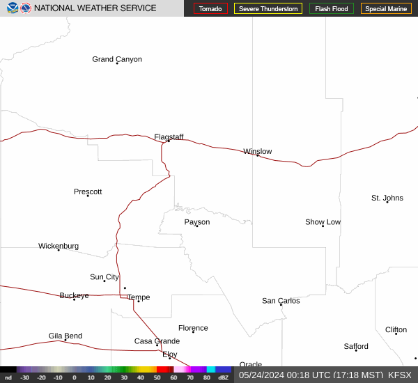
Link to Local Radar Data Link to Satellite Data

Hourly Weather Forecast

National Digital Forecast Database


