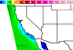
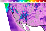
Showers and Storms continue across the East; Heat, Critical Fire Weather, Drought, and Poor Air Quality continues in the West
A series of fronts will focus locally heavy showers and storms across portions of the central and eastern U.S. through the end of the workweek. Dangerous to extreme heat continues across the Southwest U.S., eventually spreading eastward over the weekend into early next week. Elevated fire weather conditions continue across the Great Basin, with degraded air quality lingering across the Northwest. Read More >

For More Weather Information:
Tonight
SSW 9kt
Wednesday

SSW 13kt
Wednesday Night

SSW 9kt⇓
Thursday
SW 12kt
Thursday Night
SW 10kt⇓
Friday
SW 13kt
Friday Night
SW 10kt
Saturday
SW 12kt
Saturday Night
SSW 11kt
Associated Zone Forecast which includes this point
Last Update: 1:26 pm PDT Aug 4, 2026
Forecast Valid: 9pm PDT Aug 4, 2026-6pm PDT Aug 11, 2026
View Nearby Observations
Detailed Forecast
*Notices:
- This forecast is for a single location. For safety concerns, mariners should be aware of the weather over a larger area. Forecast information for a larger area can be found within the zone forecast and the NDFD graphics.
- The forecast conditions at a particular point may not exceed the criteria of a Small Craft Advisory, Gale, Storm etc. These watches/warnings/advisories are issued for the entire zone in which the point resides and mariners should act accordingly.
Additional Forecasts and Information
 Forecast Area
ABOUT THIS FORECAST
| Point Forecast: | 37.93°N 122.42°W |
| Last Update: | 1:26 pm PDT Aug 4, 2026 |
| Forecast Valid: | 9pm PDT Aug 4, 2026-6pm PDT Aug 11, 2026 |
| Forecast Discussion | |


|
RADAR & SATELLITE IMAGES