


Hazardous Weather Conditions
Current conditions at
Air Force Academy (KAFF)
Lat: 38.97°NLon: 104.82°WElev: 6572ft.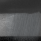
Showers in Vicinity
63°F
17°C
| Humidity | 66% |
| Wind Speed | E 6 mph |
| Barometer | 30.27 in (1016.1 mb) |
| Dewpoint | 51°F (11°C) |
| Visibility | 10.00 mi |
| Last update | 16 Jul 9:55 pm MDT |
Extended Forecast for
Pikes Peak Summit CO
Tonight
Low: 39 °F
Chance
Showers then
Slight Chance
T-stormsThursday
High: 50 °F
Slight Chance
Rain/Snow
then T-storms
LikelyThursday Night
Low: 41 °F
Chance
T-storms then
Partly Cloudy
and BreezyFriday
High: 53 °F
Sunny and
Breezy then
T-storms
LikelyFriday Night
Low: 43 °F
Chance
T-storms then
Partly CloudySaturday
High: 53 °F
Mostly Sunny
then T-stormsSaturday Night
Low: 42 °F
Chance
T-storms then
Partly CloudySunday
High: 54 °F
Mostly Sunny
and Breezy
then T-storms
LikelySunday Night
Low: 41 °F
Chance
T-storms then
Mostly Clear
and Breezy
Detailed Forecast
Tonight
A 50 percent chance of showers and thunderstorms, mainly before midnight. Widespread haze. Partly cloudy, with a low around 39. Southwest wind 10 to 15 mph. New rainfall amounts of less than a tenth of an inch, except higher amounts possible in thunderstorms.
Thursday
A slight chance of rain and snow showers between 9am and 10am, then rain showers likely. Some thunder is also possible. Widespread haze. Partly sunny, with a high near 50. West southwest wind 5 to 15 mph becoming south southeast in the afternoon. Chance of precipitation is 70%. Little or no snow accumulation expected.
Thursday Night
A 50 percent chance of showers and thunderstorms before midnight. Cloudy, then gradually becoming partly cloudy, with a low around 41. Breezy, with a south wind 15 to 25 mph becoming west after midnight. New precipitation amounts between a tenth and quarter of an inch, except higher amounts possible in thunderstorms.
Friday
Showers likely and possibly a thunderstorm between noon and 3pm, then showers and thunderstorms likely after 3pm. Increasing clouds, with a high near 53. Breezy, with a west wind 20 to 25 mph becoming north northeast 10 to 15 mph in the morning. Chance of precipitation is 70%. New rainfall amounts of less than a tenth of an inch, except higher amounts possible in thunderstorms.
Friday Night
A 40 percent chance of showers and thunderstorms before midnight. Mostly cloudy, with a low around 43. West wind 10 to 15 mph. New precipitation amounts of less than a tenth of an inch, except higher amounts possible in thunderstorms.
Saturday
Showers and possibly a thunderstorm, mainly after 3pm. High near 53. West wind 10 to 15 mph becoming south in the afternoon. Chance of precipitation is 80%. New rainfall amounts between a tenth and quarter of an inch, except higher amounts possible in thunderstorms.
Saturday Night
A 50 percent chance of showers and thunderstorms before midnight. Mostly cloudy, with a low around 42. West southwest wind around 15 mph.
Sunday
Showers and thunderstorms likely after noon. Mostly sunny, with a high near 54. Breezy, with a west southwest wind 10 to 20 mph. Chance of precipitation is 70%.
Sunday Night
A 30 percent chance of showers and thunderstorms before midnight. Partly cloudy, with a low around 41. Breezy, with a west wind 15 to 20 mph.
Monday
A 50 percent chance of showers and thunderstorms after noon. Mostly sunny, with a high near 55. Breezy, with a west wind 15 to 20 mph decreasing to 10 to 15 mph in the afternoon.
Monday Night
Partly cloudy, with a low around 44. West wind around 15 mph.
Tuesday
A chance of showers and thunderstorms. Mostly sunny, with a high near 55. West northwest wind 10 to 15 mph becoming south in the afternoon.
Tuesday Night
Partly cloudy, with a low around 43. Breezy, with a west southwest wind 15 to 20 mph.
Wednesday
A chance of showers and thunderstorms. Mostly sunny, with a high near 54. West northwest wind 10 to 15 mph becoming south southeast in the afternoon.
Additional Forecasts and Information
Basemap Options
Click map to change the forecast location
Loading map...
ABOUT THIS FORECAST
Point Forecast:
Pikes Peak Summit CO
38.84°N 105.05°W (Elev. 13750 ft)
38.84°N 105.05°W (Elev. 13750 ft)
10:09 pm MDT Jul 16, 2025
10pm MDT Jul 16, 2025-6pm MDT Jul 23, 2025
Additional Resources
Radar & Satellite Image


Hourly Weather Forecast


