

Significant Coastal Impacts to the Mid-Atlantic and Northeast; Tropical Storm Nolo to Impact Hawaii

A strong coastal storm will bring moderate to major coastal flooding, strong winds, heavy rainfall and high surf to the Mid-Atlantic and New England. Tropical Storm Nolo is expected to strengthen into a hurricane Thursday as it moves north toward the Big Island of Hawaii. Heavy rainfall will continue through Saturday, with locally catastrophic flooding possible. Hurricane Watch in effect. Read More >

Current conditions at

CW2857 Fernley (C2857)

Lat: 39.59817°NLon: 119.27417°WElev: 4252.1ft.

NA

86°F

30°C

Humidity 14%
Wind Speed WNW 4 MPH
Barometer 30.05 in (1017.61 mb)
Dewpoint 31°F (-1°C)
Visibility NA
Heat Index83°F (28°C)
Last update 23 Sep 05:25 PM PDT
Extended Forecast for

4 Miles SE Fernley NV

Fire Weather Watch September 25, 12:00pm until September 25, 10:00pm
Click here for hazard details and duration
Fire Weather Watch
  • Tonight

    Tonight: Mostly clear, with a low around 57. East wind around 5 mph becoming calm.

    Low: 57 °F

    Mostly Clear

  • Thursday

    Thursday: Sunny, with a high near 88. Southwest wind 5 to 10 mph, with gusts as high as 20 mph.

    High: 88 °F

    Sunny

  • Thursday Night

    Thursday Night: Partly cloudy, with a low around 59. West wind 5 to 15 mph, with gusts as high as 25 mph.

    Low: 59 °F

    Partly Cloudy

  • Friday

    Friday: Mostly sunny, with a high near 83. Breezy, with a southwest wind 5 to 15 mph increasing to 15 to 25 mph in the afternoon. Winds could gust as high as 35 mph.

    High: 83 °F

    Mostly Sunny
    then Mostly
    Sunny and
    Breezy

  • Friday Night

    Friday Night: Partly cloudy, with a low around 52. Breezy, with a west wind 15 to 20 mph decreasing to 5 to 10 mph in the evening. Winds could gust as high as 30 mph.

    Low: 52 °F

    Partly Cloudy
    and Breezy
    then Mostly
    Clear

  • Saturday

    Saturday: Sunny, with a high near 79. Northwest wind 5 to 10 mph becoming east in the morning.

    High: 79 °F

    Sunny

  • Saturday Night

    Saturday Night: Partly cloudy, with a low around 53.

    Low: 53 °F

    Partly Cloudy

  • Sunday

    Sunday: Mostly sunny, with a high near 77.

    High: 77 °F

    Mostly Sunny

  • Sunday Night

    Sunday Night: Partly cloudy, with a low around 49.

    Low: 49 °F

    Partly Cloudy

Detailed Forecast

Tonight
Mostly clear, with a low around 57. East wind around 5 mph becoming calm.
Thursday
Sunny, with a high near 88. Southwest wind 5 to 10 mph, with gusts as high as 20 mph.
Thursday Night
Partly cloudy, with a low around 59. West wind 5 to 15 mph, with gusts as high as 25 mph.
Friday
Mostly sunny, with a high near 83. Breezy, with a southwest wind 5 to 15 mph increasing to 15 to 25 mph in the afternoon. Winds could gust as high as 35 mph.
Friday Night
Partly cloudy, with a low around 52. Breezy, with a west wind 15 to 20 mph decreasing to 5 to 10 mph in the evening. Winds could gust as high as 30 mph.
Saturday
Sunny, with a high near 79. Northwest wind 5 to 10 mph becoming east in the morning.
Saturday Night
Partly cloudy, with a low around 53.
Sunday
Mostly sunny, with a high near 77.
Sunday Night
Partly cloudy, with a low around 49.
Monday
Sunny, with a high near 72.
Monday Night
Mostly clear, with a low around 47.
Tuesday
Sunny, with a high near 74.
Tuesday Night
Mostly clear, with a low around 48.
Wednesday
Sunny, with a high near 78.
Basemap Options
Click map to change the forecast location
Loading map...

ABOUT THIS FORECAST

 
Point Forecast:
4 Miles SE Fernley NV
 39.57°N 119.18°W (Elev. 4350 ft)
4:30 pm PDT Sep 23, 2026
5pm PDT Sep 23, 2026-6pm PDT Sep 30, 2026
 
Get as KML Get as XML

Additional Resources

Radar & Satellite Image
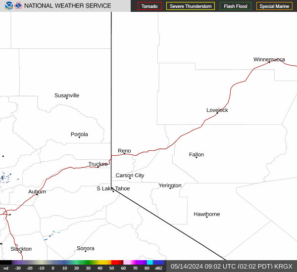
Link to Local Radar Data Link to Satellite Data

Hourly Weather Forecast

National Digital Forecast Database


