Severe Thunderstorms for Mid-Atlantic and Northeast; Typhoon Approaching Guam
A cold front will sweep eastward today accompanied by strong to severe thunderstorms for the mid-Atlantic and Northeast today. In the wake of this cold front, autumn like temperatures and gusty winds from the Plains, Mississippi Valley, Great Lakes to most of the eastern seaboard. Fire weather conditions for lower Mississippi Valley into portions of California. For Guam, a typhoon is approaching. Read More >

Hazardous Weather Conditions
Shenandoah Municipal (KSDA)
Lat: 40.75°NLon: 95.42°WElev: 971ft.
Fair
48°F
9°C
| Humidity | 58% |
| Wind Speed | N 7 mph |
| Barometer | 30.53 in |
| Dewpoint | 34°F (1°C) |
| Visibility | 10.00 mi |
| Wind Chill | 45°F (7°C) |
| Last update | 16 Oct 7:10 pm CDT |
Sidney IA
Tonight
Low: 32 °F
Clear then
Areas Frost
and Patchy
FogSaturday
High: 59 °F
Frost and
Patchy Fog
then SunnySaturday Night

Low: 38 °F
Clear
Sunday

High: 64 °F
Sunny
Sunday Night

Low: 44 °F
Mostly Clear
Monday

High: 65 °F
Mostly Sunny
Monday Night

Low: 47 °F
Partly Cloudy
Tuesday
High: 70 °F
Mostly Sunny
Tuesday Night
Low: 52 °F
Partly Cloudy
Detailed Forecast
Additional Forecasts and Information
 Forecast Area
ABOUT THIS FORECAST
40.76°N 95.64°W (Elev. 1063 ft)


Additional Resources
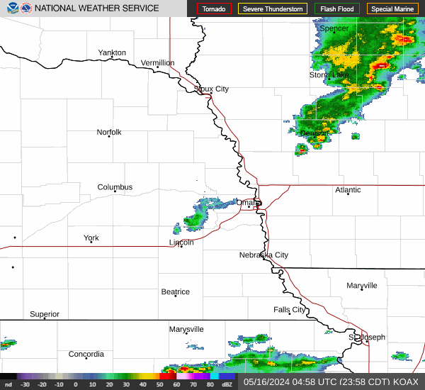
Radar & Satellite Image

Hourly Weather Forecast