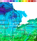
Showers and Thunderstorms from the Southern Plains into the Mid-Mississippi Valley; Record Warmth in the Plains and Midwest

Heavy rain and widely scattered severe storms capable of large hail, damaging winds, and possibly a tornado are expected over portions of the central and southern Plains into the Lower Missouri Valley. Unseasonable warmth will continue for a few more days across the Midwest and Southeast where several daily record highs could fall. Read More >

Current conditions at

Plymouth (KC65)

Lat: 41.37°NLon: 86.3°WElev: 801ft.

A Few Clouds

84°F

29°C

Humidity 51%
Wind Speed W 9 mph
Barometer 29.84 in
Dewpoint 64°F (18°C)
Visibility 10.00 mi
Heat Index85°F (29°C)
Last update 13 Oct 3:35 pm EDT
Extended Forecast for

4 Miles WSW Bremen IN

  • This Afternoon

    This Afternoon: Mostly sunny, with a high near 83. West wind around 10 mph, with gusts as high as 20 mph.

    High: 83 °F

    Mostly Sunny

  • Tonight

    Tonight: A 50 percent chance of showers and thunderstorms, mainly after 1am.  Partly cloudy, with a low around 62. Northwest wind around 5 mph becoming calm.

    Low: 62 °F

    Mostly Clear
    then Chance
    T-storms

  • Wednesday

    Wednesday: A chance of showers and thunderstorms before 9am, then a slight chance of showers between 9am and 2pm.  Mostly cloudy, with a high near 70. North wind around 5 mph.  Chance of precipitation is 30%.

    High: 70 °F

    Chance
    Showers

  • Wednesday Night

    Wednesday Night: Mostly cloudy, with a low around 55. North wind 5 to 10 mph.

    Low: 55 °F

    Mostly Cloudy

  • Thursday

    Thursday: A chance of showers, then showers and possibly a thunderstorm after 2pm.  High near 67. East wind around 10 mph.  Chance of precipitation is 90%. New rainfall amounts between a quarter and half of an inch possible.

    High: 67 °F

    Chance
    Showers then
    Showers

  • Thursday Night

    Thursday Night: Showers and possibly a thunderstorm before 2am, then a chance of showers.  Low around 49. Chance of precipitation is 90%. New rainfall amounts between a tenth and quarter of an inch, except higher amounts possible in thunderstorms.

    Low: 49 °F

    Showers

  • Friday

    Friday: A 50 percent chance of showers.  Partly sunny, with a high near 57. Breezy.

    High: 57 °F

    Chance
    Showers and
    Breezy

  • Friday Night

    Friday Night: Partly cloudy, with a low around 37. Breezy.

    Low: 37 °F

    Partly Cloudy
    and Breezy
    then Partly
    Cloudy

  • Saturday

    Saturday: Sunny, with a high near 58.

    High: 58 °F

    Sunny

Detailed Forecast

This Afternoon
Mostly sunny, with a high near 83. West wind around 10 mph, with gusts as high as 20 mph.
Tonight
A 50 percent chance of showers and thunderstorms, mainly after 1am. Partly cloudy, with a low around 62. Northwest wind around 5 mph becoming calm.
Wednesday
A chance of showers and thunderstorms before 9am, then a slight chance of showers between 9am and 2pm. Mostly cloudy, with a high near 70. North wind around 5 mph. Chance of precipitation is 30%.
Wednesday Night
Mostly cloudy, with a low around 55. North wind 5 to 10 mph.
Thursday
A chance of showers, then showers and possibly a thunderstorm after 2pm. High near 67. East wind around 10 mph. Chance of precipitation is 90%. New rainfall amounts between a quarter and half of an inch possible.
Thursday Night
Showers and possibly a thunderstorm before 2am, then a chance of showers. Low around 49. Chance of precipitation is 90%. New rainfall amounts between a tenth and quarter of an inch, except higher amounts possible in thunderstorms.
Friday
A 50 percent chance of showers. Partly sunny, with a high near 57. Breezy.
Friday Night
Partly cloudy, with a low around 37. Breezy.
Saturday
Sunny, with a high near 58.
Saturday Night
Clear, with a low around 36.
Sunday
Sunny, with a high near 64.
Sunday Night
Partly cloudy, with a low around 45.
Monday
Partly sunny, with a high near 66.
Basemap Options
Click map to change the forecast location
Loading map...

ABOUT THIS FORECAST

 
Point Forecast:
4 Miles WSW Bremen IN
 41.42°N 86.22°W (Elev. 801 ft)
3:30 pm EDT Oct 13, 2026
3pm EDT Oct 13, 2026-6pm EDT Oct 19, 2026
 
Get as KML Get as XML

Additional Resources

Radar & Satellite Image
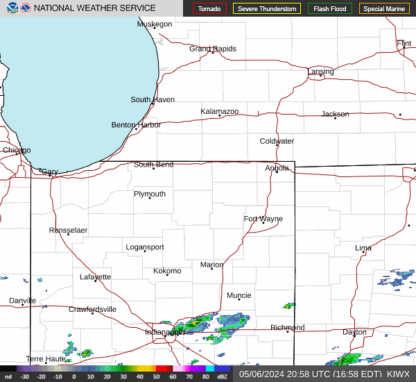
Link to Local Radar Data Link to Satellite Data

Hourly Weather Forecast

National Digital Forecast Database