

Thunderstorms and Heavy Rainfall from the Plains to the Mid-Atlantic

Severe thunderstorms producing damaging winds are most likely over parts of the Dakotas into Minnesota from this afternoon into the overnight, with other isolated storms producing hail or wind over the northern High Plains. In the Northern Plains into the Upper Great Lakes and Mid-Atlantic, heavy to excessive rain may bring flash and urban flooding through Wednesday. Read More >

Current conditions at

WY28 - South Pass (KSOU)

Lat: 42.47752°NLon: 108.8444°WElev: 8196.0ft.

NA

70°F

21°C

Humidity 31%
Wind Speed S 14 MPH
Barometer NA
Dewpoint 38°F (3°C)
Visibility NA
Last update 07 Jul 09:56 AM MDT
Extended Forecast for

15 Miles SW South Pass City WY

  • Today

    Today: Isolated showers and thunderstorms after 1pm. Some of the storms could be severe.  Mostly sunny, with a high near 81. Breezy, with a west southwest wind 13 to 17 mph, with gusts as high as 25 mph.  Chance of precipitation is 20%.

    High: 81 °F

    Breezy. Sunny
    then Severe
    Thunderstorms

  • Tonight

    Tonight: Isolated showers and thunderstorms before 8pm. Some of the storms could be severe.  Partly cloudy, with a low around 56. Breezy, with a west wind 5 to 15 mph becoming northeast after midnight. Winds could gust as high as 22 mph.  Chance of precipitation is 20%.

    Low: 56 °F

    Severe
    Thunderstorms
    and Breezy
    then Partly
    Cloudy

  • Wednesday

    Wednesday: Isolated showers and thunderstorms between 4pm and 5pm.  Mostly sunny, with a high near 80. Breezy, with a light and variable wind becoming west 11 to 16 mph in the morning. Winds could gust as high as 28 mph.  Chance of precipitation is 10%.

    High: 80 °F

    Sunny then
    Isolated
    T-storms and
    Breezy

  • Wednesday Night

    Wednesday Night: Mostly cloudy, with a low around 55. Breezy, with a southwest wind 10 to 15 mph becoming light and variable  after midnight. Winds could gust as high as 26 mph.

    Low: 55 °F

    Mostly Cloudy
    and Breezy
    then Mostly
    Cloudy

  • Thursday

    Thursday: A slight chance of thunderstorms after noon.  Sunny, with a high near 80. Light and variable wind becoming west 9 to 14 mph in the morning. Winds could gust as high as 25 mph.  Chance of precipitation is 10%.

    High: 80 °F

    Mostly Sunny
    then Slight
    Chance
    T-storms

  • Thursday Night

    Thursday Night: Mostly clear, with a low around 51. West wind 8 to 13 mph becoming light and variable  after midnight. Winds could gust as high as 23 mph.

    Low: 51 °F

    Mostly Clear

  • Friday

    Friday: Sunny, with a high near 83. Light and variable wind becoming west 8 to 13 mph in the morning. Winds could gust as high as 24 mph.

    High: 83 °F

    Sunny

  • Friday Night

    Friday Night: Mostly clear, with a low around 55.

    Low: 55 °F

    Mostly Clear

  • Saturday

    Saturday: Sunny, with a high near 89.

    High: 89 °F

    Sunny

Detailed Forecast

Today
Isolated showers and thunderstorms after 1pm. Some of the storms could be severe. Mostly sunny, with a high near 81. Breezy, with a west southwest wind 13 to 17 mph, with gusts as high as 25 mph. Chance of precipitation is 20%.
Tonight
Isolated showers and thunderstorms before 8pm. Some of the storms could be severe. Partly cloudy, with a low around 56. Breezy, with a west wind 5 to 15 mph becoming northeast after midnight. Winds could gust as high as 22 mph. Chance of precipitation is 20%.
Wednesday
Isolated showers and thunderstorms between 4pm and 5pm. Mostly sunny, with a high near 80. Breezy, with a light and variable wind becoming west 11 to 16 mph in the morning. Winds could gust as high as 28 mph. Chance of precipitation is 10%.
Wednesday Night
Mostly cloudy, with a low around 55. Breezy, with a southwest wind 10 to 15 mph becoming light and variable after midnight. Winds could gust as high as 26 mph.
Thursday
A slight chance of thunderstorms after noon. Sunny, with a high near 80. Light and variable wind becoming west 9 to 14 mph in the morning. Winds could gust as high as 25 mph. Chance of precipitation is 10%.
Thursday Night
Mostly clear, with a low around 51. West wind 8 to 13 mph becoming light and variable after midnight. Winds could gust as high as 23 mph.
Friday
Sunny, with a high near 83. Light and variable wind becoming west 8 to 13 mph in the morning. Winds could gust as high as 24 mph.
Friday Night
Mostly clear, with a low around 55.
Saturday
Sunny, with a high near 89.
Saturday Night
Mostly clear, with a low around 59.
Sunday
Sunny, with a high near 92.
Sunday Night
Mostly clear, with a low around 61.
Monday
Sunny, with a high near 92.
Basemap Options
Click map to change the forecast location
Loading map...

ABOUT THIS FORECAST

 
Point Forecast:
15 Miles SW South Pass City WY
 42.34°N 109.06°W (Elev. 7402 ft)
10:03 am MDT Jul 7, 2026
10am MDT Jul 7, 2026-6pm MDT Jul 13, 2026
 
Get as KML Get as XML

Additional Resources

Radar & Satellite Image
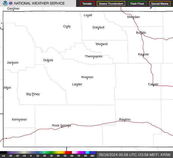
Link to Local Radar Data Link to Satellite Data

Hourly Weather Forecast

National Digital Forecast Database


