

Hazardous Coastal Conditions for the Mid-Atlantic; Storm System Approaching Southern Alaska

A Nor'easter will create hazardous marine and coastal conditions along the Mid-Atlantic coast through mid-week, with significant coastal flooding and beach erosion possible. Meanwhile, another strong storm system is forecast to bring high winds and heavy precipitation to portions of southern Alaska. Elsewhere, relatively benign weather is expected through the first half of the work week. Read More >

Current conditions at

Afton WY (KAFO)

Lat: 42.71133°NLon: 110.94217°WElev: 6201.0ft.

Clear

63°F

17°C

Humidity 27%
Wind Speed N 4 MPH
Barometer 30.18 in (1022.01 mb)
Dewpoint 28°F (-2°C)
Visibility 10.00 mi
Last update 18 Oct 02:30 PM MDT
Extended Forecast for

3 Miles SSE Smoot WY

  • This Afternoon

    This Afternoon: Sunny, with a high near 59. South southwest wind 3 to 6 mph.

    High: 59 °F

    Sunny

  • Tonight

    Tonight: Mostly clear, with a low around 37. Light and variable wind becoming southeast 5 to 7 mph in the evening.

    Low: 37 °F

    Mostly Clear

  • Monday

    Monday: Sunny, with a high near 59. Southeast wind 6 to 8 mph.

    High: 59 °F

    Sunny

  • Monday Night

    Monday Night: Partly cloudy, with a low around 40. Light and variable wind becoming east southeast 5 to 8 mph in the evening.

    Low: 40 °F

    Partly Cloudy

  • Tuesday

    Tuesday: A 30 percent chance of showers and thunderstorms after noon.  Mostly sunny, with a high near 57. Southeast wind around 6 mph becoming light and variable  in the afternoon.

    High: 57 °F

    Mostly Sunny
    then Chance
    Showers

  • Tuesday Night

    Tuesday Night: A 20 percent chance of showers and thunderstorms, mainly between midnight and 3am.  Partly cloudy, with a low around 40. Calm wind becoming east around 5 mph.

    Low: 40 °F

    Slight Chance
    T-storms

  • Wednesday

    Wednesday: Sunny, with a high near 61. East southeast wind 5 to 10 mph becoming south in the afternoon. Winds could gust as high as 20 mph.

    High: 61 °F

    Sunny

  • Wednesday Night

    Wednesday Night: Mostly clear, with a low around 43.

    Low: 43 °F

    Mostly Clear

  • Thursday

    Thursday: A 40 percent chance of showers and thunderstorms after noon.  Mostly sunny, with a high near 59.

    High: 59 °F

    Mostly Sunny
    then Chance
    Showers

Detailed Forecast

This Afternoon
Sunny, with a high near 59. South southwest wind 3 to 6 mph.
Tonight
Mostly clear, with a low around 37. Light and variable wind becoming southeast 5 to 7 mph in the evening.
Monday
Sunny, with a high near 59. Southeast wind 6 to 8 mph.
Monday Night
Partly cloudy, with a low around 40. Light and variable wind becoming east southeast 5 to 8 mph in the evening.
Tuesday
A 30 percent chance of showers and thunderstorms after noon. Mostly sunny, with a high near 57. Southeast wind around 6 mph becoming light and variable in the afternoon.
Tuesday Night
A 20 percent chance of showers and thunderstorms, mainly between midnight and 3am. Partly cloudy, with a low around 40. Calm wind becoming east around 5 mph.
Wednesday
Sunny, with a high near 61. East southeast wind 5 to 10 mph becoming south in the afternoon. Winds could gust as high as 20 mph.
Wednesday Night
Mostly clear, with a low around 43.
Thursday
A 40 percent chance of showers and thunderstorms after noon. Mostly sunny, with a high near 59.
Thursday Night
Showers and possibly a thunderstorm. Low around 38. Chance of precipitation is 90%.
Friday
Rain and snow showers. Cloudy, with a high near 44.
Friday Night
Rain and snow showers likely. Mostly cloudy, with a low around 30.
Saturday
A slight chance of snow showers. Mostly sunny, with a high near 44.
Basemap Options
Click map to change the forecast location
Loading map...

ABOUT THIS FORECAST

 
Point Forecast:
3 Miles SSE Smoot WY
 42.58°N 110.9°W (Elev. 6801 ft)
2:01 pm MDT Oct 18, 2026
2pm MDT Oct 18, 2026-6pm MDT Oct 24, 2026
 
Get as KML Get as XML

Additional Resources

Radar & Satellite Image
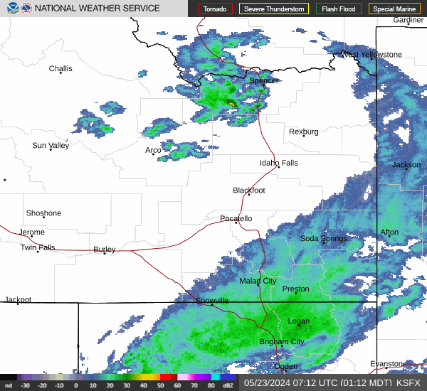
Link to Local Radar Data Link to Satellite Data

Hourly Weather Forecast

National Digital Forecast Database


