Excessive Rainfall Possible This Weekend; October Heat Wave in California

A slow moving front will be the focus area for heavy to excessive rainfall and a threat for flash/urban flooding across the northern Gulf Coast and Southeast U.S. through this weekend. Abnormally hot, potentially record-breaking, temperatures will impact southern California and stretch north toward the Bay Area and Central Valley into next week. Read More >

Current conditions at

Grand Rapids, Gerald R. Ford International Airport (KGRR)

Lat: 42.88°NLon: 85.52°WElev: 794ft.

A Few Clouds

64°F

18°C

Humidity 48%
Wind Speed SE 8 mph
Barometer 30.22 in (1023.6 mb)
Dewpoint 44°F (7°C)
Visibility 10.00 mi
Last update 3 Oct 5:53 pm EDT
Extended Forecast for

East Grand Rapids MI

  • Tonight

    Tonight: A 20 percent chance of showers after 2am.  Partly cloudy, with a low around 46. Southeast wind 3 to 5 mph.

    Low: 46 °F

    Mostly Clear
    then Slight
    Chance
    Showers

  • Sunday

    Sunday: A 10 percent chance of showers before 8am.  Mostly sunny, with a high near 66. South southwest wind 6 to 11 mph becoming west in the afternoon. Winds could gust as high as 23 mph.

    High: 66 °F

    Slight Chance
    Showers then
    Mostly Sunny

  • Sunday Night

    Sunday Night: Mostly clear, with a low around 42. Northwest wind around 6 mph becoming calm  in the evening.

    Low: 42 °F

    Mostly Clear

  • Monday

    Monday: Sunny, with a high near 61. Calm wind becoming northwest 5 to 8 mph in the morning.

    High: 61 °F

    Sunny

  • Monday Night

    Monday Night: Clear, with a low around 38. Northwest wind around 5 mph becoming calm  in the evening.

    Low: 38 °F

    Clear

  • Tuesday

    Tuesday: Sunny, with a high near 64.

    High: 64 °F

    Sunny

  • Tuesday Night

    Tuesday Night: Mostly clear, with a low around 51.

    Low: 51 °F

    Mostly Clear

  • Wednesday

    Wednesday: Mostly sunny, with a high near 67.

    High: 67 °F

    Mostly Sunny

  • Wednesday Night

    Wednesday Night: Partly cloudy, with a low around 47.

    Low: 47 °F

    Partly Cloudy

Detailed Forecast

Tonight
A 20 percent chance of showers after 2am. Partly cloudy, with a low around 46. Southeast wind 3 to 5 mph.
Sunday
A 10 percent chance of showers before 8am. Mostly sunny, with a high near 66. South southwest wind 6 to 11 mph becoming west in the afternoon. Winds could gust as high as 23 mph.
Sunday Night
Mostly clear, with a low around 42. Northwest wind around 6 mph becoming calm in the evening.
Monday
Sunny, with a high near 61. Calm wind becoming northwest 5 to 8 mph in the morning.
Monday Night
Clear, with a low around 38. Northwest wind around 5 mph becoming calm in the evening.
Tuesday
Sunny, with a high near 64.
Tuesday Night
Mostly clear, with a low around 51.
Wednesday
Mostly sunny, with a high near 67.
Wednesday Night
Partly cloudy, with a low around 47.
Thursday
Sunny, with a high near 66.
Thursday Night
Partly cloudy, with a low around 45.
Friday
Mostly sunny, with a high near 66.
Friday Night
Mostly clear, with a low around 46.
Saturday
Sunny, with a high near 70.
Basemap Options
Click map to change the forecast location
Loading map...

ABOUT THIS FORECAST

 
Point Forecast:
East Grand Rapids MI
 42.94°N 85.61°W (Elev. 748 ft)
6:03 pm EDT Oct 3, 2026
6pm EDT Oct 3, 2026-6pm EDT Oct 10, 2026
 
Get as KML Get as XML

Additional Resources

Radar & Satellite Image
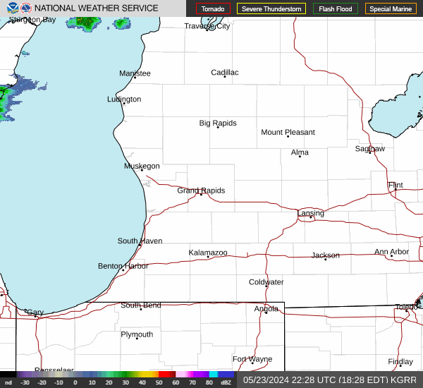
Link to Local Radar Data Link to Satellite Data

Hourly Weather Forecast

National Digital Forecast Database