Heavy to Excessive Rainfall in South Texas; Lake Effect Snow in Michigan; Tropical Storm Warning for American Samoa

Heavy to excessive rainfall may produce a localized flash flooding threat across South Texas today. Slight Risk for Excessive Rainfall issued. Lake effect snow will impact the Upper Peninsula of Michigan today, and the Lower Peninsula on Monday. A Tropical Storm Warning has been issued for Manu`a Islands and Rose Atoll in American Samoa. Read More >

Current conditions at

Ririe (ITD18)

Lat: 43.6111°NLon: 111.70531°WElev: 5106.0ft.

NA

36°F

2°C

Humidity 65%
Wind Speed W 2 MPH
Barometer NA
Dewpoint 26°F (-3°C)
Visibility 1.24 mi
Last update 22 Nov 02:00 PM MST
Extended Forecast for

2 Miles WSW Irwin ID

  • This Afternoon

    This Afternoon: Cloudy, with a high near 36. South southeast wind 3 to 5 mph.

    High: 36 °F

    Cloudy

  • Tonight

    Tonight: A 10 percent chance of snow after 5am.  Cloudy, with a low around 28. Southeast wind 5 to 7 mph.

    Low: 28 °F

    Mostly Cloudy
    then Slight
    Chance Snow

  • Monday

    Monday: A 30 percent chance of snow, mainly before noon.  Patchy fog after 5pm.  Otherwise, cloudy, then gradually becoming mostly sunny, with a high near 36. Southeast wind around 5 mph becoming calm  in the morning.  Little or no snow accumulation expected.

    High: 36 °F

    Chance Snow
    and Patchy
    Fog

  • Monday Night

    Monday Night: Areas of fog before 2am, then patchy fog after 5am.  Otherwise, partly cloudy, with a low around 22. Calm wind becoming southeast around 5 mph after midnight.

    Low: 22 °F

    Areas Fog

  • Tuesday

    Tuesday: Patchy fog before 8am.  Otherwise, mostly sunny, with a high near 38. East southeast wind 5 to 9 mph becoming light south  in the afternoon.

    High: 38 °F

    Patchy Fog
    then Mostly
    Sunny

  • Tuesday Night

    Tuesday Night: Patchy fog before 7pm.  Otherwise, partly cloudy, with a low around 25.

    Low: 25 °F

    Patchy Fog
    then Mostly
    Cloudy

  • Wednesday

    Wednesday: Partly sunny, with a high near 41.

    High: 41 °F

    Partly Sunny

  • Wednesday Night

    Wednesday Night: Mostly cloudy, with a low around 28.

    Low: 28 °F

    Mostly Cloudy

  • Thanksgiving Day

    Thanksgiving Day: A 20 percent chance of snow after 11am.  Partly sunny, with a high near 39.

    High: 39 °F

    Slight Chance
    Snow

Detailed Forecast

This Afternoon
Cloudy, with a high near 36. South southeast wind 3 to 5 mph.
Tonight
A 10 percent chance of snow after 5am. Cloudy, with a low around 28. Southeast wind 5 to 7 mph.
Monday
A 30 percent chance of snow, mainly before noon. Patchy fog after 5pm. Otherwise, cloudy, then gradually becoming mostly sunny, with a high near 36. Southeast wind around 5 mph becoming calm in the morning. Little or no snow accumulation expected.
Monday Night
Areas of fog before 2am, then patchy fog after 5am. Otherwise, partly cloudy, with a low around 22. Calm wind becoming southeast around 5 mph after midnight.
Tuesday
Patchy fog before 8am. Otherwise, mostly sunny, with a high near 38. East southeast wind 5 to 9 mph becoming light south in the afternoon.
Tuesday Night
Patchy fog before 7pm. Otherwise, partly cloudy, with a low around 25.
Wednesday
Partly sunny, with a high near 41.
Wednesday Night
Mostly cloudy, with a low around 28.
Thanksgiving Day
A 20 percent chance of snow after 11am. Partly sunny, with a high near 39.
Thursday Night
A 50 percent chance of snow. Snow level 5600 feet. Mostly cloudy, with a low around 34.
Friday
A chance of rain and snow. Snow level 5700 feet rising to 6700 feet in the afternoon. Mostly cloudy, with a high near 40. Chance of precipitation is 40%.
Friday Night
A chance of rain and snow. Snow level 6600 feet. Mostly cloudy, with a low around 35. Chance of precipitation is 40%.
Saturday
A chance of rain and snow. Snow level 6600 feet rising to 7300 feet in the afternoon. Mostly cloudy, with a high near 43. Chance of precipitation is 40%.
Basemap Options
Click map to change the forecast location
Loading map...

ABOUT THIS FORECAST

 
Point Forecast:
2 Miles WSW Irwin ID
 43.39°N 111.3°W (Elev. 5469 ft)
11:31 am MST Nov 22, 2026
2pm MST Nov 22, 2026-6pm MST Nov 28, 2026
 
Get as KML Get as XML

Additional Resources

Radar & Satellite Image
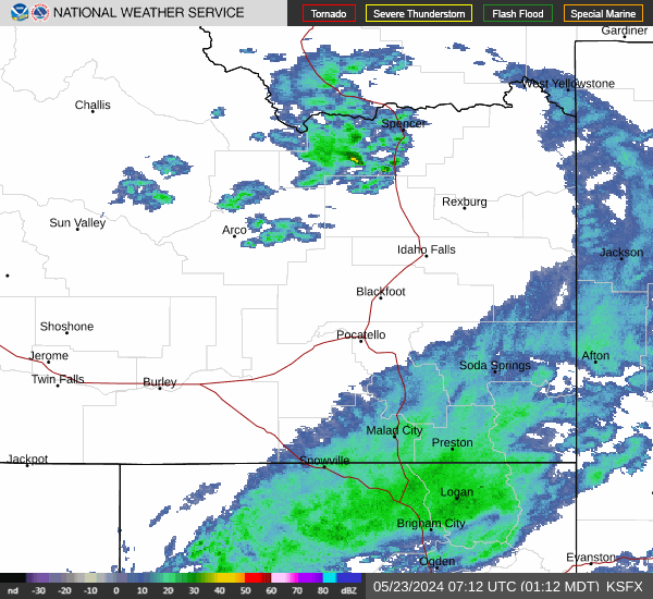
Link to Local Radar Data Link to Satellite Data

Hourly Weather Forecast

National Digital Forecast Database