

Edouard Continues to Impact Texas; Severe Storms and Heavy Rain from the Lower Great Lakes to Mid-Atlantic

Edouard will continue to bring gusty winds, heavy rainfall, and a flash flood threat over parts of eastern Texas. Severe thunderstorms and heavy rain are possible across portions of the eastern Great Lakes to the Mid-Atlantic today. Severe storms are also expected across the northern Rockies. Dangerous heat persists over the central and eastern states through Friday night. Read More >

Current conditions at

Jackson, Jackson Hole Airport (KJAC)

Lat: 43.6°NLon: 110.73333°WElev: 6450.0ft.

Clear

48°F

9°C

Humidity 93%
Wind Speed N 0 MPH
Barometer 30.09 in (1018.96 mb)
Dewpoint 46°F (8°C)
Visibility 10.00 mi
Last update 02 Sep 08:05 AM MDT
Extended Forecast for

10 Miles E Moose WY

  • Today

    Today: Mostly sunny, with a high near 67. Breezy, with an east southeast wind 8 to 16 mph becoming southwest in the afternoon. Winds could gust as high as 36 mph.

    High: 67 °F

    Mostly Sunny
    and Breezy

  • Tonight

    Tonight: Mostly cloudy, with a low around 44. West southwest wind 5 to 13 mph becoming south southeast after midnight. Winds could gust as high as 30 mph.

    Low: 44 °F

    Mostly Cloudy

  • Thursday

    Thursday: Mostly sunny, with a high near 68. Southeast wind 5 to 14 mph becoming southwest in the morning. Winds could gust as high as 32 mph.

    High: 68 °F

    Mostly Sunny

  • Thursday Night

    Thursday Night: Mostly clear, with a low around 45. Southwest wind 8 to 13 mph becoming southeast in the evening. Winds could gust as high as 31 mph.

    Low: 45 °F

    Mostly Clear

  • Friday

    Friday: Sunny, with a high near 69. South southeast wind 7 to 13 mph becoming southwest in the afternoon. Winds could gust as high as 32 mph.

    High: 69 °F

    Sunny

  • Friday Night

    Friday Night: Mostly clear, with a low around 46. Southwest wind 6 to 13 mph becoming east southeast in the evening. Winds could gust as high as 30 mph.

    Low: 46 °F

    Mostly Clear

  • Saturday

    Saturday: Sunny, with a high near 71. Southeast wind 5 to 11 mph becoming southwest in the morning. Winds could gust as high as 26 mph.

    High: 71 °F

    Sunny

  • Saturday Night

    Saturday Night: Mostly clear, with a low around 47.

    Low: 47 °F

    Mostly Clear

  • Sunday

    Sunday: A 20 percent chance of showers and thunderstorms after noon.  Mostly sunny, with a high near 69.

    High: 69 °F

    Mostly Sunny
    then Slight
    Chance
    T-storms

Detailed Forecast

Today
Mostly sunny, with a high near 67. Breezy, with an east southeast wind 8 to 16 mph becoming southwest in the afternoon. Winds could gust as high as 36 mph.
Tonight
Mostly cloudy, with a low around 44. West southwest wind 5 to 13 mph becoming south southeast after midnight. Winds could gust as high as 30 mph.
Thursday
Mostly sunny, with a high near 68. Southeast wind 5 to 14 mph becoming southwest in the morning. Winds could gust as high as 32 mph.
Thursday Night
Mostly clear, with a low around 45. Southwest wind 8 to 13 mph becoming southeast in the evening. Winds could gust as high as 31 mph.
Friday
Sunny, with a high near 69. South southeast wind 7 to 13 mph becoming southwest in the afternoon. Winds could gust as high as 32 mph.
Friday Night
Mostly clear, with a low around 46. Southwest wind 6 to 13 mph becoming east southeast in the evening. Winds could gust as high as 30 mph.
Saturday
Sunny, with a high near 71. Southeast wind 5 to 11 mph becoming southwest in the morning. Winds could gust as high as 26 mph.
Saturday Night
Mostly clear, with a low around 47.
Sunday
A 20 percent chance of showers and thunderstorms after noon. Mostly sunny, with a high near 69.
Sunday Night
A chance of showers and thunderstorms, then showers likely and possibly a thunderstorm after midnight. Mostly cloudy, with a low around 48. Chance of precipitation is 70%.
Labor Day
Showers likely and possibly a thunderstorm. Partly sunny, with a high near 62.
Monday Night
Showers likely and possibly a thunderstorm. Mostly cloudy, with a low around 43.
Tuesday
A chance of showers and thunderstorms. Partly sunny, with a high near 61.
Basemap Options
Click map to change the forecast location
Loading map...

ABOUT THIS FORECAST

 
Point Forecast:
10 Miles E Moose WY
 43.63°N 110.53°W (Elev. 7126 ft)
8:02 am MDT Sep 2, 2026
8am MDT Sep 2, 2026-6pm MDT Sep 8, 2026
 
Get as KML Get as XML

Additional Resources

Radar & Satellite Image
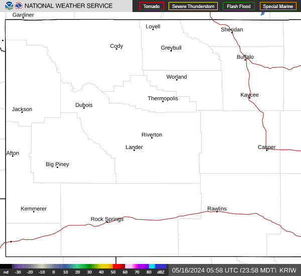
Link to Local Radar Data Link to Satellite Data

Hourly Weather Forecast

National Digital Forecast Database


