

Severe Thunderstorms and Heavy Rainfall for the Southwest; Heat Spreads Across the Center of the Nation

Moisture will continue to move into areas of the West. This will increase showers and thunderstorms coverage and intensity, with the risk of flash flooding and damaging wind gusts. Meanwhile, heat across the Southwest will expand into the center of the nation this weekend into early next week. Trends favor this heat will spread across the Ohio Valley, mid-Atlantic next week. Read More >

Current conditions at

Hailey, Friedman Memorial Airport (KSUN)

Lat: 43.5°NLon: 114.3°WElev: 5318.0ft.

Clear

54°F

12°C

Humidity 81%
Wind Speed WNW 8 MPH
Barometer 30.13 in (1020.32 mb)
Dewpoint 48°F (9°C)
Visibility 10.00 mi
Last update 29 Aug 06:53 AM MDT
Extended Forecast for

18 Miles ENE Sun Valley ID

  • Today

    Today: A chance of rain and thunderstorms before 3pm, then a slight chance of showers and thunderstorms between 3pm and 5pm.  Snow level 12000 feet. Partly sunny, with a high near 47. Southwest wind 14 to 20 mph, with gusts as high as 29 mph.  Chance of precipitation is 50%.

    High: 47 °F

    Chance Rain
    then Chance
    T-storms

  • Tonight

    Tonight: Rain likely before 2am, then a chance of rain and snow between 2am and 4am, then a chance of snow after 4am.  Snow level 12000 feet lowering to 11000 feet after midnight . Mostly cloudy, with a low around 33. West southwest wind 13 to 18 mph, with gusts as high as 28 mph.  Chance of precipitation is 60%. Little or no snow accumulation expected.

    Low: 33 °F

    Rain Likely
    then
    Rain/Snow
    Likely

  • Sunday

    Sunday: Sunny, with a high near 47. West southwest wind 15 to 17 mph, with gusts as high as 25 mph.

    High: 47 °F

    Sunny

  • Sunday Night

    Sunday Night: Mostly clear, with a low around 31. West northwest wind 9 to 14 mph, with gusts as high as 21 mph.

    Low: 31 °F

    Mostly Clear

  • Monday

    Monday: Sunny, with a high near 51. Southwest wind 11 to 15 mph, with gusts as high as 22 mph.

    High: 51 °F

    Sunny

  • Monday Night

    Monday Night: A slight chance of rain and snow before midnight.  Snow level 11400 feet. Partly cloudy, with a low around 38. Chance of precipitation is 20%.

    Low: 38 °F

    Slight Chance
    Rain/Snow
    then Partly
    Cloudy

  • Tuesday

    Tuesday: A slight chance of rain and snow before 9am, then a slight chance of rain between 9am and noon, then a chance of rain showers after noon. Some thunder is also possible.  Snow level 11800 feet. Partly sunny, with a high near 50. Chance of precipitation is 50%. Little or no snow accumulation expected.

    High: 50 °F

    Slight Chance
    Rain/Snow
    then Chance
    Showers

  • Tuesday Night

    Tuesday Night: A chance of showers and thunderstorms before midnight, then a slight chance of rain after midnight.  Snow level 11900 feet lowering to 11000 feet after midnight . Partly cloudy, with a low around 36. Chance of precipitation is 30%.

    Low: 36 °F

    Chance
    Showers

  • Wednesday

    Wednesday: Mostly sunny, with a high near 46. Breezy.

    High: 46 °F

    Partly Sunny
    then Mostly
    Sunny and
    Breezy

Detailed Forecast

Today
A chance of rain and thunderstorms before 3pm, then a slight chance of showers and thunderstorms between 3pm and 5pm. Snow level 12000 feet. Partly sunny, with a high near 47. Southwest wind 14 to 20 mph, with gusts as high as 29 mph. Chance of precipitation is 50%.
Tonight
Rain likely before 2am, then a chance of rain and snow between 2am and 4am, then a chance of snow after 4am. Snow level 12000 feet lowering to 11000 feet after midnight . Mostly cloudy, with a low around 33. West southwest wind 13 to 18 mph, with gusts as high as 28 mph. Chance of precipitation is 60%. Little or no snow accumulation expected.
Sunday
Sunny, with a high near 47. West southwest wind 15 to 17 mph, with gusts as high as 25 mph.
Sunday Night
Mostly clear, with a low around 31. West northwest wind 9 to 14 mph, with gusts as high as 21 mph.
Monday
Sunny, with a high near 51. Southwest wind 11 to 15 mph, with gusts as high as 22 mph.
Monday Night
A slight chance of rain and snow before midnight. Snow level 11400 feet. Partly cloudy, with a low around 38. Chance of precipitation is 20%.
Tuesday
A slight chance of rain and snow before 9am, then a slight chance of rain between 9am and noon, then a chance of rain showers after noon. Some thunder is also possible. Snow level 11800 feet. Partly sunny, with a high near 50. Chance of precipitation is 50%. Little or no snow accumulation expected.
Tuesday Night
A chance of showers and thunderstorms before midnight, then a slight chance of rain after midnight. Snow level 11900 feet lowering to 11000 feet after midnight . Partly cloudy, with a low around 36. Chance of precipitation is 30%.
Wednesday
Mostly sunny, with a high near 46. Breezy.
Wednesday Night
Partly cloudy, with a low around 35. Breezy.
Thursday
Partly sunny, with a high near 44. Breezy.
Thursday Night
Partly cloudy, with a low around 34.
Friday
A slight chance of rain and snow. Mostly sunny, with a high near 45. Chance of precipitation is 20%.
Basemap Options
Click map to change the forecast location
Loading map...

ABOUT THIS FORECAST

 
Point Forecast:
18 Miles ENE Sun Valley ID
 43.79°N 114.02°W (Elev. 11014 ft)
5:31 am MDT Aug 29, 2026
7am MDT Aug 29, 2026-6pm MDT Sep 4, 2026
 
Get as KML Get as XML

Additional Resources

Radar & Satellite Image
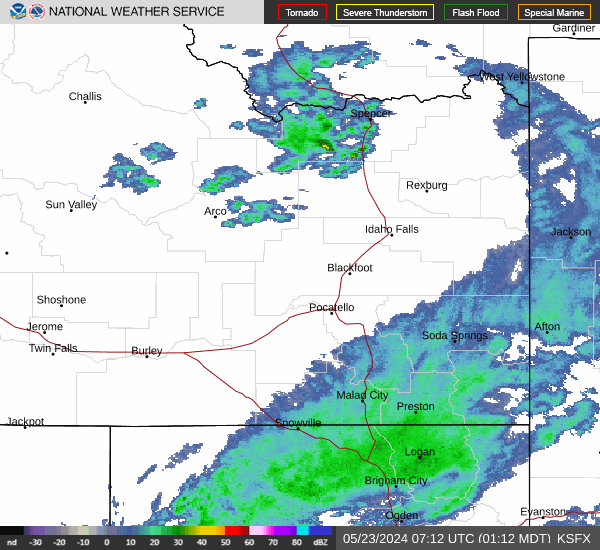
Link to Local Radar Data Link to Satellite Data

Hourly Weather Forecast

National Digital Forecast Database


