

Excessive Rainfall Possible This Weekend; October Heat Wave in California

A slow moving front will be the focus area for heavy to excessive rainfall and a threat for flash/urban flooding across the northern Gulf Coast and Southeast U.S. through this weekend. Abnormally hot, potentially record-breaking, temperatures will impact southern California and stretch north toward the Bay Area and Central Valley into next week. Read More >

Current conditions at

Philip, Philip Airport (KPHP)

Lat: 44.05°NLon: 101.6°WElev: 2208ft.

Fair

53°F

12°C

Humidity 57%
Wind Speed N 8 mph
Barometer 30.29 in (1025.2 mb)
Dewpoint 38°F (3°C)
Visibility 10.00 mi
Wind Chill50°F (10°C)
Last update 3 Oct 8:55 pm MDT
Extended Forecast for

Belvidere SD

  • Tonight

    Tonight: Partly cloudy, with a low around 40. North wind around 6 mph becoming calm  in the evening.

    Low: 40 °F

    Partly Cloudy

  • Sunday

    Sunday: Partly sunny, then gradually becoming sunny, with a high near 72. Light and variable wind becoming southeast 9 to 14 mph in the morning. Winds could gust as high as 22 mph.

    High: 72 °F

    Becoming
    Sunny

  • Sunday Night

    Sunday Night: Clear, with a low around 52. East wind 9 to 14 mph, with gusts as high as 22 mph.

    Low: 52 °F

    Clear

  • Monday

    Monday: Sunny, with a high near 84. South wind 6 to 11 mph becoming light  in the afternoon. Winds could gust as high as 20 mph.

    High: 84 °F

    Sunny

  • Monday Night

    Monday Night: Mostly clear, with a low around 55. Light and variable wind becoming southwest 5 to 8 mph in the evening.

    Low: 55 °F

    Mostly Clear

  • Tuesday

    Tuesday: Sunny, with a high near 81. West wind 7 to 11 mph becoming north in the afternoon. Winds could gust as high as 18 mph.

    High: 81 °F

    Sunny

  • Tuesday Night

    Tuesday Night: Mostly clear, with a low around 51.

    Low: 51 °F

    Mostly Clear

  • Wednesday

    Wednesday: Sunny, with a high near 74.

    High: 74 °F

    Sunny

  • Wednesday Night

    Wednesday Night: Mostly clear, with a low around 52.

    Low: 52 °F

    Mostly Clear

Detailed Forecast

Tonight
Partly cloudy, with a low around 40. North wind around 6 mph becoming calm in the evening.
Sunday
Partly sunny, then gradually becoming sunny, with a high near 72. Light and variable wind becoming southeast 9 to 14 mph in the morning. Winds could gust as high as 22 mph.
Sunday Night
Clear, with a low around 52. East wind 9 to 14 mph, with gusts as high as 22 mph.
Monday
Sunny, with a high near 84. South wind 6 to 11 mph becoming light in the afternoon. Winds could gust as high as 20 mph.
Monday Night
Mostly clear, with a low around 55. Light and variable wind becoming southwest 5 to 8 mph in the evening.
Tuesday
Sunny, with a high near 81. West wind 7 to 11 mph becoming north in the afternoon. Winds could gust as high as 18 mph.
Tuesday Night
Mostly clear, with a low around 51.
Wednesday
Sunny, with a high near 74.
Wednesday Night
Mostly clear, with a low around 52.
Thursday
Sunny, with a high near 74.
Thursday Night
Mostly clear, with a low around 52.
Friday
Sunny, with a high near 79.
Friday Night
Mostly clear, with a low around 58. Breezy.
Saturday
Mostly sunny, with a high near 80. Breezy.
Basemap Options
Click map to change the forecast location
Loading map...

ABOUT THIS FORECAST

 
Point Forecast:
Belvidere SD
 43.83°N 101.27°W (Elev. 2300 ft)
7:46 pm MDT Oct 3, 2026
9pm MDT Oct 3, 2026-6pm MDT Oct 10, 2026
 
Get as KML Get as XML

Additional Resources

Radar & Satellite Image
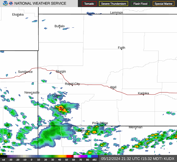
Link to Local Radar Data Link to Satellite Data

Hourly Weather Forecast

National Digital Forecast Database


