

Isaias Expected To Be A Strong Hurricane Approaching The Northern Gulf Coast Friday

Isaias is expected to strengthen and be a strong hurricane when it approaches the northern Gulf Coast on Friday. Damaging hurricane-force winds and life-threatening storm surge impacts are expected Friday into Saturday. Isaias will bring heavy rainfall to the northern Gulf Coast and much of the Southeast U.S. Friday into the weekend. Read More >

Current conditions at

Buffalo - Johnson County Airport (KBYG)

Lat: 44.38122°NLon: 106.71947°WElev: 4925.0ft.

Clear

55°F

13°C

Humidity 30%
Wind Speed W 5 MPH
Barometer 30.11 in (1019.64 mb)
Dewpoint 25°F (-4°C)
Visibility 10.00 mi
Last update 08 Oct 05:15 AM MDT
Extended Forecast for

19 Miles W Buffalo WY

Fire Weather Watch October 9, 12:00pm until October 9, 09:00pm
Click here for hazard details and duration
Fire Weather Watch
  • Today

    Today: Sunny, with a high near 54. Breezy, with a west wind 15 to 20 mph decreasing to 7 to 12 mph in the afternoon.

    High: 54 °F

    Sunny and
    Breezy then
    Sunny

  • Tonight

    Tonight: Increasing clouds, with a low around 36. Windy, with a light west wind increasing to 28 to 33 mph in the evening. Winds could gust as high as 43 mph.

    Low: 36 °F

    Increasing
    Clouds and
    Windy

  • Friday

    Friday: Sunny, with a high near 54. Windy, with a west southwest wind 25 to 33 mph, with gusts as high as 45 mph.

    High: 54 °F

    Sunny and
    Windy

  • Friday Night

    Friday Night: Partly cloudy, with a low around 37. Very windy, with a west southwest wind 20 to 30 mph increasing to 35 to 45 mph. Winds could gust as high as 60 mph.

    Low: 37 °F

    Partly Cloudy
    and Very
    Windy

  • Saturday

    Saturday: A chance of rain and snow showers after noon.  Snow level 10800 feet. Mostly sunny, with a high near 49. Very windy, with a southwest wind 28 to 38 mph decreasing to 14 to 24 mph. Winds could gust as high as 55 mph.  Chance of precipitation is 40%. Little or no snow accumulation expected.

    High: 49 °F

    Mostly Sunny
    and Very
    Windy then
    Chance
    Rain/Snow and
    Windy

  • Saturday Night

    Saturday Night: Rain and snow showers, becoming all snow after 3am.  Low around 27. South southwest wind 8 to 14 mph, with gusts as high as 21 mph.  Chance of precipitation is 100%.

    Low: 27 °F

    Rain/Snow

  • Sunday

    Sunday: Snow showers.  High near 31. Breezy, with a south southwest wind 8 to 16 mph, with gusts as high as 23 mph.  Chance of precipitation is 90%.

    High: 31 °F

    Snow Showers
    and Breezy

  • Sunday Night

    Sunday Night: Snow showers.  Low around 20. Chance of precipitation is 100%.

    Low: 20 °F

    Snow Showers

  • Columbus Day

    Columbus Day: Snow showers likely, mainly before noon.  Mostly cloudy, with a high near 28. Chance of precipitation is 70%.

    High: 28 °F

    Snow Showers
    Likely then
    Chance Snow
    Showers

Detailed Forecast

Today
Sunny, with a high near 54. Breezy, with a west wind 15 to 20 mph decreasing to 7 to 12 mph in the afternoon.
Tonight
Increasing clouds, with a low around 36. Windy, with a light west wind increasing to 28 to 33 mph in the evening. Winds could gust as high as 43 mph.
Friday
Sunny, with a high near 54. Windy, with a west southwest wind 25 to 33 mph, with gusts as high as 45 mph.
Friday Night
Partly cloudy, with a low around 37. Very windy, with a west southwest wind 20 to 30 mph increasing to 35 to 45 mph. Winds could gust as high as 60 mph.
Saturday
A chance of rain and snow showers after noon. Snow level 10800 feet. Mostly sunny, with a high near 49. Very windy, with a southwest wind 28 to 38 mph decreasing to 14 to 24 mph. Winds could gust as high as 55 mph. Chance of precipitation is 40%. Little or no snow accumulation expected.
Saturday Night
Rain and snow showers, becoming all snow after 3am. Low around 27. South southwest wind 8 to 14 mph, with gusts as high as 21 mph. Chance of precipitation is 100%.
Sunday
Snow showers. High near 31. Breezy, with a south southwest wind 8 to 16 mph, with gusts as high as 23 mph. Chance of precipitation is 90%.
Sunday Night
Snow showers. Low around 20. Chance of precipitation is 100%.
Columbus Day
Snow showers likely, mainly before noon. Mostly cloudy, with a high near 28. Chance of precipitation is 70%.
Monday Night
A 30 percent chance of snow showers before midnight. Mostly cloudy, with a low around 24.
Tuesday
A slight chance of snow showers. Sunny, with a high near 43.
Tuesday Night
A chance of snow showers. Partly cloudy, with a low around 28.
Wednesday
A chance of snow showers. Mostly sunny, with a high near 40. Breezy.
Basemap Options
Click map to change the forecast location
Loading map...

ABOUT THIS FORECAST

 
Point Forecast:
19 Miles W Buffalo WY
 44.3°N 107.08°W (Elev. 10699 ft)
2:47 am MDT Oct 8, 2026
5am MDT Oct 8, 2026-6pm MDT Oct 14, 2026
 
Get as KML Get as XML

Additional Resources

Radar & Satellite Image
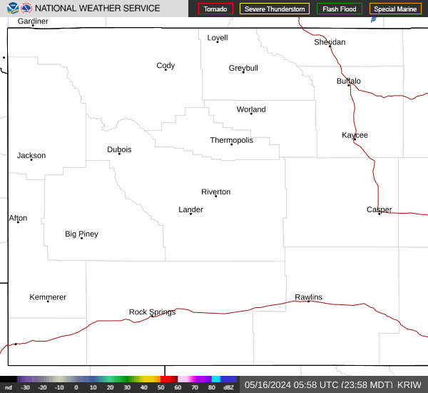
Link to Local Radar Data Link to Satellite Data

Hourly Weather Forecast

National Digital Forecast Database


