

Hazardous Weather Conditions
Current conditions at
Ephraim-Gibraltar Airport (K3D2)
Lat: 45.14°NLon: 87.19°WElev: 773ft.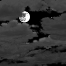
Mostly Cloudy
9°F
-13°C
| Humidity | 78% |
| Wind Speed | N 3 mph |
| Barometer | 30.25 in |
| Dewpoint | 4°F (-16°C) |
| Visibility | 10.00 mi |
| Last update | 23 Feb 9:55 pm CST |
Extended Forecast for
5 Miles SE Ellison Bay WI
Winter Weather Advisory February 24, 12:00pm until February 24, 06:00pm
Tonight

Low: 15 °F⇑
Mostly Cloudy
Tuesday
High: 30 °F
Windy. Chance
Snow then
Heavy SnowTuesday Night
Low: 16 °F
Mostly Cloudy
then Mostly
Cloudy and
BlusteryWednesday
High: 24 °F
Mostly Sunny
and Blustery
then Mostly
SunnyWednesday Night

Low: 13 °F
Partly Cloudy
Thursday
High: 28 °F
Partly Sunny
then Slight
Chance SnowThursday Night

Low: 23 °F
Partly Cloudy
Friday

High: 41 °F
Mostly Sunny
Friday Night

Low: 19 °F
Partly Cloudy
and Breezy
Detailed Forecast
Tonight
Mostly cloudy, with a temperature rising to around 22 by 5am. Light and variable wind becoming south 9 to 14 mph after midnight. Winds could gust as high as 18 mph.
Tuesday
Snow, mainly between 1pm and 4pm. The snow could be heavy at times. High near 30. Windy, with a south wind 16 to 21 mph increasing to 25 to 30 mph in the afternoon. Winds could gust as high as 39 mph. Chance of precipitation is 90%. New snow accumulation of 2 to 4 inches possible.
Tuesday Night
Mostly cloudy, with a low around 16. Blustery, with a west northwest wind 15 to 22 mph, with gusts as high as 32 mph.
Wednesday
Mostly sunny, with a high near 24. Blustery, with a west northwest wind 17 to 22 mph decreasing to 9 to 14 mph in the afternoon. Winds could gust as high as 32 mph.
Wednesday Night
Partly cloudy, with a low around 13. Northwest wind 6 to 8 mph.
Thursday
A 20 percent chance of snow after noon. Partly sunny, with a high near 28.
Thursday Night
Partly cloudy, with a low around 23.
Friday
Mostly sunny, with a high near 41.
Friday Night
Partly cloudy, with a low around 19. Breezy.
Saturday
A 20 percent chance of snow after noon. Mostly cloudy, with a high near 25.
Saturday Night
Mostly cloudy, with a low around 9.
Sunday
A 20 percent chance of snow. Mostly sunny, with a high near 19.
Sunday Night
A 30 percent chance of snow. Mostly cloudy, with a low around 13.
Monday
A 20 percent chance of snow. Partly sunny, with a high near 23.
Additional Forecasts and Information
Basemap Options
Click map to change the forecast location
Loading map...
ABOUT THIS FORECAST
Point Forecast:
5 Miles SE Ellison Bay WI
45.2°N 86.97°W (Elev. 577 ft)
45.2°N 86.97°W (Elev. 577 ft)
10:11 pm CST Feb 23, 2026
10pm CST Feb 23, 2026-6pm CST Mar 2, 2026

