Hazardous Weather Conditions
Current conditions at
Grand Rapids, Grand Rapids/Itasca County Airport-Gordon Newstrom Field (KGPZ)
Lat: 47.22°NLon: 93.52°WElev: 1355ft.
Fair
76°F
24°C
| Humidity | 48% |
| Wind Speed | Vrbl 7 mph |
| Barometer | 29.94 in (1013.5 mb) |
| Dewpoint | 55°F (13°C) |
| Visibility | 10.00 mi |
| Heat Index | 78°F (26°C) |
| Last update | 1 Sep 5:56 pm CDT |
Extended Forecast for
Grand Rapids MN
Tonight
Low: 55 °F
Mostly Cloudy
then Patchy
FogWednesday
High: 79 °F
Patchy Fog
then SunnyWednesday Night

Low: 56 °F
Increasing
CloudsThursday

High: 80 °F
Slight Chance
ShowersThursday Night

Low: 60 °F
Showers
LikelyFriday

High: 80 °F
Partly Sunny
Friday Night
Low: 61 °F
Partly Cloudy
Saturday

High: 81 °F
Slight Chance
ShowersSaturday Night

Low: 60 °F
Chance
Showers
Detailed Forecast
Tonight
Patchy fog after 5am. Otherwise, mostly cloudy, with a low around 55. West wind around 5 mph becoming calm in the evening. Winds could gust as high as 15 mph.
Wednesday
Patchy fog before 8am. Otherwise, partly sunny, then gradually becoming sunny, with a high near 79. Calm wind.
Wednesday Night
Increasing clouds, with a low around 56. Calm wind.
Thursday
A slight chance of showers between 10am and 1pm. Mostly sunny, with a high near 80. East wind 5 to 10 mph, with gusts as high as 15 mph. Chance of precipitation is 20%.
Thursday Night
Showers likely and possibly a thunderstorm before 1am, then a chance of showers. Mostly cloudy, with a low around 60. East wind 5 to 10 mph, with gusts as high as 20 mph. Chance of precipitation is 60%. New rainfall amounts between a quarter and half of an inch possible.
Friday
Partly sunny, with a high near 80. East wind around 5 mph.
Friday Night
Partly cloudy, with a low around 61. Southeast wind around 5 mph, with gusts as high as 15 mph.
Saturday
A slight chance of showers before 1pm. Partly sunny, with a high near 81. Southeast wind 5 to 10 mph, with gusts as high as 15 mph.
Saturday Night
A chance of showers and thunderstorms. Partly cloudy, with a low around 60. Southeast wind around 5 mph, with gusts as high as 15 mph.
Sunday
Partly sunny, with a high near 78. North wind 5 to 10 mph, with gusts as high as 15 mph.
Sunday Night
A chance of showers. Partly cloudy, with a low around 55. North wind around 5 mph becoming northeast after midnight.
Labor Day
A slight chance of showers. Mostly cloudy, with a high near 73. East wind 5 to 10 mph, with gusts as high as 15 mph.
Monday Night
A chance of showers. Mostly cloudy, with a low around 52. Southeast wind around 10 mph, with gusts as high as 20 mph.
Tuesday
A chance of showers. Partly sunny, with a high near 72. Breezy, with a south wind 10 to 15 mph, with gusts as high as 25 mph.
Basemap Options
Click map to change the forecast location
Loading map...
 Forecast Area
ABOUT THIS FORECAST
Point Forecast:
Grand Rapids MN
47.25°N 93.51°W
47.25°N 93.51°W
6:16 pm CDT Sep 1, 2026
6pm CDT Sep 1, 2026-6pm CDT Sep 8, 2026


Additional Resources
Radar & Satellite Image
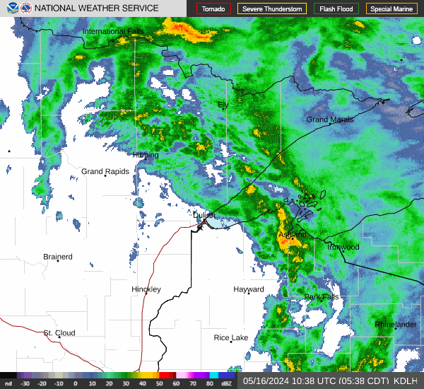

Hourly Weather Forecast