Storm System to Move Across the Ohio Valley to the Mid-Atlantic and Northeast

Isolated severe thunderstorms will be possible on Veterans Day across parts of the lower Ohio and western Tennessee Valleys. A developing storm will bring rain and gusty winds to the Mid-Atlantic and Northeast on Thursday, with the first accumulating snow likely in the higher elevations of the central Appalachians and interior Northeast. Read More >

Current conditions at

Omak Airport (KOMK)

Lat: 48.46116°NLon: 119.52086°WElev: 1293.0ft.

Fog

45°F

7°C

Humidity 100%
Wind Speed W 3 MPH
Barometer 30.02 in (1016.59 mb)
Dewpoint 45°F (7°C)
Visibility 0.24 mi
Last update 11 Nov 08:35 PM PST
Extended Forecast for

14 Miles SE Omak WA

  • Tonight

    Tonight: Mostly cloudy, with a low around 38. Calm wind.

    Low: 38 °F

    Mostly Cloudy

  • Thursday

    Thursday: Cloudy, then gradually becoming mostly sunny, with a high near 49. Calm wind becoming south around 5 mph.

    High: 49 °F

    Decreasing
    Clouds

  • Thursday Night

    Thursday Night: Mostly cloudy, with a low around 40. East wind 3 to 5 mph.

    Low: 40 °F

    Mostly Cloudy

  • Friday

    Friday: A 30 percent chance of rain after 10am.  Mostly cloudy, with a high near 54. East wind 5 to 8 mph becoming southeast in the afternoon.  New precipitation amounts of less than a tenth of an inch possible.

    High: 54 °F

    Chance Rain

  • Friday Night

    Friday Night: A 50 percent chance of rain before 10pm.  Cloudy, with a low around 41. Southeast wind around 8 mph.  New precipitation amounts of less than a tenth of an inch possible.

    Low: 41 °F

    Chance Rain
    then Mostly
    Cloudy

  • Saturday

    Saturday: Partly sunny, with a high near 47.

    High: 47 °F

    Partly Sunny

  • Saturday Night

    Saturday Night: A 30 percent chance of rain after 10pm.  Mostly cloudy, with a low around 39.

    Low: 39 °F

    Chance Rain

  • Sunday

    Sunday: Rain.  High near 44. Chance of precipitation is 90%.

    High: 44 °F

    Rain

  • Sunday Night

    Sunday Night: Rain, mainly before 10pm.  Snow level 5400 feet. Low around 39. Chance of precipitation is 80%.

    Low: 39 °F

    Rain then
    Chance Rain

Detailed Forecast

Tonight
Mostly cloudy, with a low around 38. Calm wind.
Thursday
Cloudy, then gradually becoming mostly sunny, with a high near 49. Calm wind becoming south around 5 mph.
Thursday Night
Mostly cloudy, with a low around 40. East wind 3 to 5 mph.
Friday
A 30 percent chance of rain after 10am. Mostly cloudy, with a high near 54. East wind 5 to 8 mph becoming southeast in the afternoon. New precipitation amounts of less than a tenth of an inch possible.
Friday Night
A 50 percent chance of rain before 10pm. Cloudy, with a low around 41. Southeast wind around 8 mph. New precipitation amounts of less than a tenth of an inch possible.
Saturday
Partly sunny, with a high near 47.
Saturday Night
A 30 percent chance of rain after 10pm. Mostly cloudy, with a low around 39.
Sunday
Rain. High near 44. Chance of precipitation is 90%.
Sunday Night
Rain, mainly before 10pm. Snow level 5400 feet. Low around 39. Chance of precipitation is 80%.
Monday
A 30 percent chance of rain, mainly before 10am. Snow level 4500 feet. Mostly cloudy, with a high near 44.
Monday Night
Mostly cloudy, with a low around 34.
Tuesday
Mostly sunny, with a high near 42.
Tuesday Night
A 10 percent chance of rain. Snow level 3800 feet lowering to 3100 feet after midnight . Mostly cloudy, with a low around 33.
Wednesday
A slight chance of rain and snow. Snow level rising to 3400 feet in the afternoon. Partly sunny, with a high near 41. Chance of precipitation is 20%.
Basemap Options
Click map to change the forecast location
Loading map...

ABOUT THIS FORECAST

 
Point Forecast:
14 Miles SE Omak WA
 48.27°N 119.3°W (Elev. 2756 ft)
8:42 pm PST Nov 11, 2026
8pm PST Nov 11, 2026-6pm PST Nov 18, 2026
 
Get as KML Get as XML

Additional Resources

Radar & Satellite Image
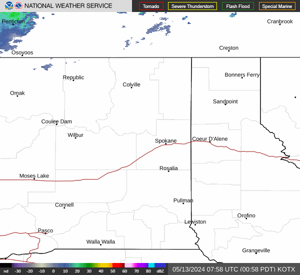
Link to Local Radar Data Link to Satellite Data

Hourly Weather Forecast

National Digital Forecast Database