

Dangerous Fire Conditions in the Southern High Plains; Severe Weather from the Great Lakes into Central/Southern Plains; Late-Season Mountain Snow

Dry and windy conditions will produce dangerous fire weather conditions across the southern High Plains into the Southwest. Severe storms, including very large hail, strong tornadoes, and winds, are expected from the Great Lakes into the central/southern Plains. Heavy late-season snow and cold temperatures are expected in the northern to central Rockies. Heat is spreading across the eastern U.S.. Read More >

Hazardous Weather Conditions

Current conditions at

STEHEKIN-AIRSTRIP (STRW1)

Lat: 48.34694°NLon: 120.72028°WElev: 1230.0ft.

NA

69°F

21°C

Humidity 28%
Wind Speed NNW 7 MPH
Barometer NA
Dewpoint 34°F (1°C)
Visibility NA
Last update 17 May 05:01 PM PDT
Extended Forecast for

6 Miles WNW Stehekin WA

Flood Warning until further notice
Click here for hazard details and duration
Flood Warning until further notice
  •  
    Flood Warning until further notice

    NOW until further notice

    Flood Warning

  • Tonight

    Low: 35 °F

    Slight Chance
    Showers then
    Areas Frost

  • Monday

    Monday: Areas of frost before 7am.  Otherwise, mostly sunny, with a high near 64. West wind 3 to 8 mph.

    High: 64 °F

    Areas Frost
    then Mostly
    Sunny

  • Monday Night

    Monday Night: Partly cloudy, with a low around 35. West wind 3 to 8 mph. Winds could gust as high as 18 mph.

    Low: 35 °F

    Partly Cloudy

  • Tuesday

    Tuesday: Mostly sunny, with a high near 64. West wind 3 to 8 mph.

    High: 64 °F

    Mostly Sunny

  • Tuesday Night

    Tuesday Night: Partly cloudy, with a low around 39. West wind 5 to 9 mph, with gusts as high as 20 mph.

    Low: 39 °F

    Partly Cloudy

  • Wednesday

    Wednesday: Sunny, with a high near 71.

    High: 71 °F

    Sunny

  • Wednesday Night

    Wednesday Night: Partly cloudy, with a low around 44.

    Low: 44 °F

    Partly Cloudy

  • Thursday

    Thursday: Mostly sunny, with a high near 70.

    High: 70 °F

    Mostly Sunny

Detailed Forecast

Tonight
A 20 percent chance of showers before 11pm. Areas of frost after 5am. Otherwise, partly cloudy, with a low around 35. West wind 3 to 8 mph.
Monday
Areas of frost before 7am. Otherwise, mostly sunny, with a high near 64. West wind 3 to 8 mph.
Monday Night
Partly cloudy, with a low around 35. West wind 3 to 8 mph. Winds could gust as high as 18 mph.
Tuesday
Mostly sunny, with a high near 64. West wind 3 to 8 mph.
Tuesday Night
Partly cloudy, with a low around 39. West wind 5 to 9 mph, with gusts as high as 20 mph.
Wednesday
Sunny, with a high near 71.
Wednesday Night
Partly cloudy, with a low around 44.
Thursday
Mostly sunny, with a high near 70.
Thursday Night
Partly cloudy, with a low around 43.
Friday
Sunny, with a high near 72.
Friday Night
Partly cloudy, with a low around 44.
Saturday
Mostly sunny, with a high near 69.
Saturday Night
Partly cloudy, with a low around 41.
Sunday
Mostly sunny, with a high near 66.
Basemap Options
Click map to change the forecast location
Loading map...

ABOUT THIS FORECAST

 
Point Forecast:
6 Miles WNW Stehekin WA
 48.38°N 120.83°W (Elev. 1401 ft)
2:56 pm PDT May 17, 2026
6pm PDT May 17, 2026-6pm PDT May 24, 2026
 
Get as KML Get as XML

Additional Resources

Radar & Satellite Image
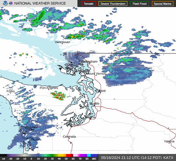
Link to Local Radar Data Link to Satellite Data

Hourly Weather Forecast

National Digital Forecast Database


