


News Headlines
- A stronger system could bring heavy rain and gusty winds to the southern panhandle later Sunday into Monday. Click for more information...
- To view or latest forecast graphics, click here...
- Click here to visit the Suicide Basin monitoring page. You can use this page for updates throughout the GLOF season to see what the condition are within the basin.

Current conditions at
Yakutat (PAYA)
Lat: 59.52°NLon: 139.67°WElev: 36ft.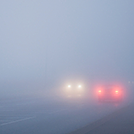
Fog/Mist
52°F
11°C
| Humidity | 97% |
| Wind Speed | SE 10 mph |
| Barometer | 30.05 in (1017.5 mb) |
| Dewpoint | 51°F (11°C) |
| Visibility | 2.00 mi |
| Wind Chill | 49°F (9°C) |
| Last update | 5 Jul 5:53 pm AKDT |
Extended Forecast for
15 Miles N Point Latouche AK
Tonight

Low: 30 °F
Chance Snow
ShowersMonday
High: 38 °F
Chance Snow
Showers then
Rain/Snow
LikelyMonday Night

Low: 34 °F
Rain/Snow
Tuesday
High: 38 °F
Rain/Snow
then Snow
ShowersTuesday Night
Low: 32 °F
Chance Snow
ShowersWednesday

High: 33 °F
Snow Showers
LikelyWednesday Night
Low: 30 °F
Chance Snow
ShowersThursday

High: 36 °F
Mostly Cloudy
Thursday Night

Low: 32 °F
Mostly Cloudy
Detailed Forecast
Tonight
A 50 percent chance of snow showers. Cloudy, with a low around 30. Calm wind becoming east around 5 mph after midnight.
Monday
A chance of snow showers before 1pm, then rain likely, possibly mixed with snow showers. Cloudy, with a high near 38. Northeast wind around 10 mph, with gusts as high as 35 mph. Chance of precipitation is 60%. New snow accumulation of less than a half inch possible.
Monday Night
A chance of rain and snow showers before 7pm, then rain showers between 7pm and 1am, then rain, possibly mixed with snow showers after 1am. Low around 34. Northeast wind around 5 mph. Chance of precipitation is 80%. Little or no snow accumulation expected.
Tuesday
Rain showers likely before 7am, then rain and snow showers likely between 7am and 10am, then snow showers after 10am. High near 38. North wind around 5 mph becoming calm. Chance of precipitation is 80%.
Tuesday Night
A 50 percent chance of snow showers. Mostly cloudy, with a low around 32. Northwest wind around 5 mph.
Wednesday
Snow showers likely. Mostly cloudy, with a high near 33. Chance of precipitation is 70%.
Wednesday Night
A 50 percent chance of snow showers. Mostly cloudy, with a low around 30.
Thursday
Mostly cloudy, with a high near 36.
Thursday Night
Mostly cloudy, with a low around 32.
Friday
Mostly cloudy, with a high near 37.
Friday Night
Mostly cloudy, with a low around 32.
Saturday
A chance of rain and snow showers. Mostly cloudy, with a high near 36.
Saturday Night
A chance of rain and snow showers. Mostly cloudy, with a low around 32.
Sunday
A chance of rain and snow showers. Mostly cloudy, with a high near 36.
Basemap Options
Click map to change the forecast location
Loading map...
 Forecast Area
ABOUT THIS FORECAST
Point Forecast:
15 Miles N Point Latouche AK
60.13°N 139.67°W (Elev. 6033 ft)
60.13°N 139.67°W (Elev. 6033 ft)
4:41 pm AKDT Jul 5, 2026
6pm AKDT Jul 5, 2026-6pm AKDT Jul 12, 2026


Additional Resources
Radar & Satellite Image

Hourly Weather Forecast


