Widespread Precipitation and Gusty Winds in the West; Snow from the Great Lakes to the Northeast

A Pacific storm system is expected to bring strong winds and more precipitation to the western U.S., along with the likelihood of snowfall into the Sierra Nevada. Accumulating snow will develop downwind from the Great Lakes into parts of the Northeast through Saturday. Polar air will surge into the eastern half of the country this weekend. Read More >

For More Weather Information:

Anchorage, AK Local Forecast Office

2NM WSW Anchorage AK

Marine Point Forecast

[NOTICE]
    • Today

      Today:N wind 5 to 10 kt. Mostly cloudy. Seas 1 ft or less.

      High: 33 °F

      N 10kt
      < 1ft

    • Tonight

      Tonight:Variable winds 5 kt or less. Partly cloudy. Seas 1 ft or less.

      Low: 23 °F

      Light Wind
      < 1ft

    • Saturday

      Saturday:Variable winds 5 kt or less. A slight chance of snow after 3pm.   Seas 1 ft or less.

      High: 31 °F

      Light Wind
      < 1ft

    • Saturday Night

      Saturday Night:Variable winds 5 kt or less. Snow, mainly after 9pm.   Seas around 1 ft.

      Low: 26 °F

      Light Wind
      1ft

    • Sunday

      Sunday:Variable winds 5 kt or less. A chance of snow before 9am.   Seas around 1 ft.

      High: 32 °F

      Light Wind
      1ft

    • Sunday Night

      Sunday Night:Variable winds 5 kt or less. Mostly cloudy. Seas around 1 ft.

      Low: 26 °F

      Light Wind
      1ft

    • Monday

      Monday:Variable winds 5 kt or less. Mostly cloudy. Seas around 1 ft.

      High: 36 °F

      Light Wind
      1ft

    • Monday Night

      Monday Night:Variable winds 5 kt or less. Mostly cloudy. Seas around 1 ft.

      Low: 26 °F

      Light Wind
      1ft

    • Tuesday

      Tuesday:Variable winds 5 kt or less. Mostly cloudy. Seas around 1 ft.

      High: 33 °F

      Light Wind
      1ft


High and low forecast temperature values represent air temperature.

Water temperature forecast is experimental.

Associated Zone Forecast which includes this point

Last Update: 4:07 am AKST Nov 13, 2026
Forecast Valid: 8am AKST Nov 13, 2026-6pm AKST Nov 19, 2026

View Nearby Observations

Detailed Forecast


Synopsis: A 967 mb N Pacific low 320 nm S of Graham Island moves to 180 nm SE of Middleton Island at 974 mb mid-morning Sat. This low dissipates in the central Gulf through Sat evening. A surface trough lingers near Kodiak Island through Sat morning and exits to the N Pacific Sat afternoon. Another 962 mb N Pacific low 250 nm SW of Graham Island Sat afternoon moves to 250 nm S of Sitka at 964 mb Sun morning.

Today
N wind 5 to 10 kt. Mostly cloudy. Seas 1 ft or less.
Tonight
Variable winds 5 kt or less. Partly cloudy. Seas 1 ft or less.
Saturday
Variable winds 5 kt or less. A slight chance of snow after 3pm. Seas 1 ft or less.
Saturday Night
Variable winds 5 kt or less. Snow, mainly after 9pm. Seas around 1 ft.
Sunday
Variable winds 5 kt or less. A chance of snow before 9am. Seas around 1 ft.
Sunday Night
Variable winds 5 kt or less. Mostly cloudy. Seas around 1 ft.
Monday
Variable winds 5 kt or less. Mostly cloudy. Seas around 1 ft.
Monday Night
Variable winds 5 kt or less. Mostly cloudy. Seas around 1 ft.
Tuesday
Variable winds 5 kt or less. Mostly cloudy. Seas around 1 ft.

*Notices:

  1. This forecast is for a single location. For safety concerns, mariners should be aware of the weather over a larger area. Forecast information for a larger area can be found within the zone forecast and the NDFD graphics.
  2. The forecast conditions at a particular point may not exceed the criteria of a Small Craft Advisory, Gale, Storm etc. These watches/warnings/advisories are issued for the entire zone in which the point resides and mariners should act accordingly.
Basemap Options
Click map to change the forecast location
Loading map...

ABOUT THIS FORECAST

Point Forecast: 61.21°N 149.94°W
Last Update: 4:07 am AKST Nov 13, 2026
Forecast Valid: 8am AKST Nov 13, 2026-6pm AKST Nov 19, 2026
  Forecast Discussion
  Get as KML Get as XML

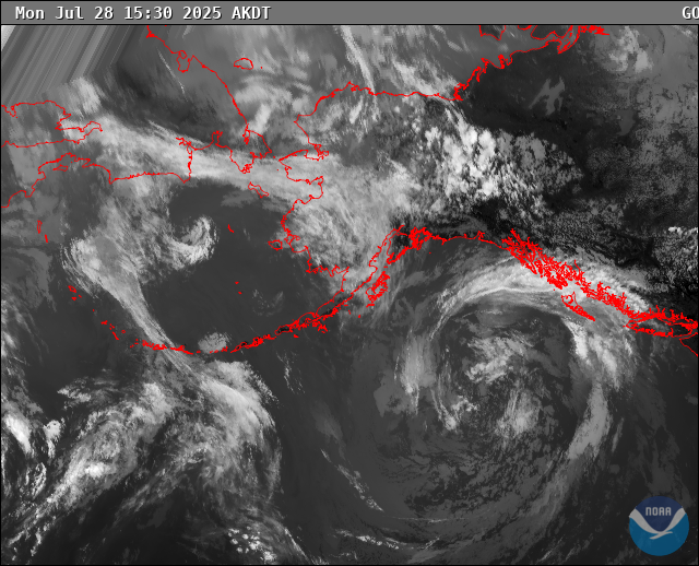
RADAR & SATELLITE IMAGES

 Link to Satellite Data